Complete Directory of Operational Airports in Peru and Regional Terminals 2026
Peru is one of the most geographically diverse countries on the continent, which has led to the need for air travel to some of the most spectacular destinations that the country has to offer. If you are looking for a peru airport that is close to the Amazon, the Andes, and the Pacific, then this guide has the complete list of airports in peru for 2026. This guide has been designed as a peru airports map, which can be read, providing travelers with all the information that they need about every major airports in peru from north to south.
Whether you are a new visitor seeking to experience some of the nation’s more popular locations, such as Machu Picchu, or a seasoned traveler seeking to optimize your travel plans by understanding the range of airports in peru, the following sections will provide you with a better understanding of the nation’s aviation network. From the international airport in Callao, the nation has seen a proliferation of airports that serve its more remote locations.
Airport in Lima and Callao: Jorge Chavez International Airport
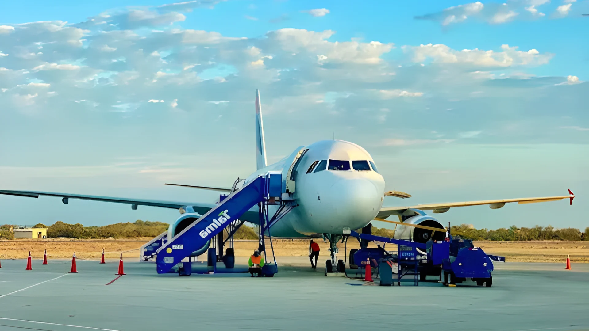
The Lima Peru airport, also known as Jorge Chavez International Airport (IATA: LIM), is the most important aviation hub in the country. Located in the port district of Callao, just a few kilometers from the historic center, this principal airport in Peru serves as the gateway for international visitors and the primary hub for domestic flights. In 2026, the airport connects passengers to over 40 international destinations across the Americas, Europe, and beyond.
A brand-new terminal building has recently been inaugurated, significantly expanding capacity and enhancing the passenger experience. Major carriers such as LATAM, American Airlines, Delta, Air France, Iberia, and Copa Airlines operate from this modern facility.
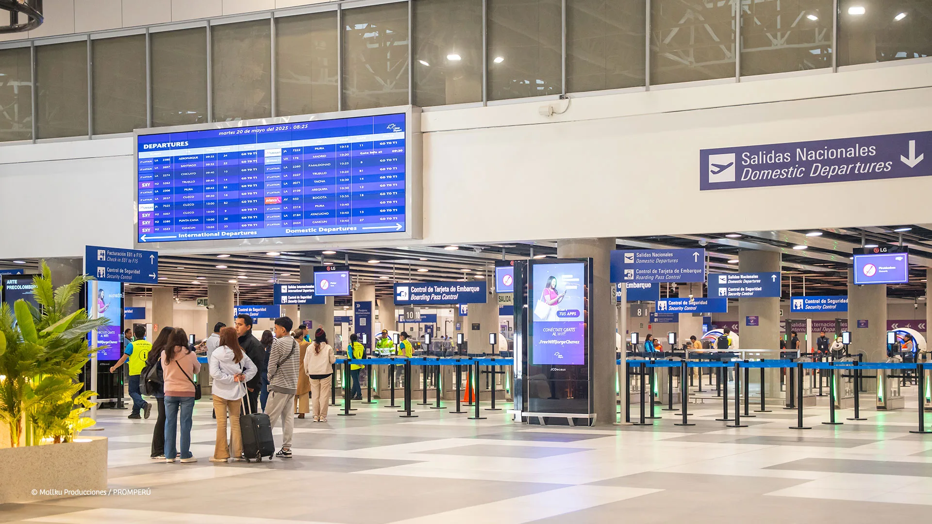
Navigating the New Single Terminal Entrance on Morales Duarez Avenue
For travelers using the airport, a major update is the new single terminal entrance located on Avenida Morales Duarez. This area has been reorganized to streamline vehicle drop-off and pick-up. The airport is linked to Miraflores by the Airport Express Lima bus service, which typically takes between 60 to 75 minutes depending on traffic conditions.
The international terminal now offers improved signage, transit areas equipped with charging points, free Wi-Fi, and an expanded selection of food and retail outlets. Official taxi services and rideshare apps like Uber operate from designated zones outside the exits. The updated layout is designed to minimize walking distances and improve passenger flow throughout the hub.
Connecting Flights and Transit Hotels Inside the New Lima Hub
Lima is a vital connection point for travelers moving between international and domestic routes. It is highly recommended to allow two to three hours for connections, as transit between different areas of the airport may vary. For those requiring overnight accommodation, the Holiday Inn Lima Airport is a popular choice, offering a direct shuttle service for travelers in transit.
There are several quality hotels near the Lima Peru airport, ranging from budget-friendly guesthouses to business-class accommodations. When choosing an airport hotel, it is advisable to select one that provides a shuttle service, as Lima’s traffic can be unpredictable during peak morning and evening hours.
| Detail | Information |
|---|---|
| IATA Code | LIM |
| Full Name | Jorge Chavez International Airport |
| Location | Callao, Lima |
| Type | International & Domestic Hub |
| Key Destinations | USA, Europe, Brazil, Colombia, Bolivia, Cusco, Arequipa |
| Transport to Lima | Airport Express Bus, Taxi, Uber (60–75 min to Miraflores) |
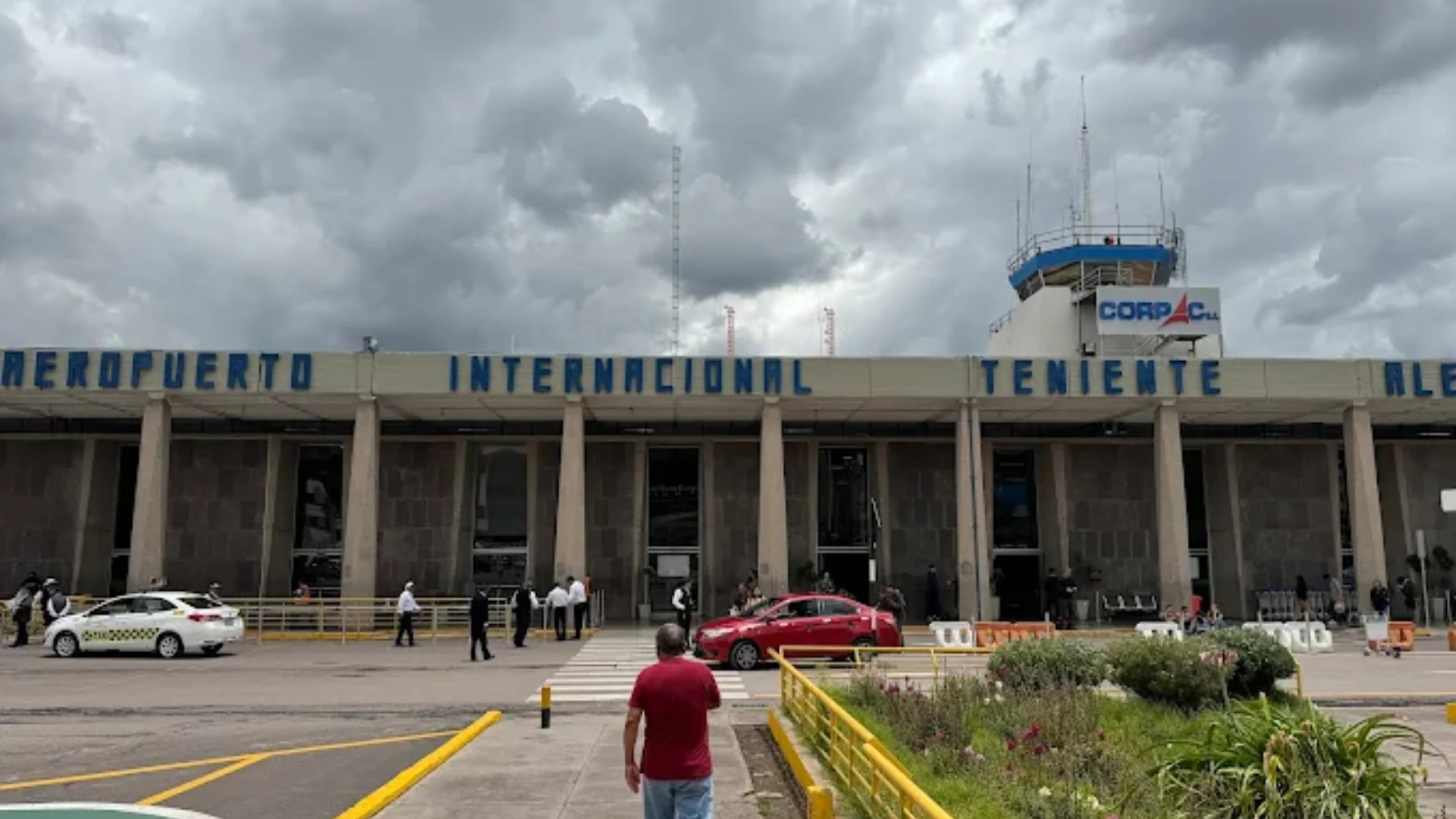
Airport in Cusco Alejandro Velasco Astete
The cusco airport peru (IATA: CUZ), also named the Alejandro Velasco Astete International Airport, is the second-busiest airport in the country and one of the most breathtakingly positioned airports around the world. Located at 3,310 meters above sea level, the cusco peru airport is the entry point into Machu Picchu, the Sacred Valley, and the Andean heartland. It is also named the peru airport near machu picchu and is the gateway through which millions of tourists move each year on their way into the most famous destination in Peru.
Airlines such as LATAM Peru, Sky Airline, and JetSmart have multiple flights a day from Lima to this peru airport near machu picchu It takes one hour to arrive at the airport. Due to the high altitude of the airport and the short runway, which is surrounded by mountains and urban development, only daytime flights are available, and all planes must be certified for high-altitude flight. There may be delays due to weather, especially in the afternoon, so travelers should be prepared, especially during the rainy season, which lasts from November to March.
Operations at Cusco Airport and Flight Restrictions due to Weather
The weather has a significant influence on the airport in cusco peru. In the rainy season, thunderstorms and low clouds are common. Therefore, travelers are advised to book flights for the mornings. The cusco peru airport code is given as CUZ. This code will appear on all the flight confirmations and boarding passes. Currently, the peru cusco airport can accommodate a maximum of 16 flights at any given hour. However, the physical limitations of the airport make it difficult to increase the capacity.
It should be noted that there are no direct flights to machu picchu. Therefore, travelers can fly to cusco and then connect to aguas calientes. There is only one runway at the cusco airport, and the instrument landing system is available. However, visual flight rules are common. When flying to cusco and connecting to places such as puno, arequipa, and lima, travelers should consider the changing weather.
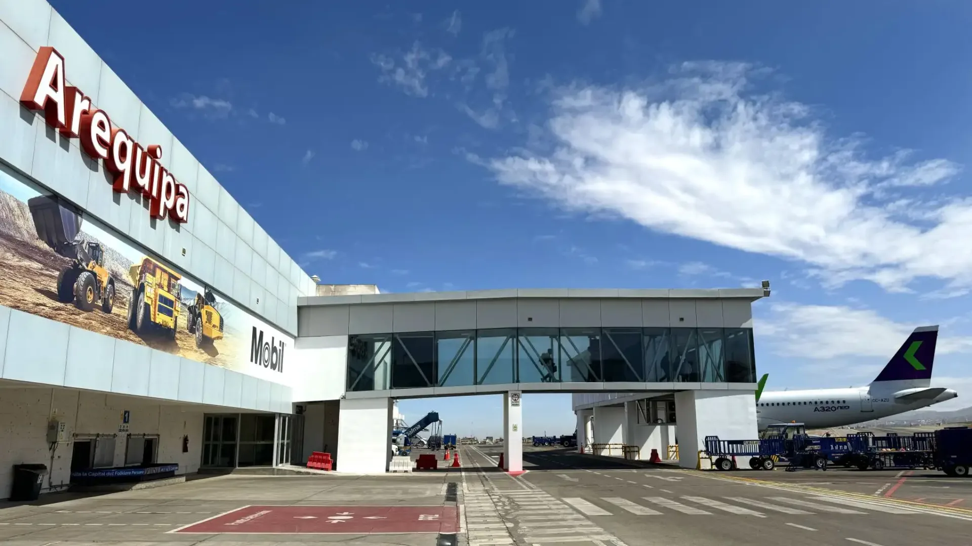
Airport in Arequipa: Alfredo Rodriguez Ballon International Airport
The arequipa airport (IATA: AQP), officially the Alfredo Rodriguez Ballon International Airport, serves Peru’s second-largest city. This major airport peru in southern Peru sits at 2,549 meters above sea level and is a key hub for the entire southern Andes region. As one of the most important peru south america airport facilities, it connects the White City to Lima, Cusco, and beyond. The recently upgraded arequipa international airport handles both domestic routes and a growing number of international services.
Arequipa is a UNESCO World Heritage Site renowned for its Spanish colonial architecture built from white sillar volcanic stone. The city serves as the natural starting point for excursions to the Colca Canyon, one of the deepest canyons in the world. Daily flights connect Arequipa to Lima in approximately one hour and fifteen minutes. The airport continues expanding its infrastructure to meet growing demand from domestic and international travelers.
Flights to Colca Canyon and Arequipa Airport Services
The airport in arequipa peru provides solid passenger services including car rental desks, taxi services, and tour operator kiosks that arrange transport directly to Colca Canyon lodges and city hotels. Flights to arequipa from Lima operate multiple times daily. From the airport, the city center is approximately 15 to 20 minutes by taxi, while the road to Colca Canyon takes three to four hours from the city.
As one of the key southern peru airports, Arequipa also serves travelers coming from Chile or Bolivia overland, or those continuing to Puno and Lake Titicaca. The network of southern airports, of which Arequipa is the flagship, is steadily improving in service quality and flight frequency, supported by Peru’s growing middle class and increasing international tourism. Bird species along the Colca Canyon flight paths and the spectacular views of El Misti volcano from arrival approaches make this one of Peru’s most scenic landing experiences.
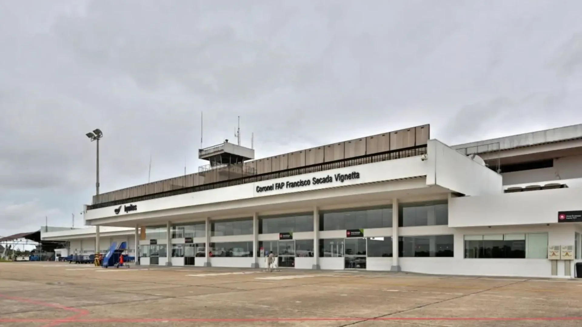
Airport in Iquitos: Francisco Secada Vignetta International Airport
The Iquitos Peru Airport, also known as Francisco Secada Vignetta International Airport, and designated by the IATA code IQT, is one of the most unique airports in South America. As one of the largest cities in the world that cannot be accessed by road, the airport iquitos peruthe only way to access this location other than a riverboat. This is an extraordinary Amazon airport that is used to access any of the jungle expeditions that a visitor to this region of Peru might wish to undertake. As a key Peru airport, this is a major entry point to this region of the country in the north of Peru and is used to access a great deal of domestic cargo flights as well as passengers.
Daily flights are available to this airport, which is served by LATAM Peru and Sky Airline, and the flight time is around one hour and forty-five minutes. This is a dramatic change in landscape from the desert to the lush green of the Amazon basin. This is a key location, as Iquitos is the capital of the Loreto region, which is the largest region in Peru.
Accessing the Amazon River and Jungle Lodges from Iquitos Airport
Once you arrive, mototaxis and taxis are available to get you to the city center from the airport. The ride takes about 20 minutes. The iquitos airport code is IQT. Luggage management is essential at this airport, particularly since the northern jungle airport connects to a boat-based transport network where weight limits apply strictly. Flights to iquitos should be booked well in advance if you’re going during the high season, since this flight tends to fill up fast.
From the Iquitos Port, boats head to the Pacaya-Samiria National Reserve, the world’s largest flooded forest, and other private ecolodges in the Amazon River tributaries. Some of the activities to look forward to include wildlife spotting, pink dolphin spotting, piranha fishing, and canopy tours. Iquitos, the city, has an interesting history and a riverfront area called the Malecon, with Iron House buildings designed by Gustave Eiffel during the rubber boom.
Airport in Piura: Guillermo Concha Iberico International Airport
The Piura Airport (IATA: PIU), also referred to as Guillermo Concha Iberico International Airport, is the commercial hub for the northern region of Peru. This airport near mancora is the main air hub for the entire northern coast region. It handles northern peru flights to Lima and other domestic destinations. The Piura airport code is PIU and is applicable for all flights. Piura is a small city at a height of only 55 meters above sea level and offers a warm and dry climate throughout the year.
Piura is the commercial center of northern Peru and a practical gateway to Peru’s finest Pacific beach destinations. Mancora, approximately 90 kilometers north of Piura, offers world-class surfing, warm Pacific waters year-round, and a vibrant resort and backpacker scene. Many travelers prefer flying into Piura and then taking ground transportation to the beach, balancing the wider flight availability with slightly longer ground transfer times.
Connecting to Northern Beaches and Coastal Transport
Regarding talara vs piura airport: Talara is geographically closer to Mancora; however, Piura offers more flights to Piura and better connections, especially from Lima. The choice is often governed by the availability of flights. Piura airport transport options include shared taxis, buses, and combis, which provide connections to Mancora, Cabo Blanco, and Punta Sal along the Pan-American Highway going north.
From Piura city, the distance to Mancora is about two hours by bus. The pleasant weather is a year-round option; besides, the region is famous for its handicrafts, especially the weaving of straw hats from Catacaos, one of the most significant handicraft centers in northern Peru. Piura airport serves a variety of airlines; the prices on the route from Lima to Piura are relatively low due to the presence of several airlines.
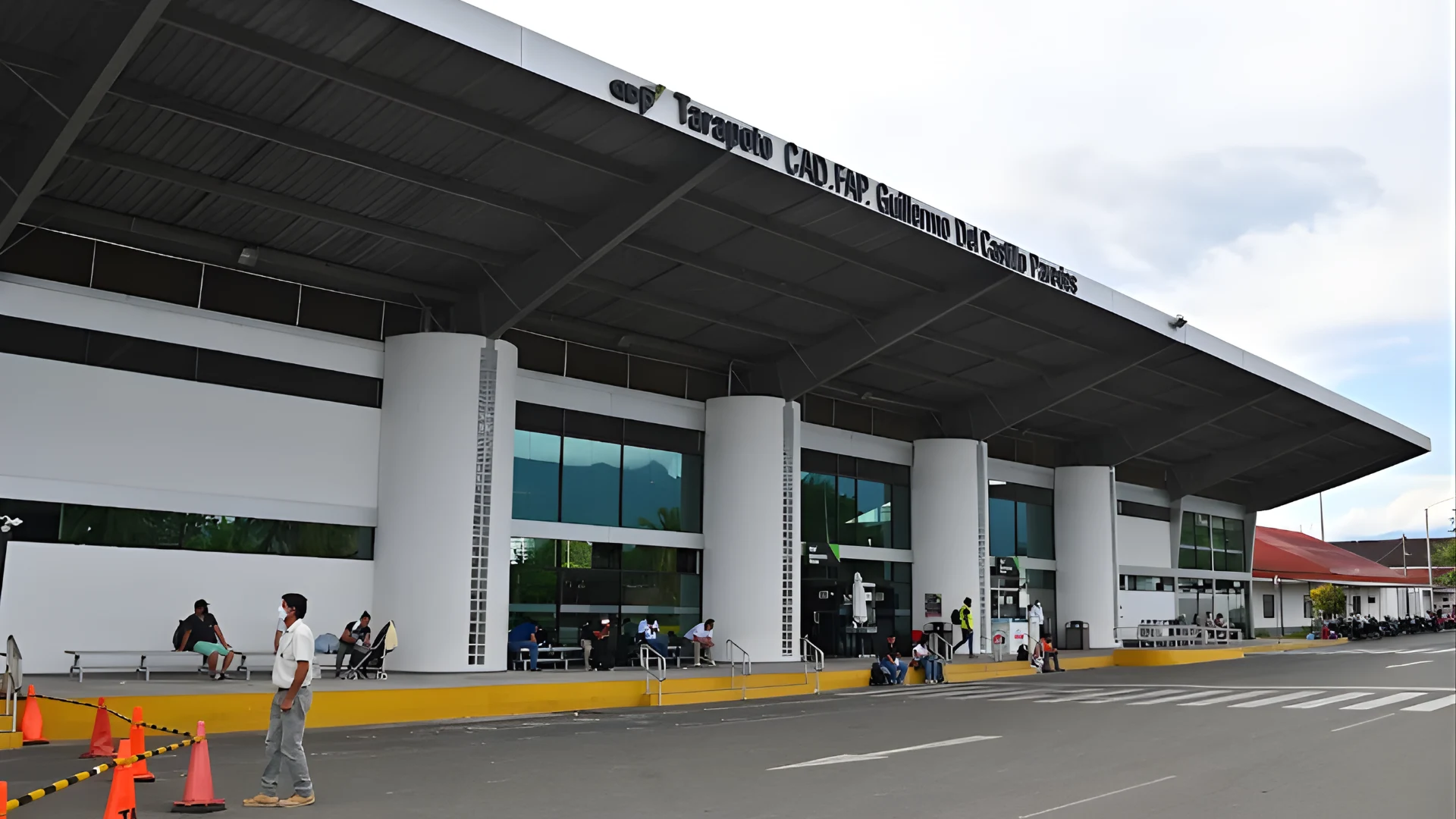
Airport in Tarapoto: Guillermo del Castillo Paredes Airport
The tarapoto airport (IATA: TPP), officially the Guillermo del Castillo Paredes Airport, serves Tarapoto in the san martin region airport network. This city is the largest in the San Martin region and a rapidly growing destination in Peru’s Selva Alta (high jungle). Among all jungle airports peru, the tarapoto airport code TPP identifies one of the best-connected regional hubs, with multiple daily flights to Lima and growing tourism infrastructure.
Located at approximately 333 meters above sea level in a fertile valley surrounded by mountains, Tarapoto enjoys excellent conditions for growing tropical fruits, cacao, and coffee. Known as the City of Palms, Tarapoto serves as a gateway to cloud forest reserves, stunning waterfalls, and unique biodiversity found at the interface between the Andes and the Amazon. Adventure tourism including river rafting, waterfall hiking, and birdwatching is readily available.
The Gateway to the High Jungle and Blue Lagoon Tours
From Lima, flights to tarapoto take approximately one hour and thirty-five minutes. Upon arrival, tarapoto airport transport is well organized, with taxis and mototaxis readily available. The Blue Lagoon near Sauce is one of the most visited natural attractions in the region. The broader network of san martin airports makes this an increasingly accessible destination for both domestic and international travelers.
Beyond the famous Blue Lagoon, the San Martin region offers excursions to the pre-Inca Gran Saposoa archaeological complex, remote river communities along the Huallaga, and highland trekking routes. The Ahuashiyacu and Tununtunumba waterfalls near Tarapoto are popular half-day trips. The region’s warm climate, growing hotel infrastructure, and distinctive gastronomy featuring jungle ingredients make it one of Peru’s most exciting emerging tourism destinations.
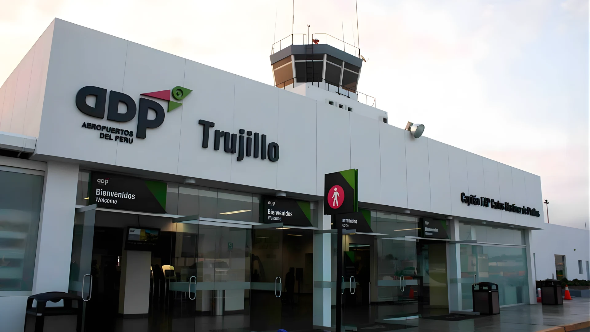
Airport in Trujillo: Carlos Martinez de Pinillos International Airport
The airport trujillo peru (IATA: TRU), Carlos Martinez de Pinillos International Airport, is the main entry point for Peru’s northern archaeological heartland. As one of the most historically significant trujillo airport peru facilities, it serves visitors coming specifically to explore the remarkable pre-Columbian heritage of the north coast. The chan chan archaeological zone nearest international airport trujillo peru designation makes TRU the essential hub for visiting this UNESCO World Heritage Site.
Trujillo is Peru’s third-largest city and a beautiful Spanish colonial settlement with a vibrant cultural scene and excellent northern Peruvian cuisine. The city’s charming historic center features colorful buildings and is considered one of the best-preserved colonial urban areas in Peru. From Trujillo, day trips can be organized to extraordinary archaeological sites including Chan Chan, the Huacas del Sol y de la Luna, and El Brujo.
Visiting Chan Chan and Huanchaco Beach from Trujillo Airport
Chan Chan, the former capital of the Chimú Empire and the largest pre-Columbian city in South America, is located a few kilometers away from the city of Trujillo. Flights to Trujillo from Lima take about an hour. The trujillo airport code TRU is used for all bookings. Within the broader network of northern peru airports, Trujillo stands out for its extraordinary density of archaeological sites accessible from a single hub.
Huanchaco Beach, located about 12 kilometers away from the city center, is known for the traditional totora reeds used to build small fishing boats called ‘caballitos de totora.’ This tradition has been around for thousands of years. This is a popular spot for surfers. From the airport, the city center is about 15 minutes away by taxi.
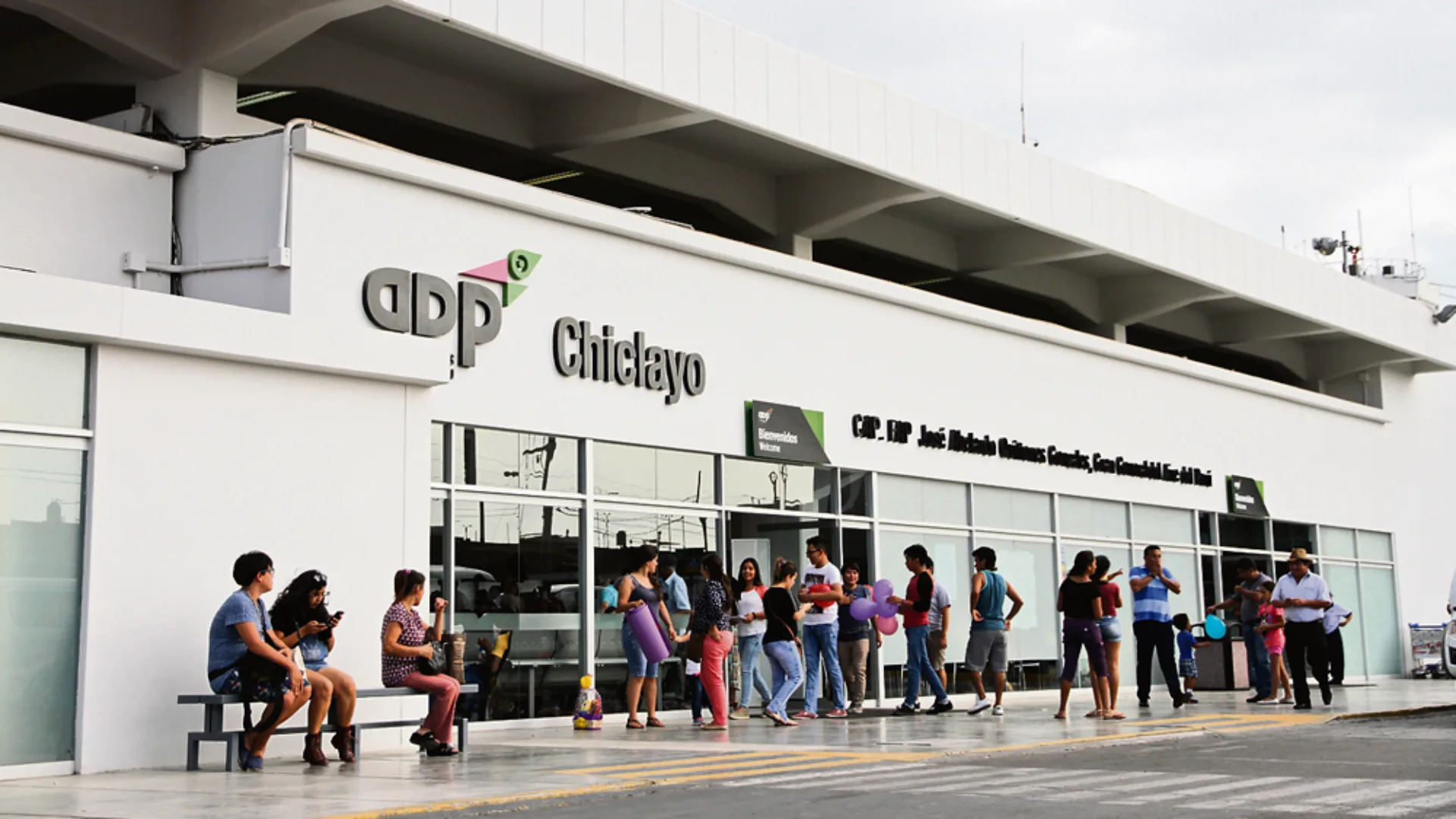
Airport in Chiclayo: Jose A. Quinones Gonzales International Airport
The chiclayo airport (IATA: CIX), also known as Jose A. Quinones Gonzales International Airport, serves the capital city of Lambayeque, one of the richest areas in Peru in archaeological terms. Officially the major Lambayeque airport hub, it is one of the major hubs in the northern peru airports. The chiclayo airport code CIX is used for all flight bookings. Often called the Capital of Friendship, Chiclayo is an ideal base for exploring the coast’s extraordinary cultural heritage.
The Lambayeque area experienced a major archaeological shift in 1987 with the discovery of the Lord of Sipan tomb, considered the most important discovery in the Americas after Machu Picchu. The artifacts from this royal Moche tomb have been put on display in the Huaca Rajada site museum and the Royal Tombs of Sipan Museum in Lambayeque.
Access to the Lord of Sipan Museum and Northern Connectivity
From Lima, flights to chiclayo take one hour and twenty-five minutes. The chiclayo airport facilities have been modernized in recent years with improved baggage handling and better retail options. The increase in the number of lambayeque flights can be attributed to the growing tourism profile of the area, based mainly on the recent archaeological findings at Sipan, Tucume, and Batan Grande.
Aside from the Sipan findings, the area has the Tucume Pyramids, a vast area of 26 adobe pyramids, and the beautiful beaches of Pimentel and Santa Rosa, located near the Pacific Ocean. Chiclayo has one of the best culinary experiences, offering the best of northern Peruvian cuisine, such as arroz con pato, cabrito, and espesado, among others, which are considered the best of Peruvian cuisine. Transportation from the airport to lambayeque for the museum visit takes 30 minutes.
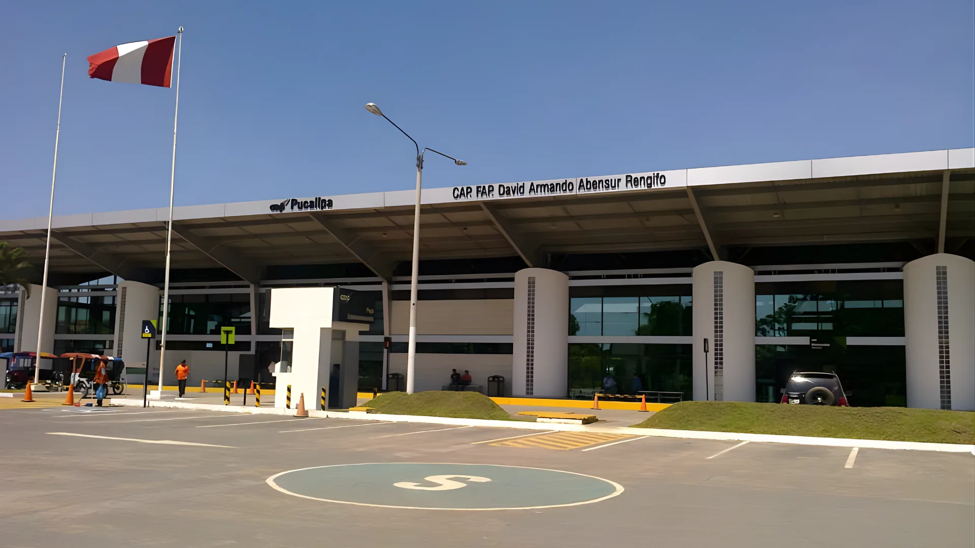
Airport in Pucallpa: David Abenzur Rengifo International Airport
The pucallpa airport (IATA: PCL), David Abenzur Rengifo International Airport, is the main airport for the region of ucayali. This ucayali airport receives daily flights to pucallpa from lima and some flights to other Amazonian cities. As a main central jungle airport, pcl airport receives flights to one of the most important river port cities in the Peruvian Amazon, where the ucayali river is the main river for commerce and daily activities.
Pucallpa is one of the most important commercial centers in the Amazon region of Peru. This Peruvian Amazon city is an important hub for activities like logging, fishing, oil exploration, and agriculture. While this Amazonian city remains off the tourist trail compared to other Amazonian cities like Iquitos, pucallpa provides authentic Amazon experiences. Yarinacocha lake, located near pucallpa, is a beautiful and scenic oxbow lake in the Amazon rainforest, ideal for boat tours and fishing, and visiting the indigenous shipibo-conibo people, who have unique designs in textiles and pottery.
Connecting to the Ucayali River and Central Amazon
From Lima, flights to Pucallpa take about one hour and twenty minutes. From Pucallpa Airport, transport to the city center can be obtained through taxis, mototaxis, and colectivos, which take about 15 minutes. In the Ucayali region, from the port of Pucallpa, cargo and passenger boats can be taken on a multi-day trip down the Ucayali River to Iquitos, passing through some of the most remote and untouched jungle landscapes in South America.
The Ucayali region has many indigenous communities, such as the Shipibo-Conibo, Cacataibo, and Yine, among others. Community-based tourism can be obtained in the region, providing an experience of the culture of the indigenous people. In the region, there is the Sierra del Divisor National Park, a lesser-known yet incredible ecosystem on the border of Brazil, with table-top mountains, called tepuyes, rising dramatically out of the jungle.
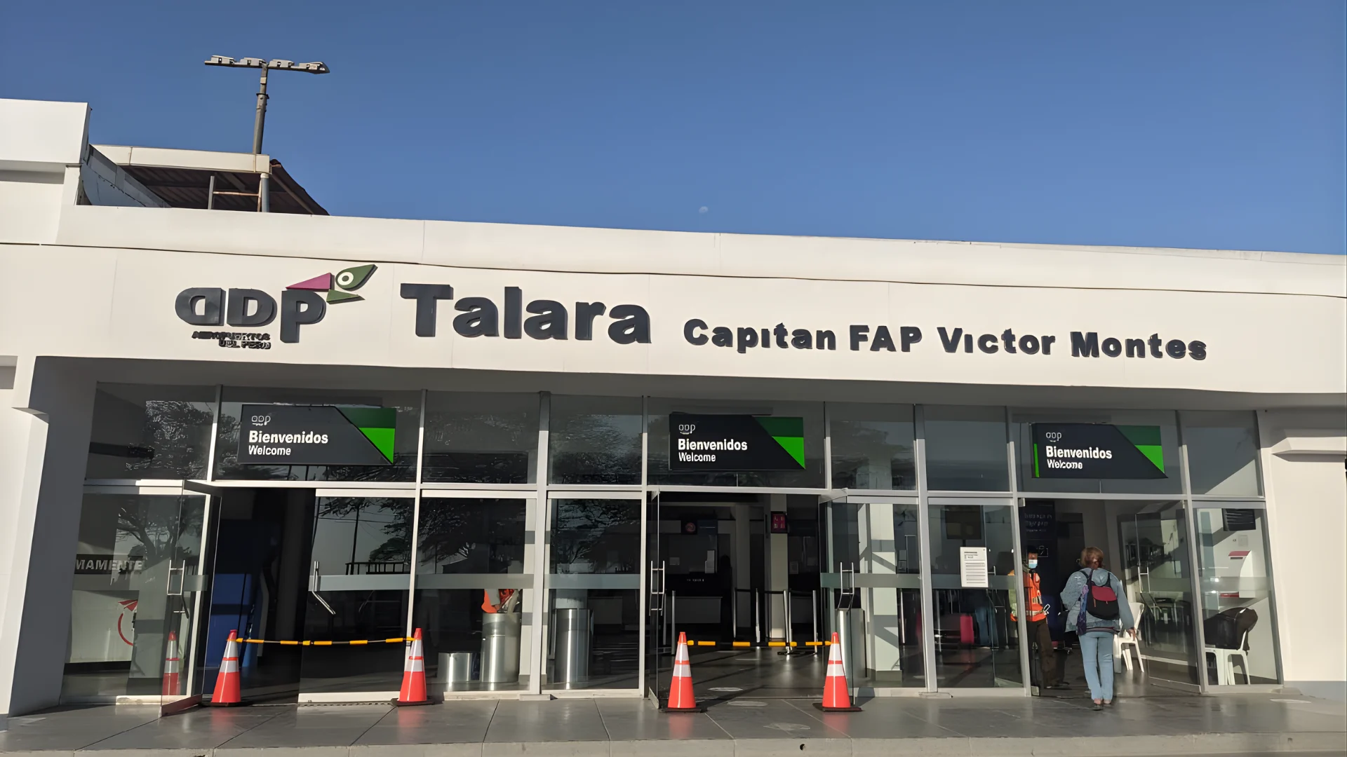
Airport in Talara: Victor Montes Arias Airport
The talara airport peru (IATA: TYL), Victor Montes Arias Airport, is of particular importance to beach-goers. The specific code for the airport, talara airport code, is TYL. This airport caters to the needs of travelers to the best beach resort locations. The importance of the airport, with regard to flights to mancora beach, makes it a preferred choice for travelers who wish to minimize the time spent on the ground. The talara international airport designation indicates that the airport has the technical capability to support international flights.
Talara has great historical importance, as the region was the main center for the oil industry. In fact, the oil industry was established in the region as far back as the late 19th century. There is a 2,500 meter runway at the airport, and the equatorial climate ensures that the beaches are pleasant almost throughout the year.
Direct Flights to Mancora and Punta Sal Beaches
Travelers who use the airport near mancora, at the town of talara, can benefit from the relatively shorter distance to the location compared to flying to the nearby town of piura. Mancora is about 70 kilometers to the north and can be reached in 60 to 75 minutes by taxi or bus. Flights to talara from lima take about one hour and forty minutes. The talara airport services are basic but functional, with taxis available upon arrival.
The beaches of Mancora have warm Pacific Ocean water temperatures between 24 and 28 degrees Celsius throughout the year, making it one of the few places in Peru where swimming and surfing are enjoyable all year round. It is one of the most popular beach destinations for South American travelers, including both international backpackers and Peruvian vacationers, because of the warm weather, the excellent surf, and the lively social atmosphere.
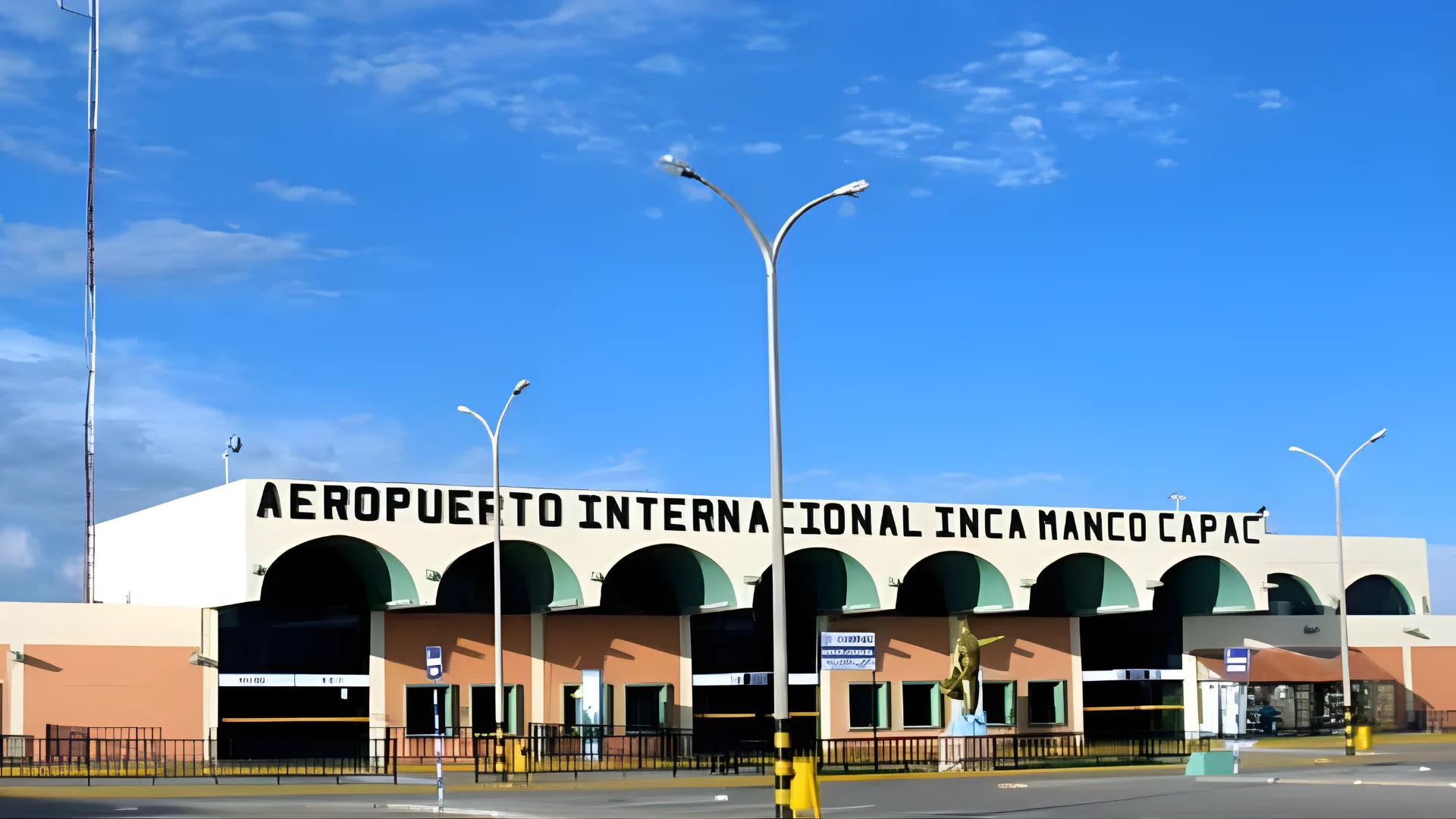
Airport in Juliaca and Puno: Inca Manco Capac International Airport
The airport in Puno Peru is technically in Juliaca and is referred to as the Inca Manco Capac International Airport (IATA: JUL). This Puno Peru airport is situated at a mind-boggling altitude of 3,824 meters above sea level. This makes it one of the highest commercial airports in the world. This Puno airport Peru is the vital entry point to Lake Titicaca and the city of Puno. The juliaca airport code JUL is used for all bookings, and travelers should note that the airport is 44 kilometers north of Puno city.
The altitude sickness or soroche is a real phenomenon that affects visitors to this airport in Peru due to the extreme altitude. Even healthy visitors from sea level may experience headache, nausea, and breathlessness. The landscape between Juliaca and Puno is breathtakingly beautiful. One passes through vast open plateaus with grazing alpacas and llamas in the distance, snow-capped mountains in the background, and skies that seem to stretch to infinity.
The Gateway to Lake Titicaca and High Altitude Considerations
From Lima, flights to juliaca takes about one hour and fifty minutes. Once one reaches the airport near Puno, one should move slowly and hydrate oneself. Altitude sickness medication should also be considered. The lake titicaca airport at Juliaca is the key to accessing one of Peru’s most culturally rich regions. From Puno, one can take a boat to the famous floating islands of the Uros people, or to the traditional communities on the islands of Amantani and Taquile.
Lake Titicaca, shared with Bolivia, sits at 3,812 meters above sea level and is the spiritual heartland of Andean civilization. The floating islands of the Uros people are constructed entirely from totora reeds and continuously maintained. The islands of Amantani and Taquile offer homestay experiences with Quechua-speaking communities maintaining traditional weaving traditions recognized by UNESCO as Intangible Cultural Heritage of Humanity.
Airport in Puerto Maldonado: Padre Aldamiz International Airport
The puerto maldonado peru airport (IATA: PEM), Padre Aldamiz International Airport, is the primary gateway to the Tambopata National Reserve. This important tambopata airport was significantly upgraded for the 2018 Summit of the Americas, resulting in an expanded terminal and improved runway infrastructure. As a major peru south america airport in the southeastern Amazon, it provides access to some of the most biodiverse ecosystems on Earth.
Puerto Maldonado sits at the confluence of the Tambopata and Madre de Dios rivers. The Madre de Dios region is part of the Western Amazon, often described by biologists as the most species-rich terrestrial ecosystem on the planet, with more recorded species of birds, mammals, reptiles, and plants than almost anywhere else in the world.
Visiting Tambopata National Reserve and Manu National Park
From Lima, flights to puerto maldonado take approximately one hour and forty-five minutes. Most ecotourists arriving at this amazon jungle airport are met by lodge representatives who arrange onward transport by road and boat. Tambopata flights connect this extraordinary conservation area to the national aviation network, supporting both tourism and the local communities living alongside the reserve.
The Tambopata National Reserve contains extraordinary oxbow lakes home to giant river otters, black caimans, capybaras, and an almost overwhelming diversity of bird species including macaws, toucans, and over 600 recorded bird species within the reserve itself. Peru has become one of the world’s top birdwatching destinations, and Puerto Maldonado is at the center of that reputation, with over 1,000 bird species recorded in the immediate vicinity.
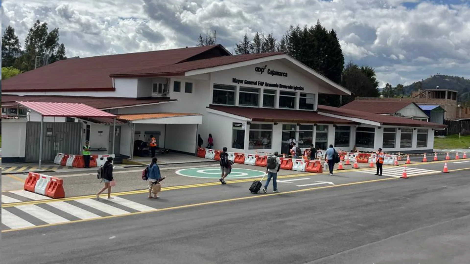
Airport in Cajamarca: Armando Revoredo Iglesias Airport
The cajamarca airport (IATA: CJA), Armando Revoredo Iglesias Airport, serves one of Peru’s most historically significant cities. Regular flights to cajamarca from Lima connect the city to the national network in approximately one hour and twenty minutes. This northern andes airport uses the cajamarca airport code CJA. It was in Cajamarca in 1532 that Francisco Pizarro captured Inca Emperor Atahualpa, effectively ending the Inca Empire.
Cajamarca is a charming colonial city surrounded by fertile Andean valleys, famous for its dairy production, carnival celebrations, and hot spring bathing facilities. It represents one of Peru’s most underrated destinations, offering authentic highland experiences away from the main tourist circuits, combined with extraordinary historical significance that few other cities in the Americas can match.
The Ransom Room and Thermal Baths Access from Cajamarca
Accessible by cajamarca airport taxi in about 10 minutes from arrival, the city’s main attractions include the Ransom Room (Cuarto del Rescate), the only standing pre-Columbian building in Cajamarca. The thermal baths of Baños del Inca are among the most popular in Peru, fed by natural springs at approximately 72 degrees Celsius. Key to planning any itinerary is booking flights to cajamarca in advance, particularly during the famous February Carnival.
Cajamarca tourism is anchored by its spectacular Semana Santa celebrations, its colonial churches, the nearby Kuntur Wasi archaeological site (featuring some of the oldest gold artifacts found in the Americas), and the extraordinary surrounding countryside with its patchwork of green fields, whitewashed farmhouses, and clear highland skies. The cheese and dairy products of Cajamarca are famous throughout Peru and well worth seeking out at local markets.
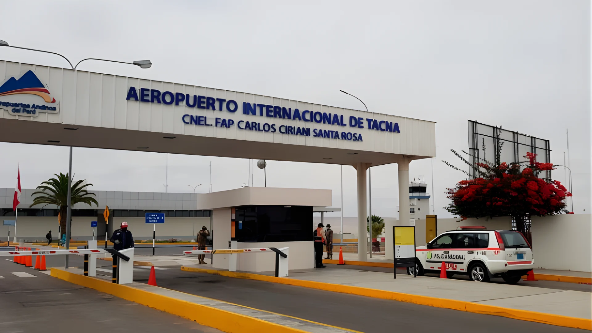
Airport in Tacna: Carlos Ciriani Santa Rosa International Airport
The tacna airport (IATA: TCQ), also known as Carlos Ciriani Santa Rosa International Airport, is the closest airport to Chile. As the main airport near chile border, it plays an important role in cross-border commerce and travel. Among southern peru airports, tacna airport is exceptional in its international border crossing capability. The tacna airport code is TCQ. This code represents the strategically located airport in the southernmost major city of Peru.
The city of Tacna is a source of great national pride in Peru. This is due to its resistance to Chilean occupation during the War of the Pacific (1879-1883). After 49 years of occupation, the city was returned to Peru in 1929. Presently, the city is an essential shopping hub for Chileans who enter the country to take advantage of price disparities between the two countries for food products and consumer electronics.
Border Crossing to Chile and Tacna Airport Logistics
From Lima, flights to tacna ttakes about two hours, which is one of the longer internal flights, given the length of Peru from north to south. The tacna airport location is approximately 3 kilometers from the city center, and this makes movement from the airport to the city and vice versa relatively quick and cheap. As a key southern border airport, Tacna has customs and immigration facilities for international arrivals, primarily from Chile.
The border town service to Arica, Chile, is frequent, and this service leaves from the international bus station. This service usually takes about two to three hours, including going through customs. For people planning to visit Peru and Chile, this is a good stopover, as it is a pleasant town with good hotels, restaurants, and a pleasant park area.
Airport in Tumbes: Pedro Canga Rodriguez Airport
The tumbes airport (IATA: TBP), Pedro Canga Rodriguez Airport, serves Peru’s northernmost coastal city. As the main airport near ecuador border, TBP connects this remote corner of northern Peru to the national aviation network. Sometimes also called the punta sal airport by travelers heading to the beaches, the official tumbes airport code is TBP, and the facility handles daily flights to Lima with a journey time of approximately two hours.
The Tumbes region has a unique ecology where warm equatorial waters meet the Peruvian coast, creating conditions for mangrove forests, coral reefs, and warm swimming beaches. The Tumbes Mangroves National Sanctuary is one of the most extensive mangrove ecosystems on the Pacific coast of South America, while Cerros de Amotape National Park protects equatorial dry forests the southernmost extension of this ecosystem on the continent.
Access to Punta Sal and Zorritos Beaches from Tumbes Airport
From Lima, flights to tumbes take approximately two hours. Tumbes airport transport options include taxis and colectivos available at the terminal exit. For travelers heading to the northern beaches airport connections, Punta Sal is approximately 60 kilometers south of Tumbes (75 minutes by taxi), while Zorritos is approximately 25 kilometers from the city.
The northern beaches accessible from Tumbes enjoy warm Pacific water temperatures of 26 to 29 degrees Celsius, considerably warmer than the cold Humboldt current waters characterizing most of Peru’s Pacific coast. Zorritos has seen growing development of quality beachfront accommodations and fresh seafood restaurants. The mangrove ecosystems near Tumbes provide fascinating boat tour experiences observing egrets, frigate birds, and the extraordinary ecological complexity of these coastal forests.
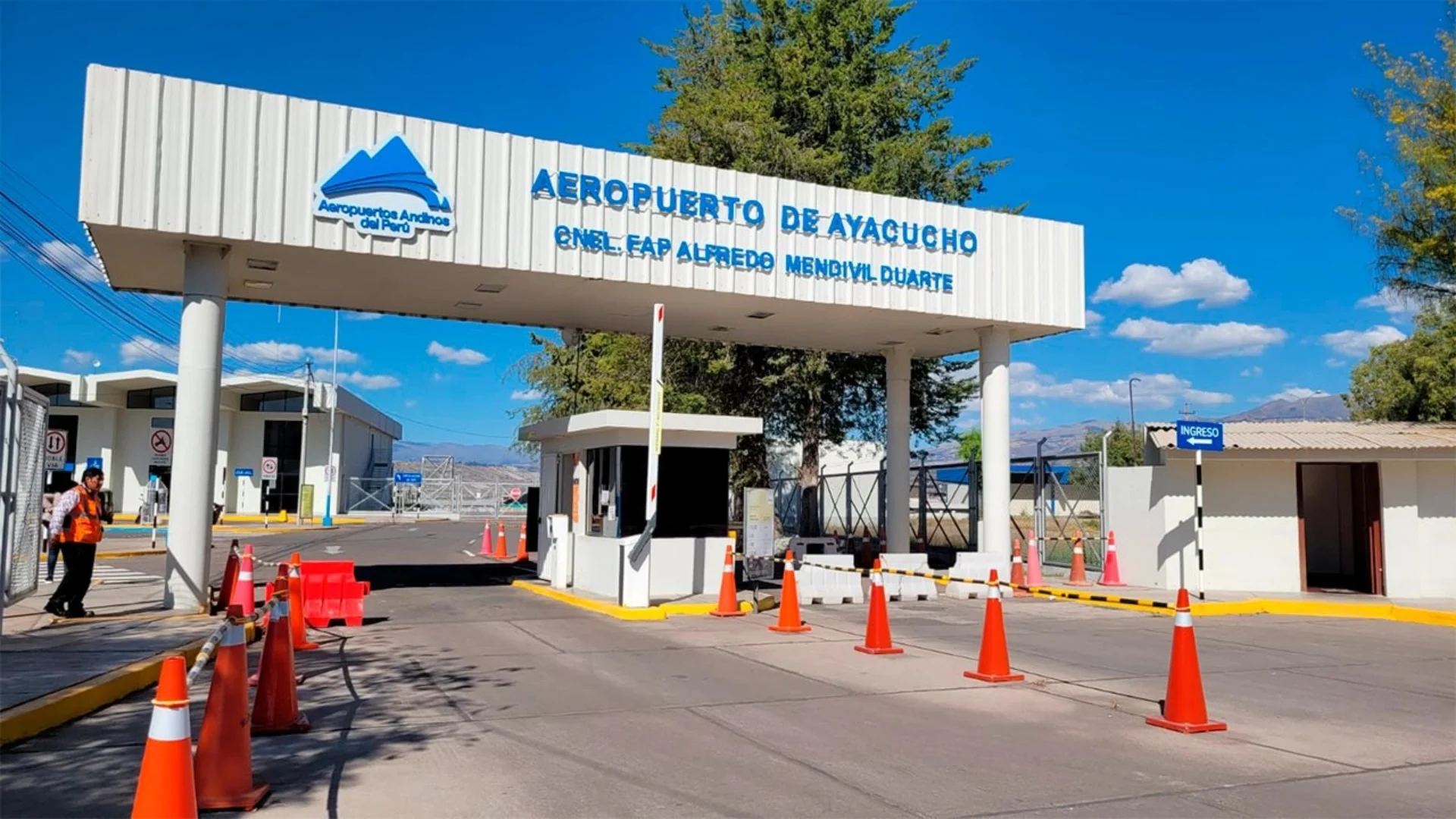
Airport in Ayacucho: Alfredo Mendivil Duarte Airport
The ayacucho airport (IATA: AYP), Alfredo Mendivil Duarte Airport, serves one of Peru’s most beautiful colonial cities. The ayacucho peru airport connects this culturally rich highland city to Lima with daily flights to ayacucho taking approximately one hour and ten minutes. The ayacucho airport code AYP is used for all bookings. Ayacucho sits at 2,746 meters in a warm, dry Andean valley and is home to over 30 churches representing different Spanish colonial architectural styles.
Ayacucho is home to one of the most famous Semana Santa celebrations in Latin America, considered second only to Seville in elaborateness and devotion. The celebration involves more than a week of processions, masses, and festivities involving the entire community. The city also represents one of the cradles of Peruvian independence, hosting some of the earliest republican battles, and maintains extraordinary artisan traditions in retablos, alabaster carving, and fine textiles.
Semana Santa Travel and Wari Culture Access
During Semana Santa, demand for flights to ayacucho surges dramatically and should be booked months in advance. Ayacucho airport transfer services are well organized but can become congested during peak festival periods. As the main central andes airport for this region, AYP provides access to the Wari ruins 22 kilometers north of the city capital of one of South America’s first multi-ethnic empire states, predating the Inca by centuries.
The Regional Museum of Ayacucho contains outstanding Wari ceramics and textiles, and local artisan traditions of retablos, alabaster carving, and fine weavings can be purchased directly from workshops throughout the city. Ayacucho’s relatively compact size, walkable historic center, and friendly local population make it one of the most rewarding highland cities to explore on foot at a leisurely pace.
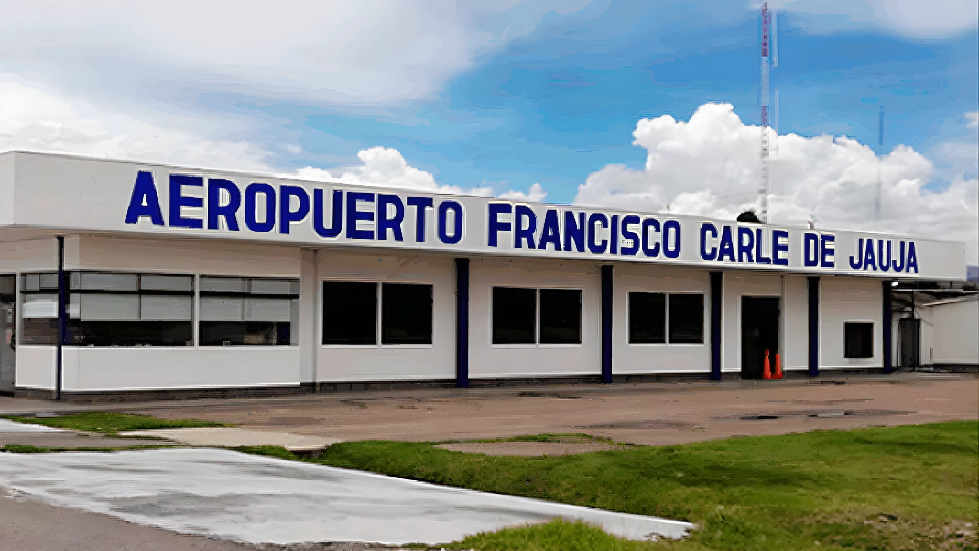
Airport in Jauja: Francisco Carle Airport
The Jauja Airport (IATA: JAU) also known as the Francisco Carle Airport, can be considered the airport for Huancayo and the Mantaro Valley, since the city of Huancayo does not have a commercial airport. This Huancayo Airport Alternative is located at an altitude of 3,363 meters above sea level and can be considered one of the central peru airports. The jauja airport code JAU serves one of Peru’s most historically significant cities Jauja was the first Spanish capital of Peru, founded by Pizarro in 1534.
The Mantaro Valley is one of the more productive agricultural areas in Peru, noted for its production of potatoes, quinoa, artichokes, and endemic Andean tubers. The area is also noted for its musical heritage, particularly the huayno music of Junin, and weaving styles from places such as Hualhuas and San Pedro de Cajas. The area’s richness in terms of culture and scenic beauty make it one of the more rewarding off-the-beaten-path destinations in Peru.
The Main Hub for Huancayo and the Mantaro Valley
The bus from Jauja to Huancayo takes about one hour, traveling a modern road through a fertile valley, making Jauja a relatively easy entry point. While flights to Jauja are not as frequent as to major destinations, they connect the valley to Lima several times a week. The central highlands airport at Jauja also provides access to Lake Junin, Peru’s second-largest lake, located above 4,000 meters and home to the Junin grebe, a species of waterbird endemic to Peru.
Huancayo is a lively commercial town with excellent Sunday and daily markets, especially the famous Cocharcas market, which is considered one of the largest indigenous markets in central Peru. In addition, the town’s tradition of silverwork and hand-woven textiles is considered to be among the finest in Peru. The central railway, which links Lima to Huancayo, is one of the highest in the world and a feat of engineering, known as the Ferrocarril Central Andino.
Airport in Huaraz and Anta: German Arias Graziani Airport
The Huaraz airport, which has the official name German Arias Graziani Airport or anta airport peru (ATA), serves the Cordillera Blanca region of the Ancash department. While flights to huaraz have historically been limited, recent efforts aim to establish regular commercial jet services to this world-class trekking destination. The Huaraz airport, which has the official name German Arias Graziani Airport or anta airport peru (ATA), serves the Cordillera Blanca region of the Ancash department.
The Cordillera Blanca has over 30 peaks over 6,000 meters high, including the 6,768-meter-high Huascaran, which is the highest peak in Peru. The Huascaran National Park is a UNESCO World Heritage Site and Biosphere Reserve. At the moment, the only way to reach Huaraz is to take an overnight bus from Lima (8 hours), but the possibility of air service to Huaraz is met with great enthusiasm.

New Commercial Jet Flights to the Cordillera Blanca
The development of flights to huaraz latam or other carriers would transform regional tourism. The huaraz airport code ATA is already listed on flight booking systems, reflecting the airport’s formal capacity. Huaraz has become known as Peru’s premier trekking airport peru destination, with world-famous trails including the Santa Cruz Trek, Huayhuash Circuit, and the breathtaking Laguna 69 day hike drawing thousands of international trekkers each year.
In the meantime, comfortable bus services from Lima operated by Cruz del Sur, Movil Tours, and Oltursa provide reliable overnight connections with modern coaches. The region’s growing quality of accommodation, guided trekking services, and outdoor recreation infrastructure makes Huaraz increasingly competitive with international mountain destinations. Improved air access would make it accessible to a much broader segment of travelers.
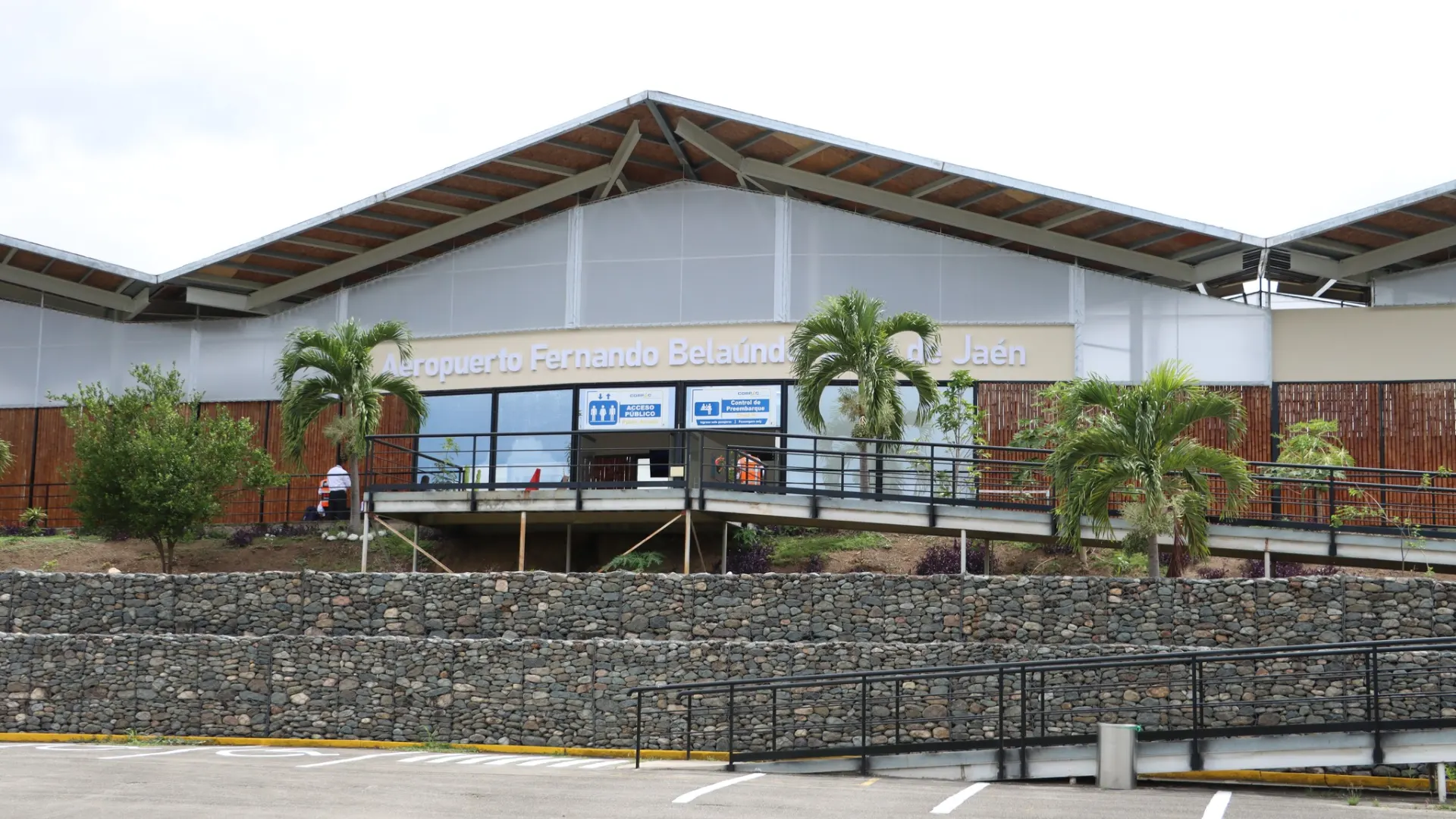
Airport in Jaen: Shumba Airport for Kuelap Access
The Jaén Airport (IATA: JAE), officially Shumba Airport, serves the city of Jaen in northern Peru and functions as a key gateway to the Amazonas region. As the main airport near Chachapoyas, which is option accessible by air, it provides connections for travelers headed to Kuelap. Flights to Jaén, Peru from Lima take approximately one hour and twenty minutes. The Jaén airport code JAE identifies this gateway to the extraordinary Chachapoyas cultural landscape.
Jaen is located at approximately 729 meters above sea level in a transitional zone between the Andes and the Amazon, giving it a warm subtropical climate. The region’s economy has grown significantly through production of specialty coffee and fine-flavor cacao. From Jaen, travelers can reach the Chachapoyas area in four to five hours by road, accessing the great Kuelap fortress the circular stronghold of the mysterious Chachapoya cloud warriors culture.
Connecting to Chachapoyas and Gocta Waterfall
The current Jaén airport status as a commercial facility has improved with better passenger facilities. For travelers focused on the kuelap airport question, Jaén provides the most accessible flying entry point to the broader region. Daily bus services connect to Chachapoyas from Jaén. Flights to Jaén are served by LATAM Peru and Sky Airline with reliable scheduling.
The Gocta Waterfall near Chachapoyas, at approximately 771 meters, is one of the tallest in the world. The combination of Kuelap fortress, the sarcophagi of Karajia set into dramatic cliff faces, the mausoleums of Revash, and the cloud forest scenery makes the Chachapoyas region one of Peru’s most extraordinary cultural landscapes. The cable car (teleferico) to Kuelap has made the fortress dramatically more accessible than the previous steep multi-hour climb.
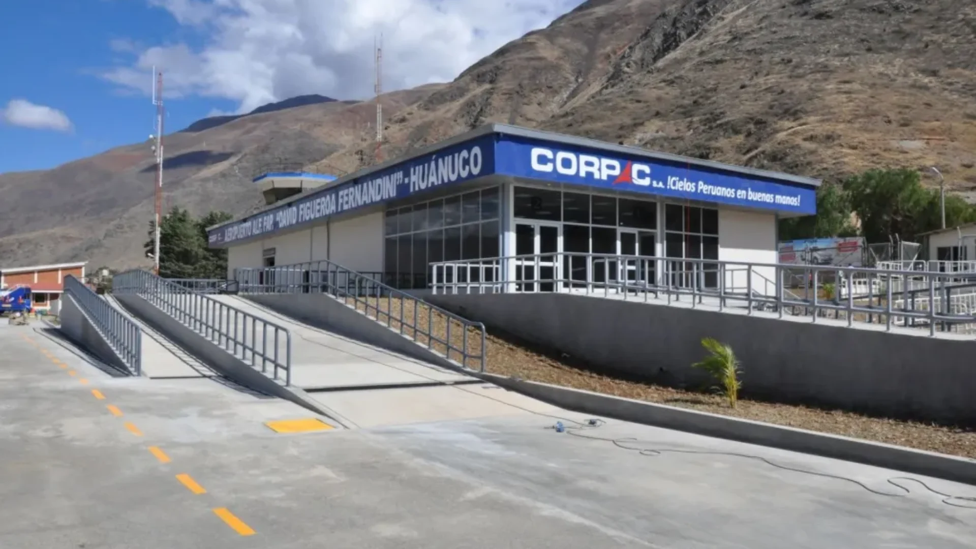
Airport in Huanuco: David Figueroa Fernandini Airport
The Huanuco Airport (IATA: HUU), David Figueroa Fernandini Airport, serves Huanuco, a pleasant city along the Huallaga River at 1,894 meters above sea level. Regular flights to Huanuco from Lima take approximately 55 minutes, making it one of the shorter domestic routes. The airport also serves as a central jungle access point for travelers heading east into the high jungle. The huanuco airport code HUU is used for all bookings.
Huanuco is considered one of the warmest highland cities in Peru thanks to its relatively low elevation, and its population has grown significantly as the central jungle access route through the city increases commercial activity. The remarkable pre-Inca site of Kotosh, approximately 4 kilometers from the city, is one of the oldest known ceremonial structures in the Americas at approximately 4,000 years old, predating even the earliest Chavin culture.
Gateway to Tingo Maria and the Sleeping Beauty Mountain
The Huanuco airport location on the city’s edge means transfers to the center take just 10 to 15 minutes by taxi. From Huanuco, the highway descends into the cloud forest and high jungle to reach Tingo Maria, approximately 120 kilometers and two hours away. As one of the key central peru airports, HUU opens up this fascinating transition zone between the Andes and Amazon to travelers preferring not to make the lengthy overland journey from Lima.
Tingo Maria National Park is home to the Sleeping Beauty mountain, a series of ridgelines forming the unmistakable silhouette of a reclining woman when viewed from the valley. The park offers cave exploration, including the famous Cave of the Owls (Cueva de las Lechuzas), home to thousands of oilbirds that emerge in spectacular flocks at dusk. River rafting, waterfall hikes, and high-jungle wildlife watching complete the Tingo Maria experience.
Airport in Nazca: Maria Reiche Neuman Airport
The nazca airport peru (IATA: NZA), Maria Reiche Neuman Airport, is one of the most specialized aviation facilities in Peru, existing primarily to support scenic nazca lines flights. Named after the German mathematician who dedicated her life to studying the geoglyphs, this nazca aerodrome uses the nazca airport code NZA. The Nazca Lines, created between 500 BCE and 500 CE, are a UNESCO World Heritage Site visible only from above.
The Nazca Lines cover approximately 450 square kilometers on the Nazca Plateau and depict animals (hummingbird, spider, monkey, condor, whale), geometric forms, and long straight lines extending for kilometers. Their origin and purpose remain one of archaeology’s great mysteries. Most travelers arrive in Nazca by road from Lima (7 hours) or Ica (2 hours) and take short scenic flights from the local airport, which handles multiple small aircraft simultaneously during peak hours.

Scenic Overflights of the Nazca Lines Geoglyphs
The nazca lines airport handles scenic nazca flights typically lasting 30 to 60 minutes depending on the package. As one of Peru’s premier tourism airport peru facilities, it supports multiple aviation companies offering overflight routes. Morning flights are recommended to avoid thermal turbulence. Travelers susceptible to motion sickness should take precautions before the flight.
Beyond the Lines, the Nazca area offers the Cantalloc Aqueducts, an extraordinary engineering achievement maintaining water supply across the desert for over 1,500 years the Cahuachi ceremonial center (the largest adobe city in the ancient Americas), and the Chauchilla Cemetery where naturally mummified human remains are on open display. Nazca has a comfortable range of hotels and restaurants catering to the international market.
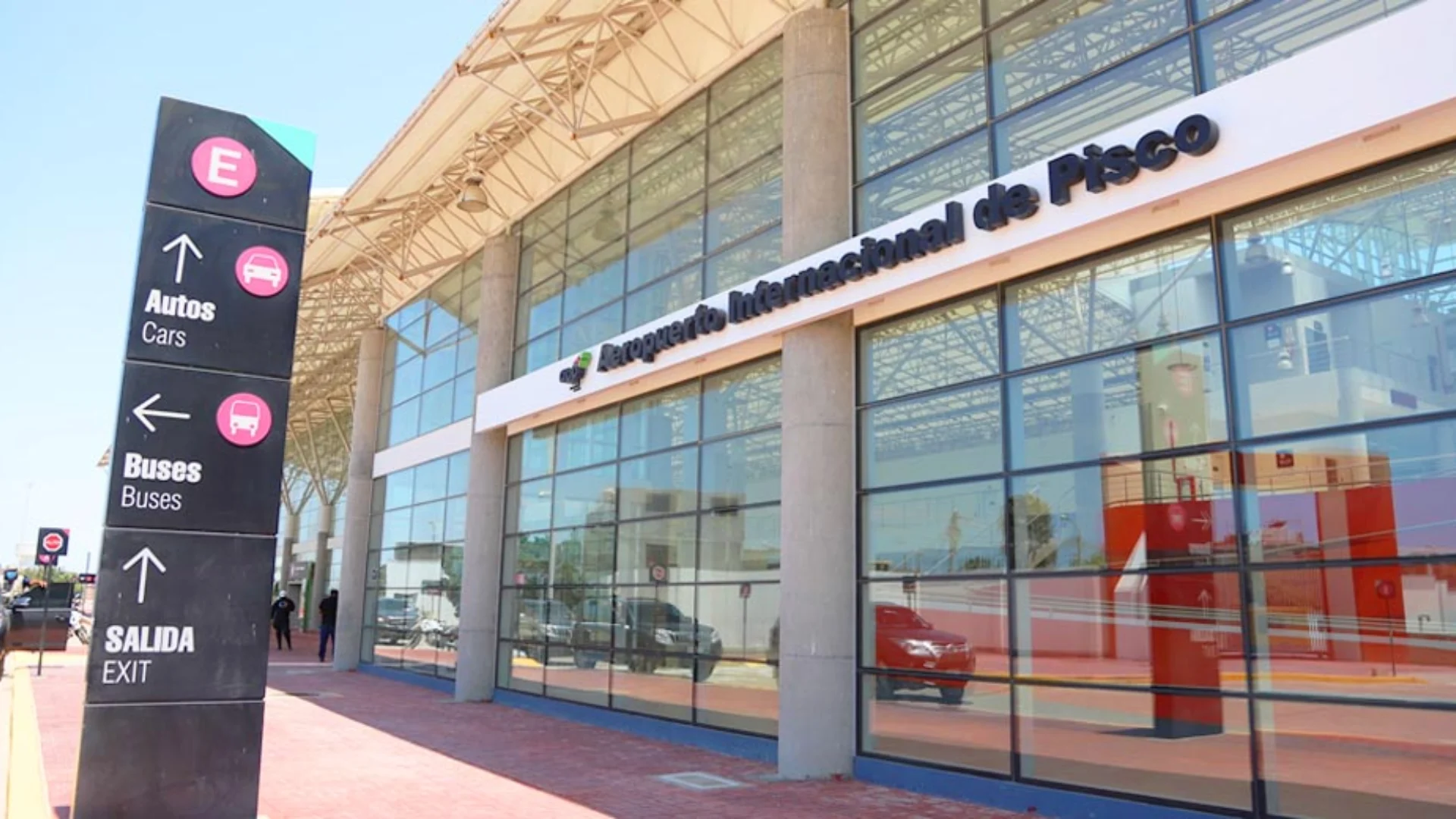
Airport in Pisco: Renan Elias Olivera Airport
The Pisco Airport Peru (IATA: PIO), officially known as Renán Elías Olivera Airport, serves the coastal area of the Ica region. It holds strategic value as the primary Paracas airport and functions as the official alternate airport for Lima for international flights when Jorge Chávez Airport is closed due to weather conditions. Located 240 km south of Lima, it provides access to some of Peru’s most spectacular natural environments.
The Paracas National Reserve, located near Pisco, features a unique desert-meets-ocean landscape and diverse marine wildlife. It is the departure point for boat tours to the Ballestas Islands, often called the “Galapagos of Peru,” which are home to large colonies of Humboldt penguins, sea lions, and diverse seabirds. In recent years, the area has seen an increase in luxury hotels catering to high-quality international tourism.
Paracas Reserve Flights and Alternate Landing for Lima
While flight availability at Paracas airport continues to evolve, most travelers currently reach the area via comfortable direct buses from Lima, a journey of approximately three to four hours. However, charter and seasonal flights to Pisco are increasing. Because it serves as a critical alternate landing site for Lima, the airport maintains high-level ground handling and customs facilities to manage diverted international traffic.
Beyond Paracas, the Ica region offers other world-class attractions, including the Huacachina oasis a picturesque lagoon surrounded by massive sand dunes and the famous vineyards of the Ica Valley, renowned for producing Peru’s finest wines and Pisco.
Quick Reference: All Major Airports in Peru 2026
| City | Airport Name | IATA Code | Altitude (m) | Type |
|---|---|---|---|---|
| Lima / Callao | Jorge Chavez International | LIM | 13 | International Hub |
| Cusco | Alejandro Velasco Astete | CUZ | 3,310 | International |
| Arequipa | Alfredo Rodriguez Ballon | AQP | 2,549 | International |
| Iquitos | Francisco Secada Vignetta | IQT | 126 | International |
| Piura | Guillermo Concha Iberico | PIU | 55 | International |
| Tarapoto | Guillermo del Castillo Paredes | TPP | 333 | Domestic |
| Trujillo | Carlos Martinez de Pinillos | TRU | 34 | International |
| Chiclayo | Jose A. Quinones Gonzales | CIX | 27 | International |
| Pucallpa | David Abenzur Rengifo | PCL | 149 | International |
| Talara | Victor Montes Arias | TYL | 85 | Domestic |
| Juliaca / Puno | Inca Manco Capac | JUL | 3,824 | International |
| Puerto Maldonado | Padre Aldamiz | PEM | 256 | International |
| Cajamarca | Armando Revoredo Iglesias | CJA | 2,621 | Domestic |
| Tacna | Carlos Ciriani Santa Rosa | TCQ | 552 | International |
| Tumbes | Pedro Canga Rodriguez | TBP | 17 | Domestic |
| Ayacucho | Alfredo Mendivil Duarte | AYP | 2,746 | Domestic |
| Jauja / Huancayo | Francisco Carle | JAU | 3,363 | Domestic |
| Huaraz / Anta | German Arias Graziani | ATA | 2,800 | Limited Ops |
| Jaen | Shumba Airport | JAE | 729 | Domestic |
| Huanuco | David Figueroa Fernandini | HUU | 1,894 | Domestic |
| Nazca | Maria Reiche Neuman | NZA | 598 | Tourism / Charter |
| Pisco / Paracas | Renan Elias Olivera | PIO | 39 | Domestic / Alternate |
Peru’s aviation network continues to expand, reflecting the country’s growth as one of South America’s premier tourism destinations. Whether you are planning a visit to Machu Picchu or an expedition through the Amazon or the coast, this guide to the Peru airport network will help you plan your 2026 travels. Always verify current schedules directly with carriers.
Frequently asked quetions about Complete Directory of Operational Airports in Peru and Regional Terminals 2026
-
Peru has 22 major operational airports in 2026. The most important are Jorge Chavez International Airport (LIM) in Lima, Alejandro Velasco Astete Airport (CUZ) in Cusco, Alfredo Rodriguez Ballon Airport (AQP) in Arequipa, Inca Manco Capac Airport (JUL) in Juliaca/Puno, and Francisco Secada Vignetta Airport (IQT) in Iquitos. Together they connect Peru’s coast, Andes, and Amazon regions.
-
The best airport depends on your destination. Lima Jorge Chavez International Airport (LIM) is the best entry point for most international travelers, connecting to all domestic routes. If heading to the Inca heartland, connect to Cusco Airport (CUZ), the closest airport to Machu Picchu and the Sacred Valley.
-
There are proposals for Chinchero International Airport, approximately 26 km from Cusco in the Sacred Valley. The project has faced years of delays due to funding disputes, environmental concerns, and UNESCO objections. As of 2026, construction is in progress but not yet operational. The only current option is to fly into Cusco Airport (CUZ) and continue by train or bus to Machu Picchu.
-
What is the nearest airport to Machu Picchu? Cusco’s airport, Alejandro Velazco Astete, located at an altitude of 3,416 m / 10415ft, is the nearest airport to Machu Picchu in Peru. It is the second busiest international airport in Peru after Lima’s airport.
-
The best airport for visiting Machu Picchu is Cusco Airport (CUZ). From Cusco take the train from Poroy or Ollantaytambo to Aguas Calientes, then a bus to the entrance. There are no direct flights to Machu Picchu since no airport exists at the site itself.