Nazca Lines: Mystery, Size & How They Were Made (2026 Guide)
In the annals of ancient Peru’s mysteries, the Nazca Lines stand out as one of the world’s greatest enigmas. These giant geoglyphs stretch across the arid desert floor, depicting geometric shapes, animals, and plants that only reveal their true form from the sky.
To understand their magnitude before you visit, here are the Quick Facts every traveler should know:
| Location: | Nazca Desert, Southern Peru (400 km from Lima) |
| Created by: | The Nazca Culture (200 BCE – 600 CE) |
| Total Area: | Nearly 500 square kilometers (190 sq mi) |
| Biggest Figure: | The Pelican (Albatross) at 300 meters long |
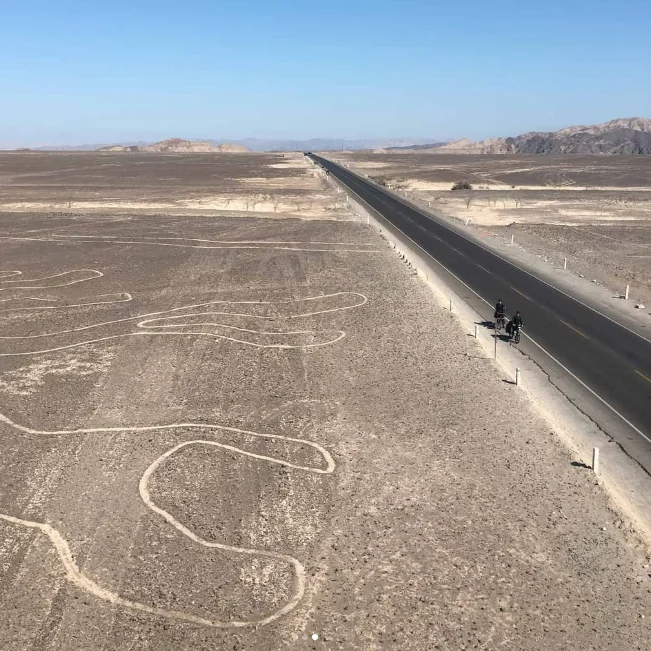
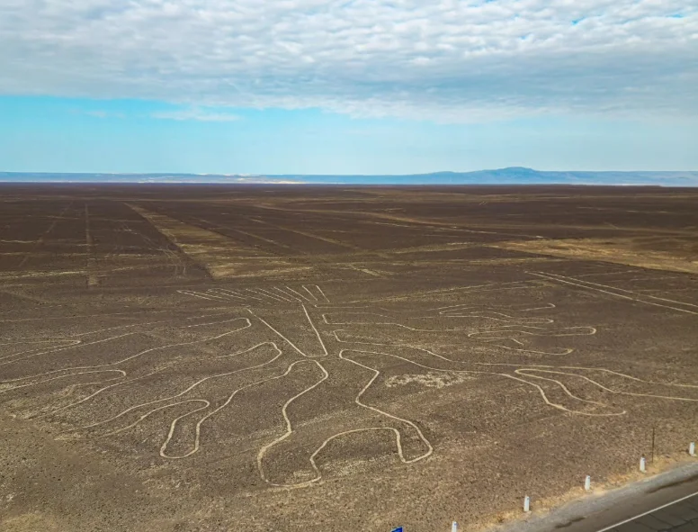
The Nazca desert drawings are unlike other archaeological sites in that they require the observer to be at least a few hundred feet above the desert floor for the true expression and greatness of the designs to be visualized. Each year international visitors flock to southern Peru to see these vast artistic extensions, which are quite possibly the most persistent enigmas involving the human condition.
How were the Nazca Lines made?
One of the top questions is: How were these drawings made without modern technology? The answer lies in the unique geology of the Peruvian desert.
The lines were not “painted” but created through a process of subtraction. The surface of the desert is covered with reddish-brown pebbles, oxidized by the sun. The ancient Nazca people carefully removed these dark top stones to reveal the lighter, lime-colored soil underneath. This created a sharp color contrast that is visible from the sky.
Because the Nazca Desert is one of the driest places on Earth (with very little wind or rain), these “desert drawings” have remained naturally preserved for nearly 2,000 years, acting like a graphical book on the desert floor.
How Big are the Nazca Lines? (Real Size)
The sheer scale of these geoglyphs is mind boggling and difficult to imagine from the ground. While some straight lines run across the desert for over 30 kilometers (18 miles), the famous animal figures have impressive dimensions.
Here is the real size of the most iconic drawings:
| Figure Name | Length (Approx) |
|---|---|
| The monkey | 310 ft |
| The Condor | 130 meters (440 ft) |
| The Hummingbird | 96 meters (310 ft) |
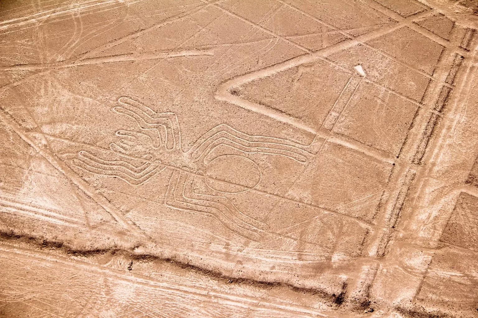
| The Spider | 46 meters (150 ft) |
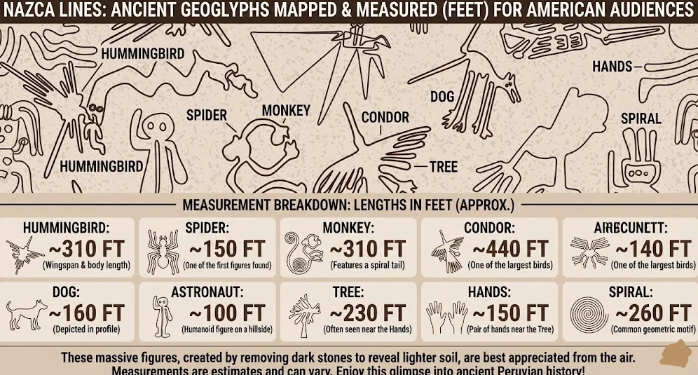
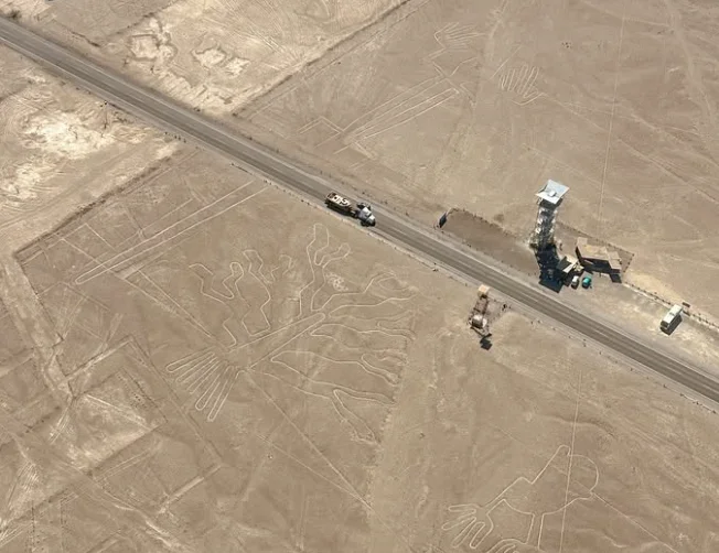
Because of these massive dimensions, it is almost impossible to distinguish the shapes while walking on the ground. That is why the best experience is taking a Flight Tour, where pilots bank the plane so you can capture the perfect photo of these giant figures.
The meaning behind Peru desert drawings
The significance of the drawings in the desert of Peru is still up for debate, but there seems to be clear agreement amongst most scholars that these illustrations were of great cultural and spiritual importance. Whether they were depictions of deities, natural elements, or cosmological maps, regardless of their exact meaning by themselves, the geoglyphs show that the Nazca people had a complex view of the world. It may be that they are all forms of a connect with the gods or a way of showing gratitude to their gods, or a way organize their actions in a balance with nature. The Nazca lines show us that art and spirituality existed together in ancient Peru, and the desert was the appropriate medium and location to conduct their connection to the divine.
The mystery of their purpose has generated dozens of theories over the last century. While we may never know for sure, these are the three most prominent explanations:
1. The Astronomical Calendar: The German mathematician Maria Reiche dedicated her life to studying the lines. She believed they functioned as a giant calendar to track the sun and stars, which was vital for agriculture in the desert.
2. Water Rituals: Recent archaeological studies suggest the lines were ritual pathways. The Nazca people likely walked these lines in procession to pray to the gods for water, the most precious resource in this arid region.
3. The Alien Theory: Popularized by books and TV shows, this theory suggests the lines were landing strips for “ancient astronauts.” While it is an exciting idea, there is no scientific evidence to support it, but it adds an air of mysticism to the visit.
The story of how the drawings in Peru were created by ancient cultures
The inception of the drawings in Peru begins with the Nazca culture and the era between 200 BCE and 600 CE. The Nazca removed the top layer of the earth which was made up of dark rocks to expose the lighter soil underneath. They created a very large contrast as it has been said that the images can be seen from miles away. In order to do this, it was important to not just work hard, but to also have the skills to keep things in proportion, in line, in angle, and with respect to the gods in the stars. Some have suggested that it is very possible wooden stakes were put in place to maintain the accuracy of the rock placements, especially with the larger designs and figures. The evidence shows that the Nazca people valued hard work and were able to establish a cooperative work force that indicate a society with some level of cultural cohesion and project planning.
Understanding the true nature of the lines of Nazca
To truly appreciate the lines of Nazca, one must think beyond the naked eye. These geoglyphs aren’t just random patterns; they are deliberately made geoglyphs that have meaning. Perhaps, they were to serve as maps, calendars or ceremonial places, possibly fulfilling many different roles in society We are only beginning to look for aspects of their purpose by investigating their orientation, their relationship with water, and celestial events, in which the lines of Nazca exist as an open book of mysteries, with each method of archaeology, and new technology, peeling off layers.
Exploring the mystery of the Nasca lines
The quest to understand the mystery of the Nasca lines is one of the most fascinating adventures for historians and tourists alike. When you are standing in the desert, you can literally feel the size of these geoglyphs. For example, on the ground some of the lines stretch out into the horizon and they appear also to be endlessly if you are in the air you fins out a bit about their actual dimensions and shape. You leave reflecting on humanity’s ability to create things, to endure and strive to leave a mark of our existence. The Nasca lines are still a perplexing puzzle, a reminder that our history still remains a mystery.
Exploring the Nazca drawings and their hidden history
Journeyweaving the Nazca drawings opens a gateway to an ancient world that, by virtue of sheer artifice and art, defined a people’s existence and created community. These drawings can be understood not only in the desert but also in the cosmovision and practices that are still being enacted and lived today by some people in the area. In the context of the Nazca geoglyphs, there is hidden history waiting to be remembered. The narratives of geoglyphs await archaeological discoveries to piece together this obscured history. Each drawing is another piece of the puzzle of how the Nazca lived, what they valued, and how they engaged their environment. They demonstrate a civilization that fundamentally sought and revealed meaning in its cultural expression, and that in its simplicity produced a powerful spiritual and artistic manifestation.
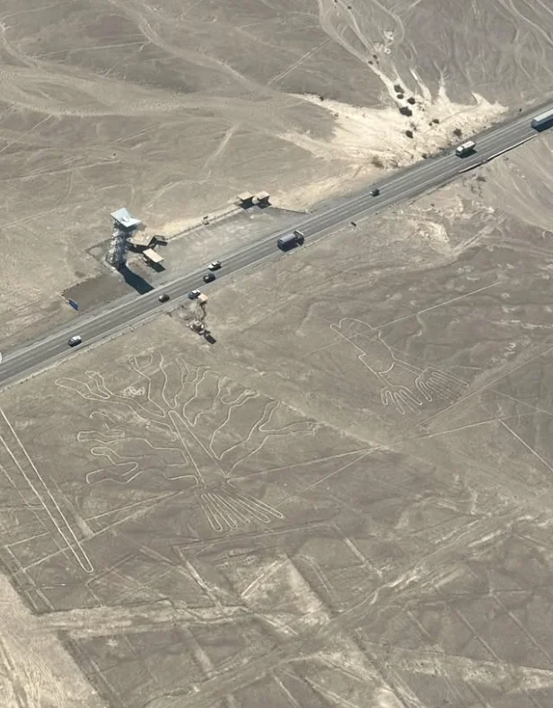
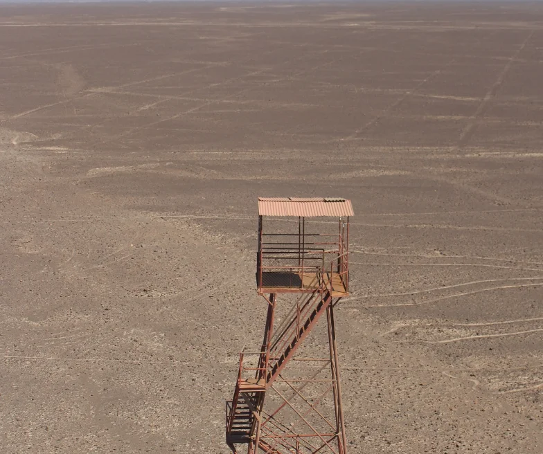
How to see the Nazca lines from the ground and the sky
There are two primary means for visitors to view the Nazca lines; ground based and sky based viewing. Observational towers can provide a unique vantage point to view some of the figures in considerable detail from the ground and allow a perspective in regard to size and scale. However, the only way to really appreciate the true scale of the geoglyphs is to have a birds eye view from overhead. Small aircraft fly tourists over the desert and provide a panoramic view of the giant drawings, which is incredibly breathtaking. Engaging with the Nazca lines from the land and air enables a more complete understanding of the innate genius of the Nazca people. Regardless of the means of travel used in order to see the Nazca lines, they are guaranteed to be one of the most memorable experiences in Peru.
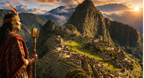
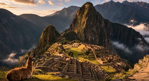
Nazca Lines vs. Inca Lines: Clearing the Confusion
Many travelers search online for “Inca drawings” or “Inca lines,” but this is a common misconception. The Nazca Lines predate the Incas by over 1,000 years. While the Incas built impressive roads (the Qhapaq Ñan) and citadels like Machu Picchu in the 15th century, they did not create these geoglyphs. The Nazca culture flourished much earlier, between 100 BCE and 800 CE. Understanding this timeline helps us appreciate the advanced engineering possessed by pre-Inca cultures on the coast of Peru.
nazca lines size
Travelers frequently want to know: just how big are the Nazca Lines? The results may surprise you. Although some geoglyphs are relatively small and measure just a few meters across, the largest figures and lines measure several hundred meters across the desert plain!
Below we have a clear and concise overview of the most interesting facts and size details.
| Category | Size / Notes |
|---|---|
| Typical length of geoglyphs | Most Nazca Lines measure between 50 m and 300 m |
| Smallest figures | Around 10–20 meters in length |
| Largest figures and lines | Some extend over 300 m — the size of three football fields |
| Overall desert area | The Nazca Lines cover hundreds of square kilometers in southern Peru |
| Best way to see them | From a scenic flight (300–500 m altitude) for full views; observation towers offer partial views |
| Time of creation | Dating from 200 BCE to 600 CE |
| Coordinates | Nazca Desert, Peru — approx. 14.7° S, 75.1° W |
| Nazca lines dimensions | The Nazca Lines dimensions range from small figures of about 10–20 meters to giant geoglyphs stretching over 300 meters across the desert. |
Frequently asked quetions about Nazca Lines: Mystery, Size & How They Were Made (2026 Guide)
-
The Nazca desert drawings, also known as Nazca geoglyphs, are large figures carved into the dry plains of southern Peru. The drawings in the desert consist of animals, plants, and geometric shapes that had been developed over 1,500 years ago by the Nazca culture. They are one of the greatest mysteries of ancient civilizations and will remain visible for many generations because of the dry climate of the region.
-
The Nazca Lines vary immensely in size. Some are just a few meters across while others extend hundreds of meters across the desert floor. When asked about the size of Nazca Lines or just in general the dimensions of the Nazca Lines, experts say that the hummingbird, for example, is about 93 meters long and the biggest drawings are above 300 meters in length. If you have ever asked how long are the Nazca Lines, the answer depends on the figure, but individually the Nazca Lines cover nearly 1,000 square kilometers of the desert.
-
While they may be confused with Inca lines or even Aztec lines by some travelers, the Nazca Lines were created by the Nazca Culture, which existed long before the Incas. This is why terms like Nazca Lines Inca or Aztec Lines are technically incorrect, but they reveal how people associate these desert geoglyphs with other great cultures of the Americas.
-
The precise nature of the Nazca drawings is unknown. Some theorize the desert drawings in Peru had astronomical functions, others suggest ceremonial paths or offerings to gods. Regardless of intended use, the Peru ground drawings also called the Peru drawings in desert remain one of archaeology’s fascinating mysteries.
-
It is almost impossible to distinguish the lines of Nazca from the ground due to their size. This is why most visitors view them in a small airplane. The Nazca Lines are so large that viewed from above you can understand fit them into the figures and contemplate the questions about how they were made.