Inca Trail Guide 2026: Everything nobody tells you to get to Machu Picchu.
By: Napoleon arcondo
The Inca Trail isn’t just a path; it’s a living organism with rules dating back 600 years. If you arrive in Cusco on a Monday and intend to climb to 4,215 meters on Tuesday, the mountain won’t welcome you; it will teach you a lesson your lungs won’t forget. But it doesn’t have to be that way. There’s a secret map of timing, acclimatization, and logistics that separates tourists from true explorers. Want to learn more?
Inca Trail: History and Adventure to Machu Picchu Step by Step
The Inca Trail is a place where physical pain and spiritual glory go hand in hand on every stone step. But what if I told you that 90% of the frustration travelers feel along the route is completely avoidable? From the mystery of Kilometer 82 to the tunnels carved into solid rock, there is a way to experience the Qhapaq Ñan of the Empire without turning the journey into torture. Let me show you how.
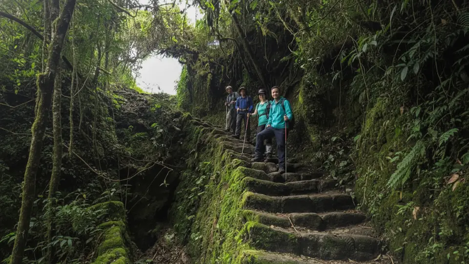
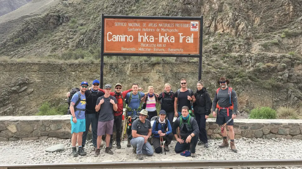
Foreign tourists hiking the Inca Trail
What Is the Inca Trail and Why Is It a World Heritage Site?
It served as a tool for connectivity, linkage, and coordination between Cusco, provincial administrative centers, villages, production and extraction areas, and natural resources, making economic traffic and exchange, as well as the mita, possible. But it was also used to transmit the Inca worldview, connecting sacred spaces such as the countless apachetas associated with the ceque system.
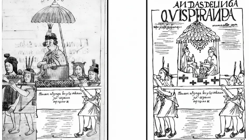
The Sapa Inca and his royal entourage traveling along the Inca Trail in a litter
Meaning of Qhapaq Ñan or the Inca Trail
The Inca Trail, also known in Quechua as “Qhapaq Ñan,” means “Road of the Lord,” “Royal Road,” or “main road.” It was built by the Incas throughout the Tahuantinsuyo Empire, connecting territories from Colombia to central Chile.
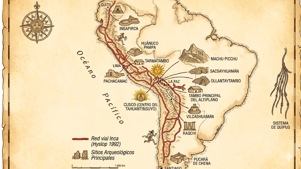
The Inca Trail as the center of the road network in the Inca Empire
How Long Was the Inca Trail?
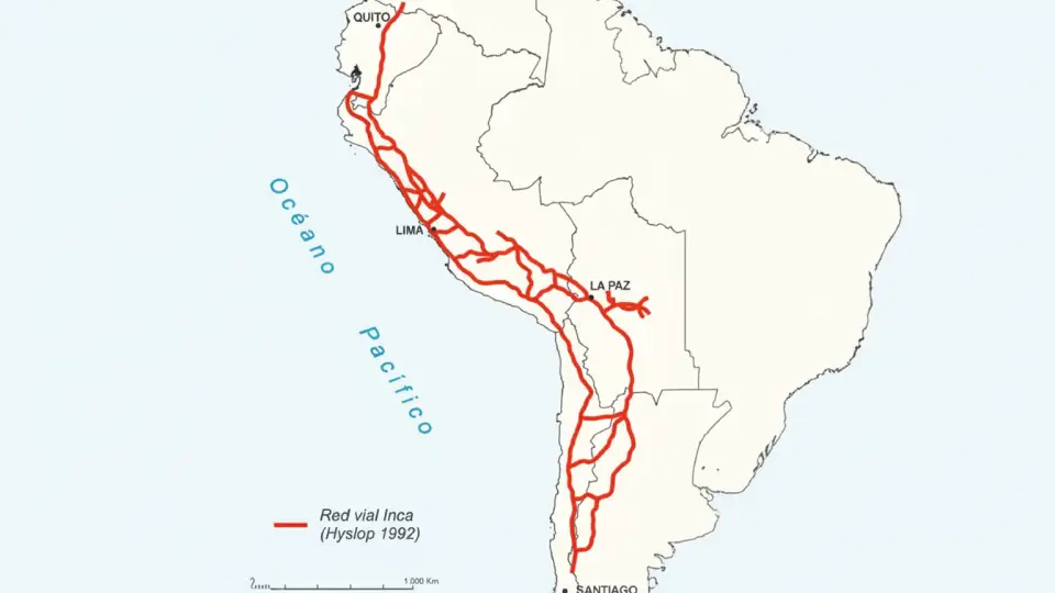
Of the more than 4,300 miles of the Andes mountain range, around 3,100 miles were covered by the Inca Trail, with a network estimated to have exceeded 18,600 miles of developed roads. Along those 3,100 linear miles, a wide variety of landscapes can be found, from snowcapped mountains, páramos, and cold steppes to ravines with humid or dry forests, savannas, and nearby temperate or warm valleys.
Extent of the Inca Trail during the Tahuantinsuyo in the Inca period
600 Years of History: From the Height of the Inca Empire to UNESCO World Heritage Status
Origin of the Inca Trail
This road network, which exceeds 23,000 km, was not built entirely during the little more than a century that the Inca Empire lasted. It also incorporated routes that predated the Incas, since five hundred years before the rise of the Inca Empire, the Wari Empire had already woven a network of roads throughout the Central Andes.
Image showing the Tarmatambo road in Ayacucho
Height of the Inca Trail
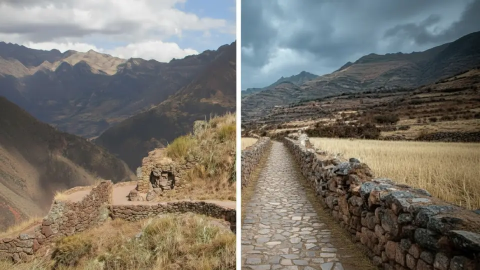
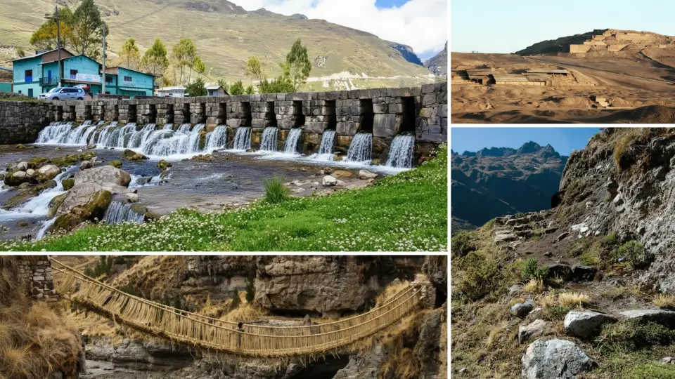
The Inca Trail traveled today was built approximately 600 years ago during the height of the Inca Empire, between the 14th and 16th centuries. Much of the original stone paving remains intact. The route ran lengthwise through the mountain range, overcoming slopes with stairways, ravines with bridges, and creating tunnels by opening “passes” through rocky outcrops.
Construction of the Inca Trail and bridges during the height of the Inca Empire
The Inca Trail During the Colonial Period
After the arrival of the Spanish, the Qhapaq Ñan or Inca Trailbecame part of the conquest of the Andes by the Spanish, making it easier for Francisco Pizarro to move toward the far reaches of this empire in his campaign of conquest.
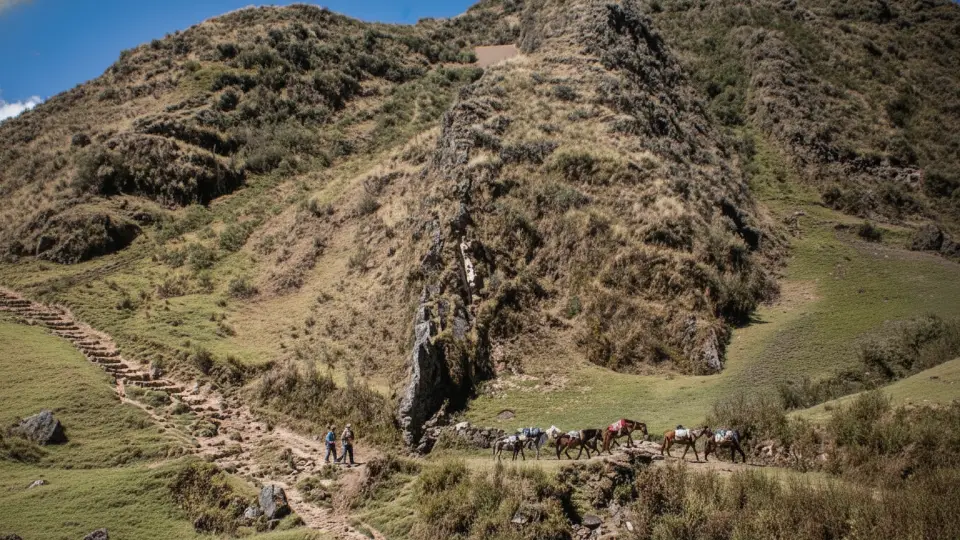
Pack horses traveling along the Inca Trail
The Change in Use of the Inca Trail
On the other hand, the new viceregal order restructured the network to connect mines and haciendas with the coast. However, the lack of labor and the introduction of horses, which were poorly suited to Inca steps, caused many sections to deteriorate.
Abandonment of the Inca Trail
The need for an abundant labor force for maintenance
The expansion of the Inca road system, which during the Colonial and Viceroyalty periods was noticeably reduced by epidemics and work in the mines.
The unsuitability of the sections for the horses and mules introduced with the conquest, which became the most common new beasts of burden and transport.
The opening of new routes to connect emerging production centers, such as haciendas and mines, with coastal ports
Current Recognition of the Inca Trail
In June 2014, the Qhapaq Ñan or Inca Trail was declared a UNESCO World Heritage Site
Internationally, the Qhapaq Ñan, at the request of the Peruvian government, was inscribed on the tentative list of World Heritage sites in 2002, with the support of Argentina, Chile, Bolivia, and Ecuador.
The 4 Inca Roads of Tahuantinsuyo
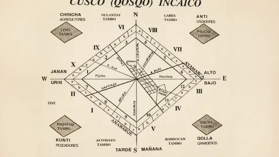
The four roads of the Inca Empire started from the Plaza de Armas in Cusco. From this sacred point, the four main roads began, connecting the four “suyos” or regions of the Empire. In fact, this network not only linked cities, but also structured the Inca worldview through the ceque system, or sacred lines.
Starting point of the 4 Inca roads from the city of Cusco
The First Royal Road to the North: Chinchasuyo
This was the most important route in the Empire. It connected the lowland plains with the entire highland region and the coast of the Tumbes sea, reaching the provinces of Quito in Ecuador and the kingdom of Chile, covering a distance of 900 leagues. This route is the most important in the Empire because of its construction characteristics, with a width ranging from 3 to 16 meters.
Important fact…
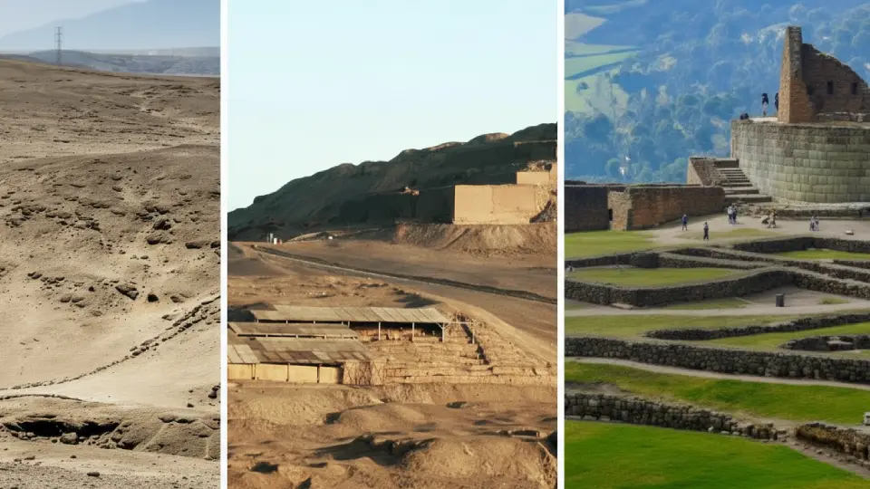
Along this route are the archaeological centers of Vilcashuamán, Xauxa, Tarmatambo, Pumpu, Huanucopampa, Cajamarca, and Huancabamba, in the current territories of Peru; and Ingapirca, Tomebamba, or Riobamba in Ecuador.
Inca Trail toward Chinchaysuyo, where Pachacamac in Lima and Inca Pirca in Ecuador can be seen.
The Second Royal Road, Known as Qollasuyo
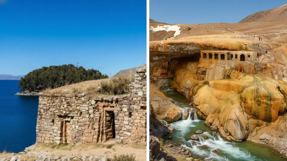
It headed south and traveled through the highlands, skirting Lake Titicaca and extending across the Bolivian Altiplano until reaching central Chile and Argentina. Part of these roads had already been in use during the Tiwanaku period and were incorporated into the Inca road network, where tambos and pucaras were built.
Inca Trail of Qollasuyo showing the Temple of the Sun on Lake Titicaca and the Inca Bridge in Argentina
The Third Road, Known as Contisuyu
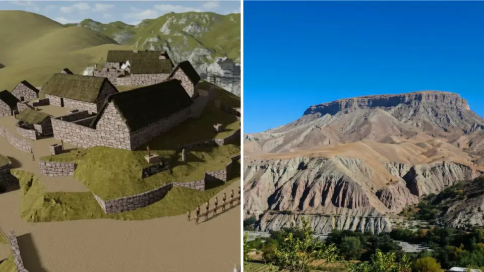
This road headed toward the southwestern coast, connecting Cusco with territories such as Arequipa, Moquegua, and Tacna. For this reason, these roads are complementary cross routes that crossed a variety of ecological zones, from the mountains to coastal areas, allowing the exchange of marine resources and products from temperate valleys over distances of 30, 50, and 60 leagues.
Inca Trail toward Contisuyu, where the citadel of Moqi in Tacna and Cerro Baúl in Moquegua can be seen
The Fourth Road, Known as Andesuyo
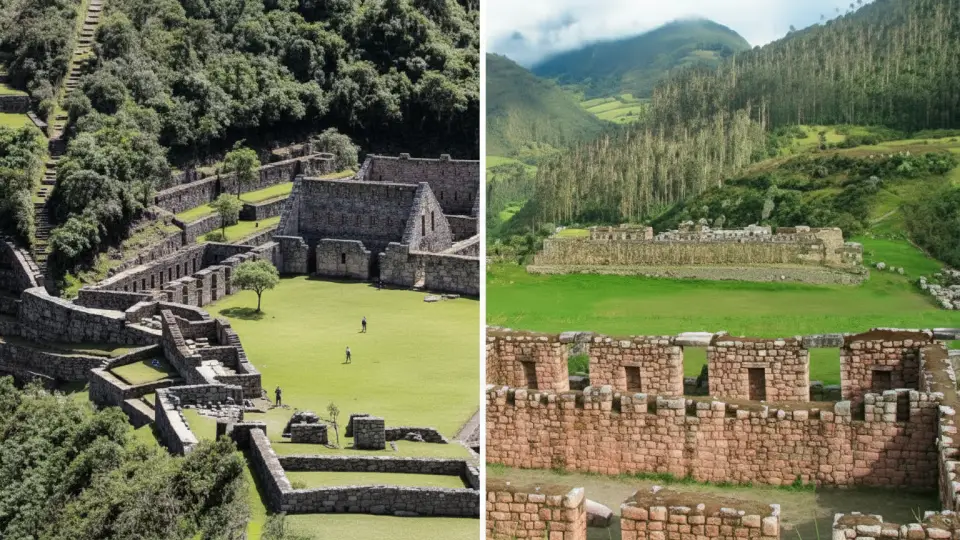
This is the least-known route due to the dense vegetation of the high jungle. Although climatic conditions have made it difficult to preserve its archaeological sites, it represented the Inca expansion toward the eastern Amazon.
Inca Trail to Andesuyo toward the jungle, showing Choquequirao and Vilcabamba.
What Was This Immense Road Network Used For?
More than simple trails, these roads were the veins of Tahuantinsuyo. In effect, their main function was to efficiently connect every corner of the empire, allowing a constant flow of products, culture, and services between nearby and distant communities.
Who Brought the Road to Life?
The road never rested. Meanwhile, the following traveled along it:
Armies and Mitimaes: Entire families relocated to colonize new lands.
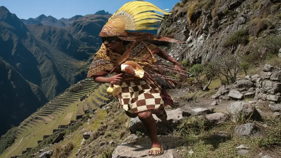
Chaskis: Fast messengers who could carry fresh fish from the coast to the Inca’s table in Cusco in record time.
Llamas: The true beasts of burden that transported exotic goods over thousands of kilometers.
Inca chaski traveling along the Inca Trail toward Cusco
Architecture at the Service of the Traveler
Along the route, the Empire built astonishing infrastructure:
Tampus: Administrative and rest centers.
Kollcas: Food warehouses used to prevent famines.
Kallankas: Large halls for ceremonies and shelter.
Chaskiwasis: Strategic relay posts for messengers.
Bridges: From fiber suspension bridges to stone structures designed to overcome the geography.
Did You Know There Were Different Categories of Roads?
Not all trails were the same; their design reflected the Inca hierarchy:
Royal Road: Reserved for the elite and nobility.
Collective Roads: Used by the general population.
Military Roads: Intended for defense and territorial expansion.
Ritual Roads: Sacred routes that led to sanctuaries and temples on the mountaintops.
Amazing Facts
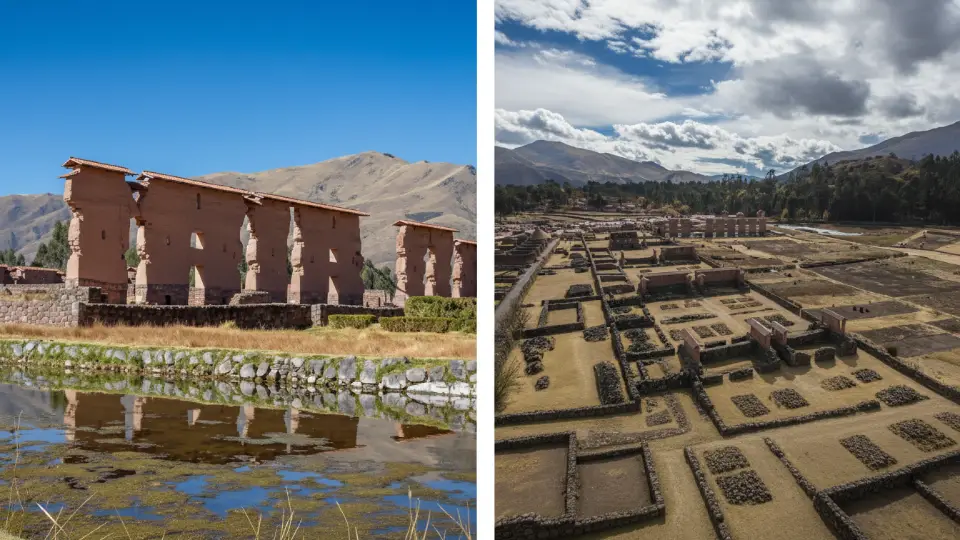
On the coast, the road could measure up to 12 meters, or 40 feet, wide, protected by tall adobe walls. You can still see traces of this grandeur in Pachacamac in Lima and Raqchi in Cusco.
The section from Cusco to Quito is the ultimate expression of its power. Known as the Qhapaq Ñan, or Road of the Lord, it is a masterpiece of road engineering that still leaves us breathless today.
Inca Trail connecting ceremonial centers such as the Temple of Raqchi in Sicuani, Cusco.
Inca Trail – Qhapaq Ñan to Machu Picchu
First, you need to understand that the Inca Trail is a 45-kilometer challenge that tests your physical and mental endurance. In fact, the altitude profile is a constant up-and-down route ranging from 2,600 to 4,215 meters.
Climate on the Inca Trail
The climate along the route is extremely varied. In fact, you will pass through microclimates ranging from the intense cold of the mountain passes to the humid heat of the high jungle. Temperatures fluctuate between 18°C and 22°C during the day, while at night they can drop to 0°C.
Rainy season (November to April): This season is characterized by persistent fog and frequent rain, with temperatures around 18°C during the day and 9°C at night. However, the landscape turns a vibrant emerald green.
Dry season (May to October): This is the most popular season, with clear, warm days. Temperatures reach around 16°C, while clear nights can drop below 0°C, making nighttime significantly colder.
Best Time to Hike the Inca Trail
I recommend starting the trek during the dry season. The months of June, July, and August receive the highest number of tourists. If you can, aim for May or September to October to enjoy good weather with fewer people on the trail, when the climate is more stable and weather conditions are optimal.
Important Warning!
The Inca Trail officially closes in February for maintenance. Therefore, if you plan to travel during that month, you will need to choose alternative routes such as Salkantay or Lares.
Where Exactly Does the Inca Trail Start?
There are two main starting points, and the choice usually depends on your agency’s logistics. Below is a comparison so you can understand the differences:
Starting point of the Inca Trail from KM 82 to Machu Picchu.
Kilometer 82 vs. Kilometer 88
Kilometer 82 (Piscacucho)
Kilometer 88 (Qoriwayrachina)
How do you get there from Cusco?
By bus from Cusco to the starting point, with a travel time of 1 hour and 30 minutes to two hours.
Departure time: 5:00 to 6:00 am.
By train from Cusco toward Aguas Calientes, getting off at the corresponding stop.
Importance
It is the most common starting point today.
It is used less today, but it was the traditional starting point of the Inca Trail.
Location
Starts at Km 82 from Cusco along the railway line, in Piscacucho.
Train route, Qoriwayrachina stop, Km 88.
Ministry of Culture
checkpoint
Here they will check your permit, you will receive your official wristband, and you will officially begin the trek.
In the past, the hike started here after getting off the train and crossing the Urubamba River on a suspension bridge.
Advantages
Allows you to add 6 extra km of hiking through the Urubamba Valley before reaching the first archaeological site.
A shorter hike to Machu Picchu without much distance to cover.
Benefits
Gives you time to warm up your muscles and acclimate to the rhythm of the trail.
A shorter hiking route.
“If this is your first time, I recommend starting at Km 82. Those additional 6 km are flat and beautiful; they serve as the perfect warm-up so your muscles can prepare before facing the tougher climbs.”
Traveler Tips…
Regardless of the starting point you use, your permit must be issued for that specific kilometer. The permit is non-transferable and cannot be modified, so make sure to confirm it with your agency before traveling to Cusco.
Inca Trail Step by Step
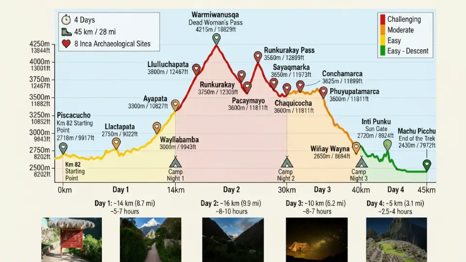
Here, you will discover why the Inca Trail is different from a simple mountain trek: the number of ruins, temples, administrative centers, and checkpoints you pass through on the way to Machu Picchu. Below, I’ll detail each and every site you will find from Km 82 to the wonder of the world.
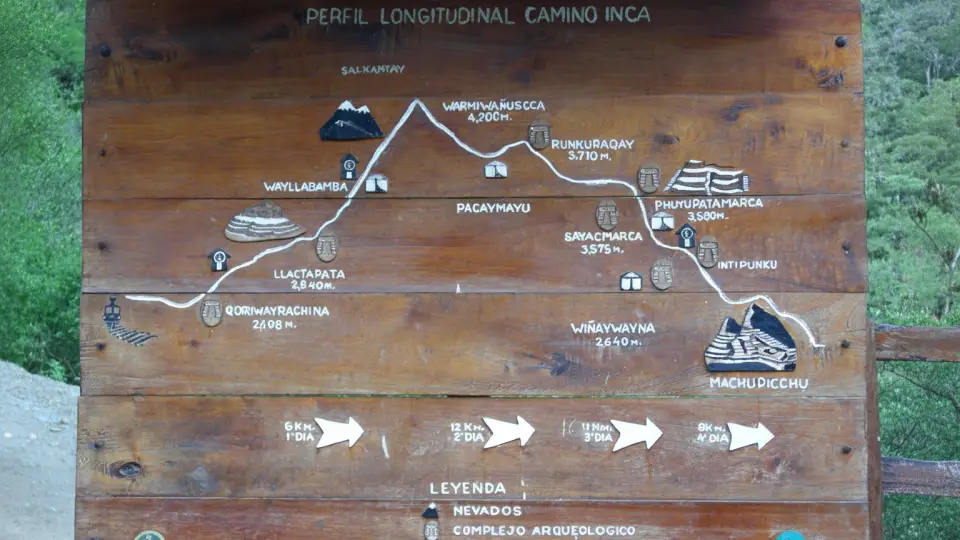
Schedule chart for the Inca Trail to Machu Picchu
Day 1 of the Inca Trail (Kilometer 82)
Km 82 – Llactapata – Huayllabamba to Ayapata (14 km route with moderate difficulty)
The first day is the easiest part of the trek, but that does not mean it should be taken lightly. You start by following the Urubamba River through cornfields and eucalyptus trees, and within a few hours, you begin to notice the terrain gaining altitude.
Salapunku
Salapunku is an archaeological center located at Km 82 of the railway line, the starting point of the Inca Trail, about 15 km from Ollantaytambo. It served as a checkpoint and religious site. Here, you will see impressive carved stone walls, Inca niches, and a set of agricultural terraces, making it the official gateway for those beginning the great adventure to Machu Picchu.
Image showing Salapunku at the beginning of the Inca Trail to Machu Picchu
Patallacta or Llactapata (Kilometer 88)
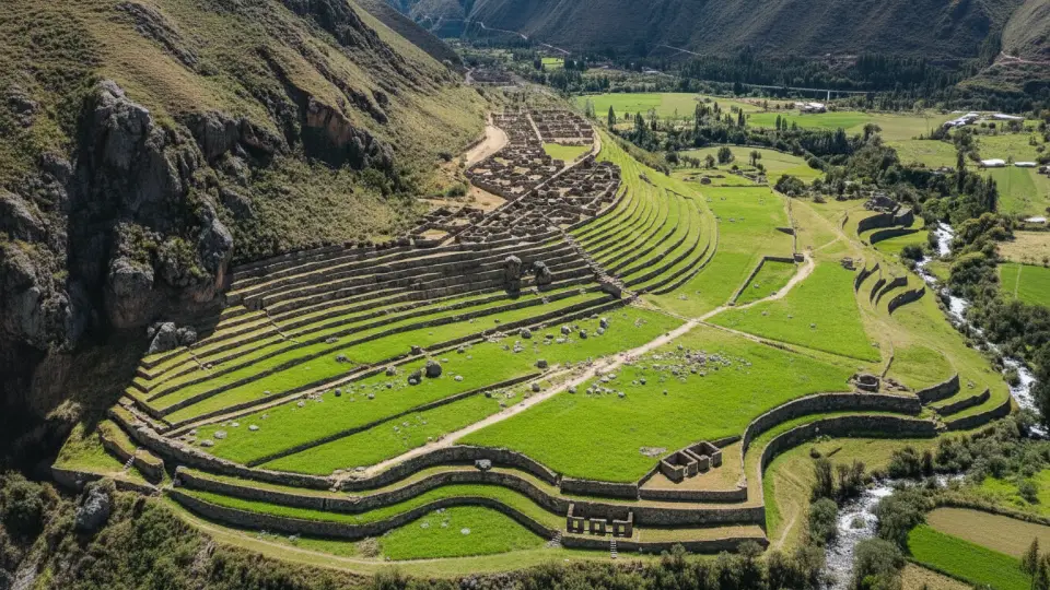
In the early morning hours, we arrive at Llactapata, located 5 km away, approximately a three-hour hike. Here, you will see an Inca agricultural administrative center located at 2,840 meters above sea level. It has a temperate climate, and its name, Llactapata, means “flat place on the hill” in Quechua. It contains a series of agricultural terraces and rectangular enclosures arranged on an open esplanade with direct views of the Aobamba River valley.
Archaeological site of Llactapata or Patallacta on the Inca Trail to Machu Picchu
Did you know…
This is the first archaeological center that appears after crossing the Urubamba River, and it serves as a kind of welcome to the archaeological world of the Inca Trail.
During the Inca period, the complex functioned as an administrative and religious center directly related to Machu Picchu, with which it also maintains a precise astronomical alignment during the June solstice.
Huayllabamba
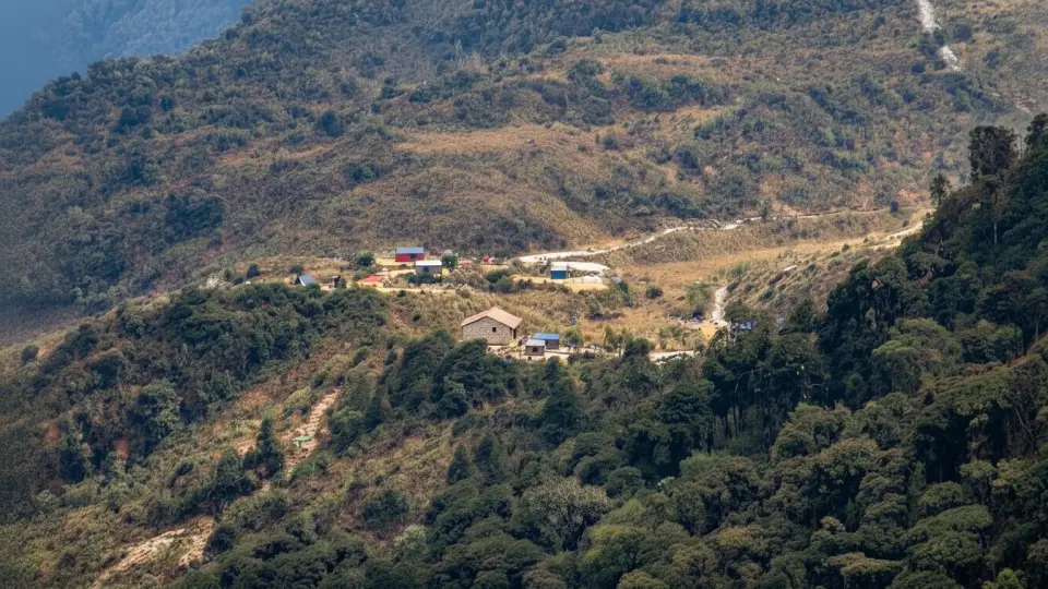
Continuing the hike, you reach the village of Huayllabamba around lunchtime or in the early afternoon. It is the only inhabited village you will find along the Inca Trail, located at 3,000 meters above sea level. This is where the first campsite of the classic route is located, and there are small shops where you can buy bottled water, snacks, and fresh fruit. The name means “plain of yellow grass.”
Did you know…
Second SERNANP checkpoint
It is the most anticipated place after the first hike.
This village is surrounded by pastures and cultivated fields, where water channels and Inca terraces are still used, contrasting beautifully with the mountains.
Ayapata: First Campsite of Day 1
Two kilometers from the village of Huayllabamba, we continue ascending to 3,300 meters above sea level until reaching the first campsite of the day, where you will spend the night to regain your strength and continue your hike the next day.
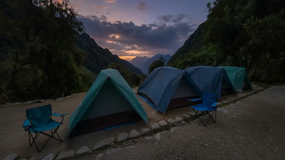
First rest campsite on the Inca Trail to Machu Picchu
Day 2 of the Inca Trail
Ayapata – Huayllabamba – Pacaymayo and Sayacmarca – Chaquicocha (16 km route with hard difficulty)
The second day is the true “trial by fire” of the Inca Trail. Not only is it the longest section at 16 km, but it is also the most physically demanding. In fact, this is the moment when your mind takes control over your legs. We leave early, between 5:00 and 6:00 in the morning, to get ahead of the sun and face the ascent toward Llulluchapampa, where we will pass the third SERNANP checkpoint.
Second SERNANP checkpoint in Llulluchapampa during the Inca Trail to Machu Picchu
Dead Woman’s Pass or Warmiwañusca
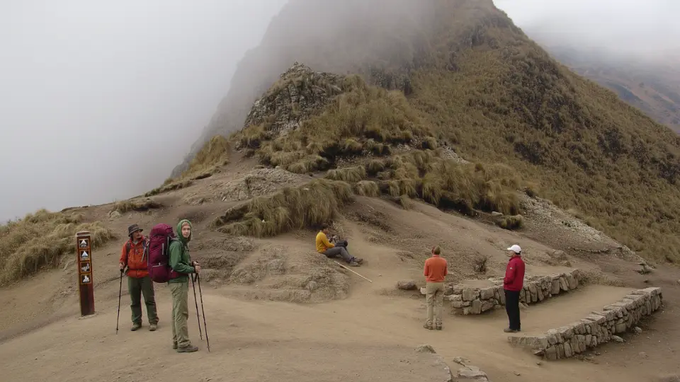
Next, the trail turns into an endless stone staircase that seems to lead straight to the sky. The most important thing at this point is to keep a steady pace and not rush. Finally, after a heroic effort, we reach Warmiwañusca Pass. From here, at 4,215 meters above sea level, you begin the descent toward the Pacaymayo Valley.
Highest pass of the Inca Trail, Warmiwañusca, where tourists take a break before continuing
Runkurakay
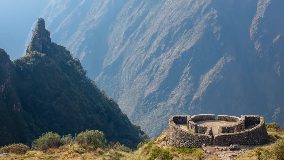
Meanwhile, after a descent that will put your knees to the test, we begin the climb toward the second-highest pass of the day. There, Runkurakay awaits us, an archaeological site located at 3,760 meters above sea level. Unlike most Inca constructions, this one has a circular or horseshoe shape. Therefore, archaeologists conclude that it functioned as a tambo and watch post for the chaskis.
Did you know…
Its double-faced wall technique with internal fill demonstrates the brilliant engineering they used to stabilize slopes.
Archaeological site of Runkurakay on the Inca Trail to Machu Picchu
Sayacmarca: Afternoon
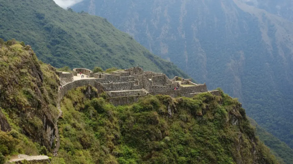
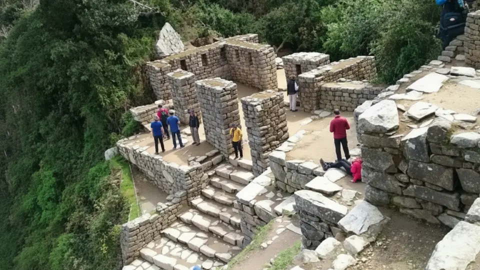
On the other hand, as evening falls, we arrive at one of my favorite places: Sayacmarca. Its name says it all: “dominant town.” It is built literally on the edge of a rocky mountain and can only be reached by a staircase carved in stone that will make you feel like an explorer from the last century. It is a bit narrow, so pay attention.
Important Fact…
In fact, what is most striking here is how the structures seem to grow out of the natural rock itself. However, do not limit yourself to looking at the walls; pay attention to its water channels and trapezoidal niches, clear signs that the Inca elite lived here.
Sayacmarca on the Inca Trail to Machu Picchu
Chakicocha or Conchamarca
Finally, we end the day at Chakicocha, located at 3,600 meters above sea level, our campsite and second overnight stop. In Quechua, this name means “dry lagoon,” suggesting that in ancient times, the geography was very different. Although it is a less well-preserved site than the previous ones, it has circular platforms that were used for astronomical observation.
Archaeological site of Conchamarca that you will see on the Inca Trail to Machu Picchu
Did you know…
The site features remains of platforms and circular enclosures that served as an astronomical observation center. Chakicocha is the second campsite on the Inca Trail.
Dead Woman’s Pass, or Warmiwañusca, located at 4,215 meters above sea level, is the highest point of the trail and is reached at the end of the second day. It is the most physically demanding moment. I recommend dressing warmly at the passes, where the cold is intense, while the lower valleys can feel humid and warm.
Rest area of Chakicocha during the second day of trekking on the Inca Trail
Day 3 of the Inca Trail
Chakicocha – Phuyupatamarca – Wiñay Wayna (10 km route with moderate difficulty)
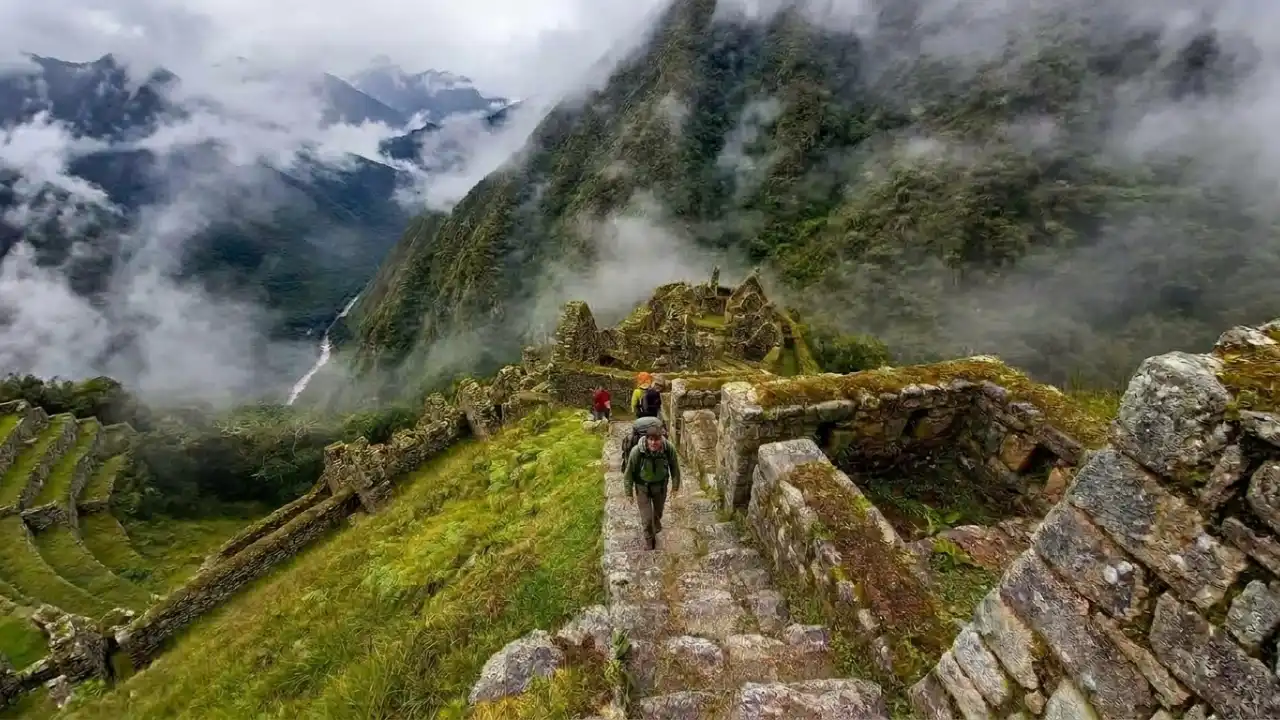
On the third day, you will leave the Chakicocha campsite. This area is also marked by a passage through an Inca tunnel carved into solid rock, one of the most photogenic sections of the entire third day of hiking. This is the most varied day in terms of scenery. You pass from a polylepis forest, also known as queñual, into the cloud forest.
Phuyupatamarca: Morning
During the morning, you reach Phuyupatamarca, a Quechua name that means “town among the clouds.” Located at 3,600 meters above sea level, it is considered a ceremonial water center and is often wrapped in mist during the mornings and afternoons. Here, I recommend paying attention to the six perfectly aligned ceremonial water fountains, which are still functioning and channel water from natural springs.
Important Fact…
For the Incas, water was sacred, connected to the worship of Viracocha and the fertility of the land. In addition, on clear days, there is a direct view of the snowcapped Salkantay mountain, at 6,270 meters, one of the sacred Apus of the Andean world.
Archaeological center of Phuyupatamarca seen during the Inca Trail to Machu Picchu
Wiñay Wayna: Afternoon
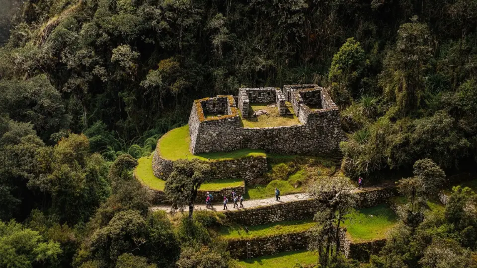
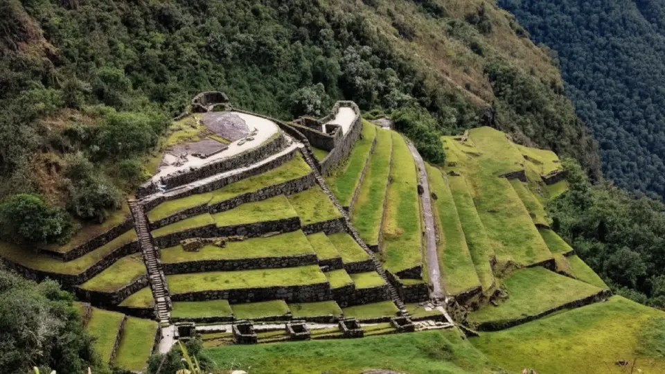
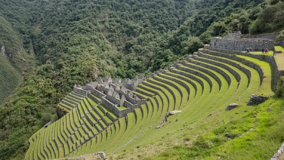
After a long stepped descent of more than 1,000 meters in elevation loss, you reach Wiñay Wayna, a Quechua name that means “forever young.” Located at 2,650 meters above sea level, here you should pay special attention to the circular tower with windows facing astronomical points, a ceremonial plaza, enclosures with trapezoidal niches, and ceremonial agricultural terraces that descend almost to the Urubamba River.
Important Fact…
The final campsite of the trail is set up here, and at night, many groups hold a small celebration before the last day.
This site is home to a pink orchid that grows on its walls during much of the year and shares the same name.
Archaeological site of Wiñay Wayna on the Inca Trail
Day 4 of the Inca Trail
Wiñay Wayna – Inti Punku – Machu Picchu: 5 km route with easy difficulty
On the last day of the hike, you will see two archaeological sites before arriving at Machu Picchu. You are usually woken up before dawn, around 4:00 or 4:30 in the morning, and leave in single file with your headlamp along the final stretch of the trail until reaching Inti Punku. There, with the first light of day, Machu Picchu appears below you, and all the effort of the previous three days suddenly makes sense.
Inti Punku – Machu Picchu
At sunrise, you will reach the final point of the Inca Trail, Inti Punku, which means “Sun Gate” in Quechua. Located at 2,720 meters above sea level, it is a two-story structure built on a small summit at the edge of the mountain. It has a central opening aligned with the winter solstice sun on June 21, when the first rays of sunlight pass through the gate and project their light onto Machu Picchu.
Did you know…
For the Incas, this phenomenon was not an astronomical accident, but the result of deliberate design, considered the official entrance to the sacred city of Machu Picchu.
Inti Punku, the last archaeological center of the Inca Trail, from where you get a general view of Machu Picchu.
Machu Picchu: End of the Inca Trail
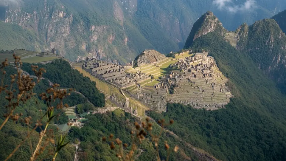
After three days of ascents and descents through cold and warm climates, you will finally have arrived at Machu Picchu and remember the purpose of your trip to Peru. It will leave you amazed when you find a sacred site just like the one shown in the photos, radiating an energy you can only feel by being here.
Important Facts…
Take all the photos you want to preserve, while still taking time to admire the beauty of its architecture. Do not miss the ceremonial temples it contains, and if you have the opportunity to climb Huayna Picchu, take it.
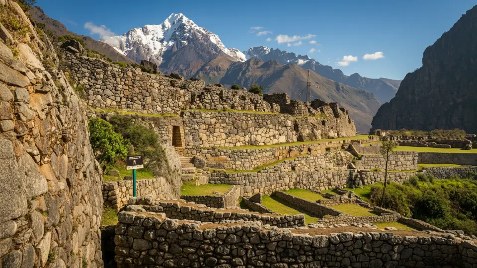
View of the Inca city of Machu Picchu
Itinerary for Travelers Who Move at Their Own Pace
If you are not used to long hikes or simply want to take it slow, we adapt the route with closer rest areas designed for your comfort. Machu Picchu is waiting for you, and we will get there at your pace.
Day
Starting Point
Route / Difficulty
Places to See
Campsite and Rest Area
1
Km 82/88 to Huayllabamba
12 km / Moderate
You start by following the Urubamba River
You pass Llactapata in the first few hours
In the afternoon, you arrive in Huayllabamba for lunch.
You start by following the Urubamba River
You pass Llactapata in the first few hours
In the afternoon, you arrive in Huayllabamba for lunch.
2
Huayllabamba – Pacaymayo – Sayacmarca
12 km / Hard
This is the most demanding day of the four.
You begin with the ascent to the first pass, Warmiwañusca.
You then descend to the Pacaymayo Valley.
You continue climbing to the second pass, Runkurakay.
At nightfall, you will rest in Sayacmarca, the second campsite of the Inca Trail.
3
Sayacmarca – Phuyupatamarca – Wiñay Wayna
16 km / Moderate
This is the longest day in kilometers, but also the most varied.
You pass from the polylepis forest, or queñual, into the cloud forest and cross an Inca stone tunnel.
You arrive at Phuyupatamarca.
After a long stepped descent, you reach Wiñay Wayna.
Wiñay Wayna. This is the final campsite of the Inca Trail on the last night.
4
Wiñay Wayna – Inti Punku – Machu Picchu
4 km / Easy
You wake up between 4:00 and 4:30 am to walk the final stretch of the trail.
You reach the Sun Gate, Inti Punku
Machu Picchu
After the tour, you return to Cusco.
Key Altitude Points on the Inca Trail
To give you a clear idea of the physical challenge involved in the Inca Trail, here are the key points along the route, listed in the order they appear on the trail.
Chart Showing the Altitude Points of the Inca Trail
Point
Altitude
Day
Km 82 (Start)
2,658 m.a.s.l.
1
Km 88
2,600 m.a.s.l.
1
Llactapata
2,840 m.a.s.l.
1
Huayllabamba
3,000 m.a.s.l.
1
Warmiwañusca Pass (highest point)
4,215 m.a.s.l.
2
Runkurakay Pass
3,998 m.a.s.l.
2
Runkurakay (ruins)
3,760 m.a.s.l.
2
Sayacmarca
3,625 m.a.s.l.
2
Phuyupatamarca
3,600 m.a.s.l.
3
Wiñay Wayna
2,650 m.a.s.l.
3
Intipata
2,840 m.a.s.l.
3
Inti Punku (Sun Gate)
2,720 m.a.s.l.
4
Machu Picchu
2,430 m.a.s.l.
4
Traveler Tips
At the highest summits, you will see piles of stones known as the famous “Apachetas.” Leave coca leaves as an offering or place a small stone on the pile so the mountain gods will let you pass, give you strength to continue the trail, and help you reach your destination without setbacks.
High points of the four-day Inca Trail to Machu Picchu
How to Book and Secure Your Inca Trail Permits
This is perhaps the most critical aspect of planning the Inca Trail and the one that causes the most frustration among travelers who arrive in Cusco without having considered it. So pay attention, because there is no room for error here.
Why Is It So Difficult to Get Inca Trail Tickets?
The Peruvian Ministry of Culture protects the route by limiting access to only 500 people per day. However, this number can be misleading, since only 200 spaces are for tourists; the other 300 are for the support team, including guides, cooks, and porters. As a result, competition for a spot is fierce, especially during high season.
How Far in Advance Should You Buy Inca Trail Tickets?
If you plan to travel during the months of June, July, or August, the most important thing is to book 5 to 6 months in advance.
High Season (June-August): 5 to 6 months in advance.
Shoulder Season (May, September, October): 3 to 4 months in advance.
Low Season (November-January): 4 to 6 weeks may be enough.
The Booking Process: Mandatory Steps
Below, we detail the only legal way to set foot on the trail. On the other hand, you should know that hiking the route independently is strictly prohibited.
Contact an authorized agency: Only companies certified by the Ministry of Culture can manage permits. They handle all logistics, from campsites to meals.
Send your official information: You will need your valid original passport or ID. Likewise, if you plan to renew your document before the trip, check with your agency about how to update your information to avoid problems at the checkpoints.
Make the deposit payment: Without payment, the agency cannot reserve your spot in the government system.
Other Inca Trail Routes to Machu Picchu
If you realize that spots for the classic route are sold out, do not lose hope. On the contrary, there are spectacular alternative routes that also end at Machu Picchu, such as:
Lares to Machu Picchu 4 Days Route: 38 km of cultural immersion and Andean villages.
Choquequirao to Machu Picchu 8 to 9 Days: 115 km for true lovers of extreme challenges.
Traveler Tip…
When booking, you will need to provide the passport number of each participant, since the permit is personal and non-transferable. If you change travel companions or someone in the group cannot go, the permit is lost.
What to Bring to Conquer the Inca Trail
Waterproof trekking boots worn on at least 3 previous outings.
Merino wool socks, at least 3 pairs
Quick-drying base layer, no cotton
Fleece or softshell jacket for the cold at the passes
Waterproof rain jacket, not ponchos
Convertible trekking pants
Wool hat and lightweight gloves for nighttime and early-morning passes
This is where most people get it wrong: they arrive in Cusco (3,400 m.a.s.l.) just one day before the trek and start hiking the next morning. The result, quite often, is that they spend the second day, the most demanding one, dealing with a pounding headache and nausea. Ideally, you should arrive in Cusco at least 2 or 3 days in advance. In the meantime:
Traveler Tips…
Stay constantly hydrated, do not wait until you are thirsty.
Drink coca tea or muña tea, which is excellent for digestion and the lungs.
One of the things that surprises travelers the most is the diversity of ecosystems. In fact, you will go from the arid environment of the Sacred Valley to the high Andean puna, and then immerse yourself in the tropical cloud forest.
Chart of Flora You Will See on the Inca Trail
Polylepis (queñual)
The highest-growing tree in the world in terms of altitude, growing between 3,500 and 4,500 meters. Its reddish trunks and peeling bark are unmistakable.
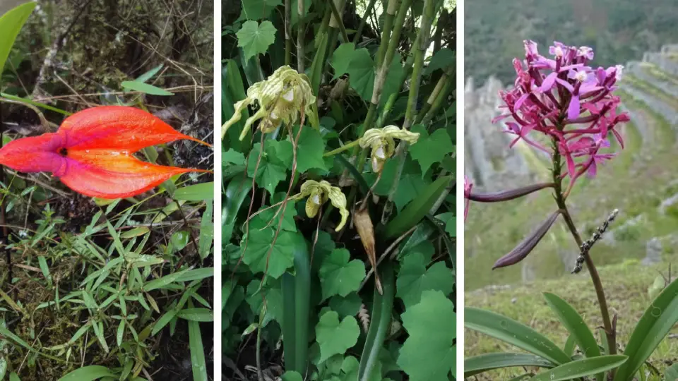
Orchids (300+ species)
The Inca Trail has more than 300 registered species of orchids. The best known is Epidendrum secundum, the pink orchid of Wiñay Wayna.
Ichu
The tough puna grass that covers the areas around the mountain passes. It is the main food source for the llamas and alpacas in the area.
Cantuta
The national flower of Peru, with trumpet-shaped petals in red, yellow, and white. It was sacred to the Incas.
Tree fern
In the cloud forest on the third day, giant ferns create a movie-like atmosphere that many travelers describe as “Jurassic.”
Puya Raimondi
The longest-living plant in the Andes. It can live for more than 100 years and blooms only once before dying. If you happen to see one in bloom, it is an exceptional rarity.
Orchids you will see during your Inca Trail hike
Fauna You Will Find on the Inca Trail
Andean condor
The largest bird in the Western Hemisphere. With luck, you will see it gliding over the mountain passes on the second day, taking advantage of warm air currents.
Torrent duck
An endemic species of Andean rivers that you will see in the Urubamba on the first day. Its black-and-white plumage makes it unmistakable.
Andean cock-of-the-rock
The national bird of Peru, with its spectacular orange crest. It lives in the cloud forest on the third day and is one of the most sought-after sightings among birders.
Vizcacha
A rodent similar to a chinchilla. It is very common to see them sunbathing on rocks near archaeological sites.
Llamas and alpacas
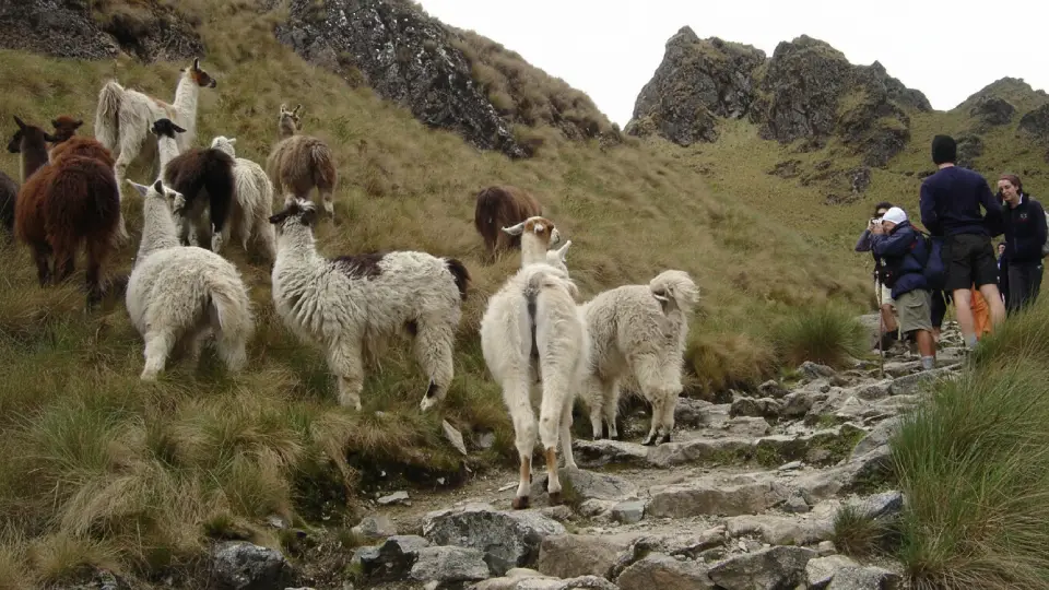
The llamas that graze freely near the campsites and archaeological sites have been part of the Inca Trail landscape for centuries.
Spectacled bear
The only bear native to South America lives in the forests of the Inca Trail, although sightings are extremely rare.
Did you know…
The Puya Raimondi is the plant that watches centuries go by; it blooms once every 100 years and then dies. Seeing it in bloom is like receiving a blessing from the Apus.
Llamas on the Inca Trail
What Really Awaits You on the Inca Trail
Inca Trail Porters
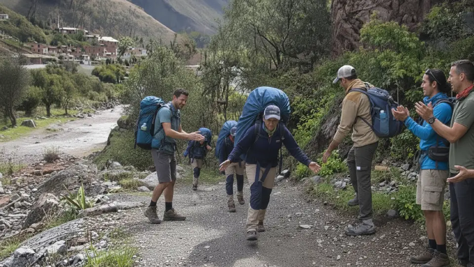
The porters are the most impressive part of the entire experience. In fact, they carry up to 25 kg at speeds that leave even the best athletes stunned. Likewise, they are the ones who make sure that, when you arrive at camp, your tent is ready and hot water is waiting for you. For this reason, a fair tip at the end of the trek is more than a gesture; it is a thank-you for their superhuman effort.
The heroes of the Inca Trail, local porters who accompany us during the Inca Trail.
Food on the Inca Trail
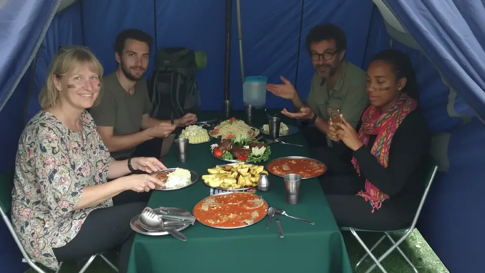
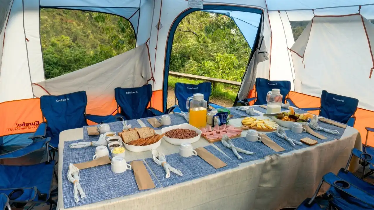
On the other hand, the food is usually an incredible surprise. The cooks prepare everything from comforting soups to gourmet desserts in the middle of nowhere.
Important Fact…
If you are vegetarian, vegan, or celiac, I recommend informing your agency several weeks in advance. They can adapt the entire menu for you.
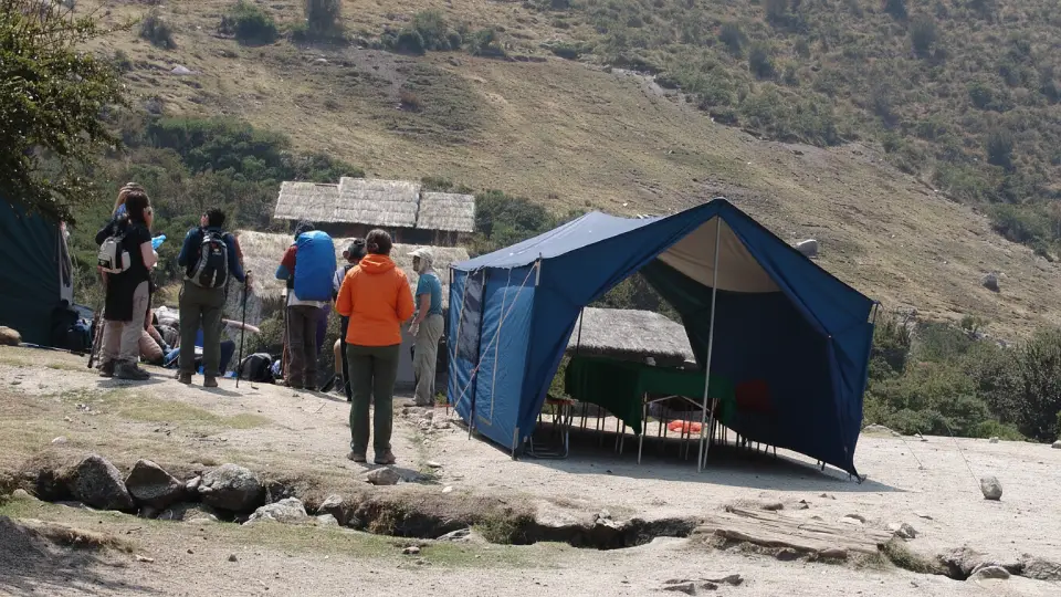
Tourists enjoying lunch during the Inca Trail
Connectivity and Services: The Reality on the Trail
There is no Wi-Fi: There is no mobile signal. Therefore, let your family know that you will be disconnected for 4 days. In emergencies, your guide carries a communication radio.
Bathrooms: You will find basic latrines at the campsites. Always carry toilet paper and hand sanitizer with you.
Golden Rule
If you have an emergency along the trail, move at least 100 meters away from any water source and from the main path. Taking care of the environment is everyone’s responsibility!
Have you already hiked the Inca Trail, or are you planning your first time? Share your experience or your best tips below and help more travelers conquer the sacred citadel. On the other hand, if this blog has served as a guide for you, share it with that friend who needs a little push to pack their backpack. See you on the trail!
Frequently asked questions about Inca Trail Guide 2026: Everything nobody tells you to get to Machu Picchu.
Choose the Inca Trail if your dream is to feel like an ancient explorer. This is the classic route, where you hike along original Inca stone paths and, most exciting of all, you are among the few travelers who enter Machu Picchu through the famous Sun Gate at sunrise. That said, you need to plan well in advance because permits sell out fast.
Choose Salkantay if you are drawn to wild nature and postcard-worthy landscapes. It is a bit more demanding on the legs, but it rewards you with spectacular views of snowcapped peaks and turquoise lagoons. It is also ideal if you prefer a more spontaneous trip, since last-minute availability is usually easier to find.
No, the answer is a firm no. Do not try to find alternative routes to enter on your own. Peru’s Ministry of Culture requires every trekker to be accompanied by an officially licensed guide. As a result, permits are issued only through authorized agencies. This rule helps protect both your safety and the preservation of this historic route.
The price usually ranges from $790 to $2,850 USD, depending on the level of service and exclusivity you are looking for. Pay close attention to what the package includes, especially transportation, return train tickets, and full meals. Also, keep in mind that breakfast on the first day and the final lunch in Aguas Calientes are generally not included, so I recommend bringing some extra cash in Peruvian soles.
The Inca Trail is considered a moderate to challenging trek. However, the real difficulty is not the 45 kilometer distance itself, but the elevation gain and the altitude. You do not need to be an elite athlete, but you do need a reasonable level of fitness. Above all, be prepared to climb more than 1,600 meters in a single day, which means your lungs and legs will be working hard.
Ideally, I recommend arriving in Cusco 3 days before the trek. This gives your body time to acclimate to the altitude, but it also allows you to review your agency’s gear, make final preparations, and, if you wish, visit a few sites in the Sacred Valley before starting the big journey.
There is no official age regulation, but Peru’s Ministry of Culture recommends that children under 8 years old do not complete the full route. On the other end, many travelers in their 70s have completed the Inca Trail successfully, as long as they are properly prepared and take enough time at the mountain passes.
The guide team is trained to recognize and manage altitude sickness, locally known as soroche. In mild cases, such as headache, nausea, or fatigue, the usual response is to stop, hydrate the traveler, and provide coca tea or ibuprofen. In more serious cases, the protocol is to descend to a lower altitude as soon as possible. That is why proper acclimatization before the trek should never be underestimated.
Editor in Cusco, Peru with the soul of an explorer
My name is Napoleón Arcondo. I live in Cusco and I write about what I’m passionate about: Peruvian history, education, and the reality of our country.
My work involves conducting in-depth research, verifying facts, and translating complex topics into simple, clear, and useful articles. Whether I’m exploring our cultural heritage or writing practical and informative guides about modern-day Peru, I strive to ensure that every piece is well-researched and addresses what people really need to know. I write from Cusco with the goal of sharing well-researched knowledge with readers across the country.