
The Inca Trail from Cusco to Machu Picchu
The inca trail from cusco is more than just a trekking route; it is a profound journey through time, traversing the diverse ecosystems of the Peruvian Andes and the remnants of one of history’s greatest empires. Originally part of the Qhapaq Ñan, a massive road network spanning over 40,000 kilometers, this specific stretch was a royal pilgrimage route reserved for the Incan elite. Walking these stones today offers a rare connection to a civilization that mastered architecture and astronomy in some of the world’s most challenging terrain.
For the modern traveler, the logistics begin long before the first step is taken. Because of the trail’s historical significance, the Peruvian government strictly regulates access, requiring all hikers to be accompanied by certified guides. This means that booking inca trail tours from cusco is a necessity. The preparation involves securing permits months in advance, often as early as October for the following year’s peak season, making it one of the most exclusive trekking experiences on the planet.
What Is the Inca Trail, Really?
There’s a reason people search for the Inca Trail from Cusco more than almost any other hike in South America. It’s not just the destination though Machu Picchu at dawn is something you carry with you for the rest of your life. It’s the whole journey: four days of climbing through cloud forest and high-altitude grassland, past ruins the Spanish never found, along stone paths that the Inca laid six hundred years ago with nothing but labor, precision, and an intimate understanding of the mountain.
Did you know that…
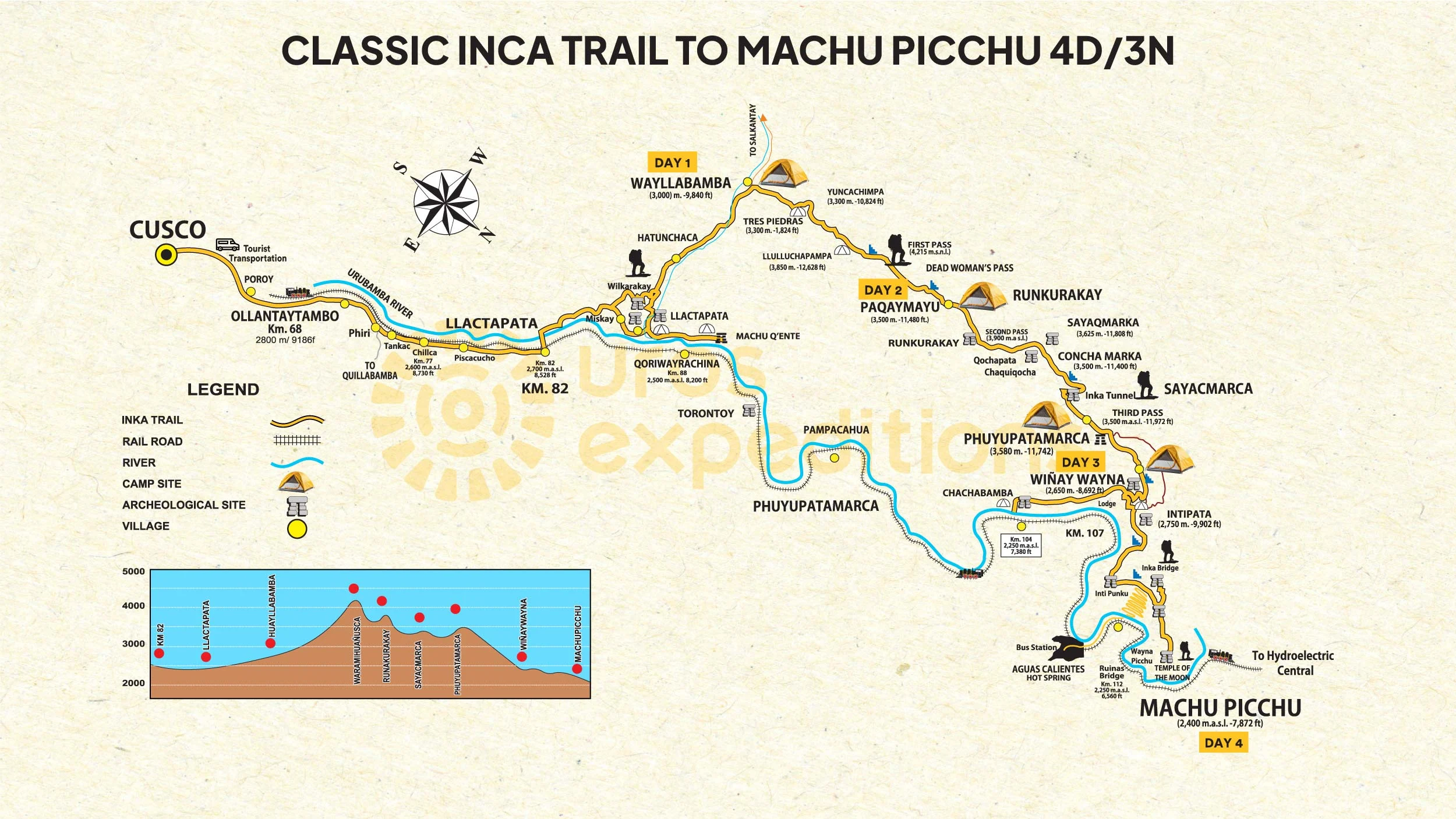
The Inca Trail (Camino Inca in Spanish, Qápac Ñan in Quechua) is a section of the ancient Inca road network the Qhapaq Ñan that once spanned over 40,000 kilometers connecting the entire Tawantinsuyu empire from modern-day Colombia to southern Chile. What trekkers walk today is a 43-kilometer segment of that system, running through the Sacred Valley of the Incas and ending at Machu Picchu.
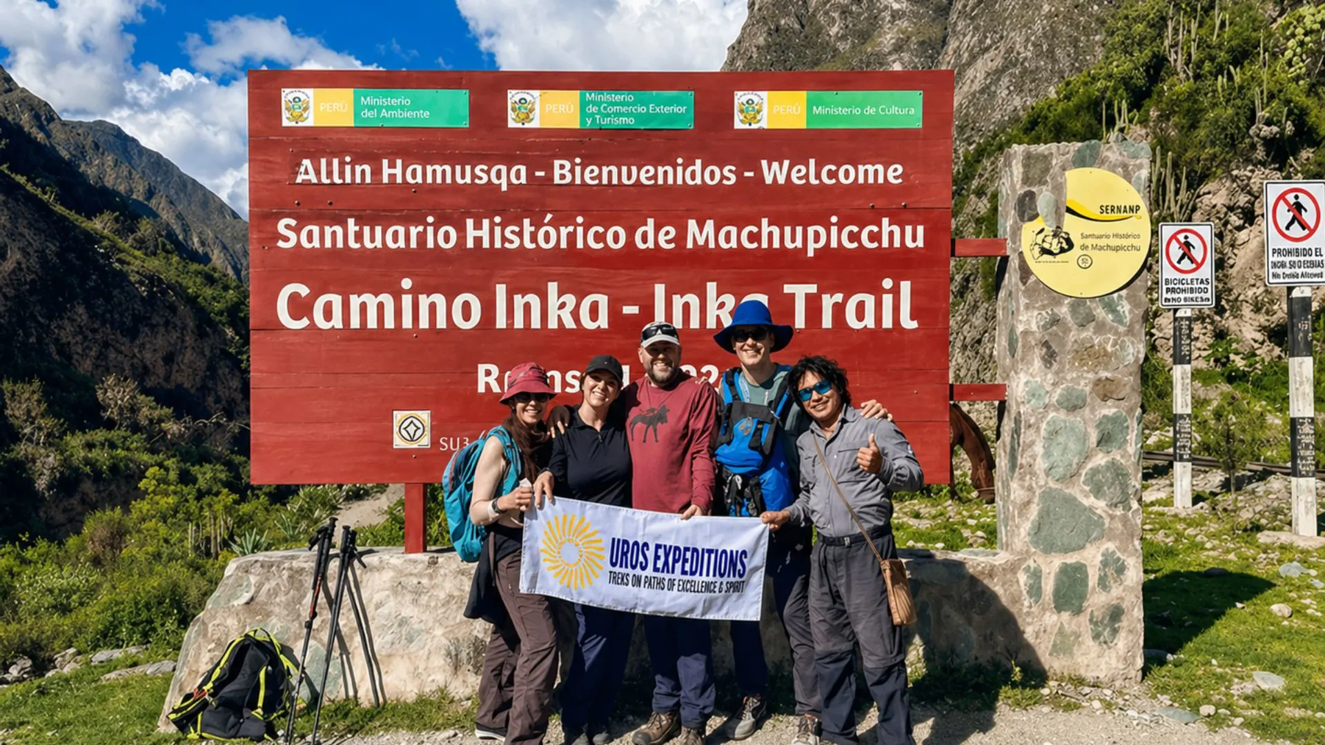
The trail begins at a checkpoint called Kilometer 82 (locally known as Piscacucho), about 82 kilometers from Cusco by road and rail, at an elevation of 2,720 meters. From there, it climbs through three distinct ecological zones high Andean puna grassland, cloud forest dripping with bromeliads and orchids, and subtropical jungle crossing three mountain passes before descending to the Sun Gate (Inti Punku) above Machu Picchu at 2,720 meters.
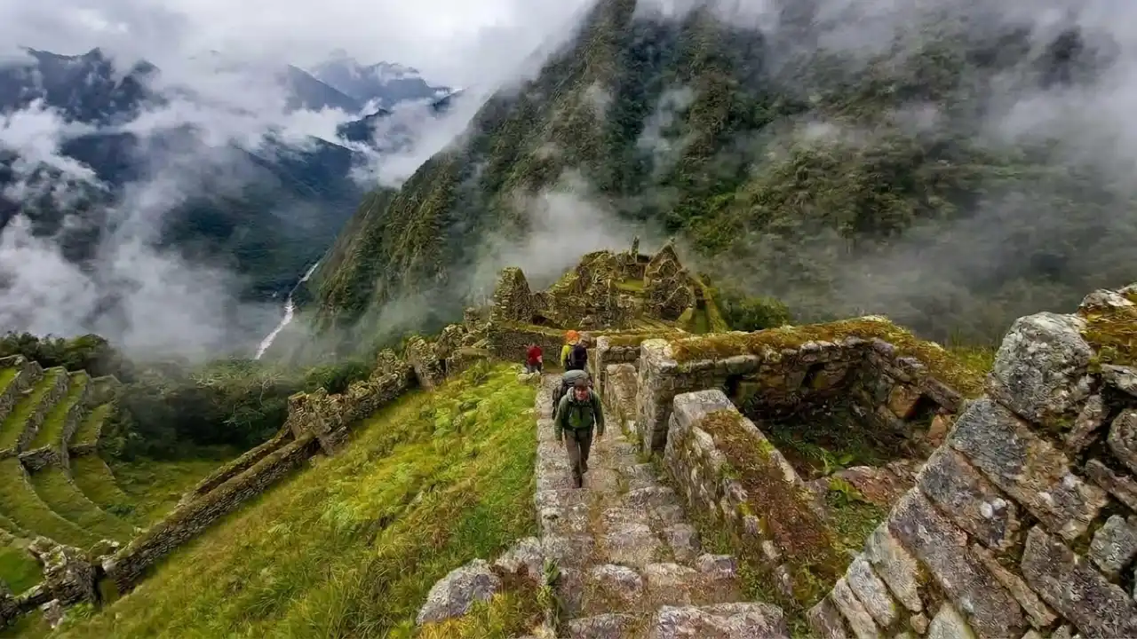
The path itself is largely the original Inca paving: flat granite stones fitted without mortar, drainage channels cut into the mountainside, and staircases so precisely engineered that some of them remain intact and functional after six centuries of Andean weather.
“You don’t just walk to Machu Picchu on the Inca Trail you walk through the logic of an entire civilization. Every step, every fountain, every agricultural terrace is an argument about how to live in the mountains.”
Trail Options at a Glance
Here’s the honest breakdown of what you’re actually choosing between when you decide to hike the Inca Trail from Cusco to Machu Picchu.
Main Inca Trail Options
| Feature | Classic 4-Day Inca Trail | 2-Day Inca Trail Km 104 |
|---|---|---|
| Best for | The full and most iconic Inca Trail experience | Travelers with limited time or looking for a shorter hike |
| Distance | 43 km | Around 12 km |
| Duration | 4 days / 3 nights | 2 days / 1 night |
| Start point | Km 82, Piscacucho | Km 104, Chachabamba |
| Max elevation | 4,215 m | 2,700 m |
| Sites visited | 7–9 ruins along the route | Wiñay Wayna, Inti Punku, Machu Picchu |
| Difficulty | Strenuous | Moderate |
| Permit required | Yes, sells out fast | Yes, usually easier to get |
| Crowds | More popular and more competitive | Less crowded than the classic route |
Alternative Treks to Machu Picchu
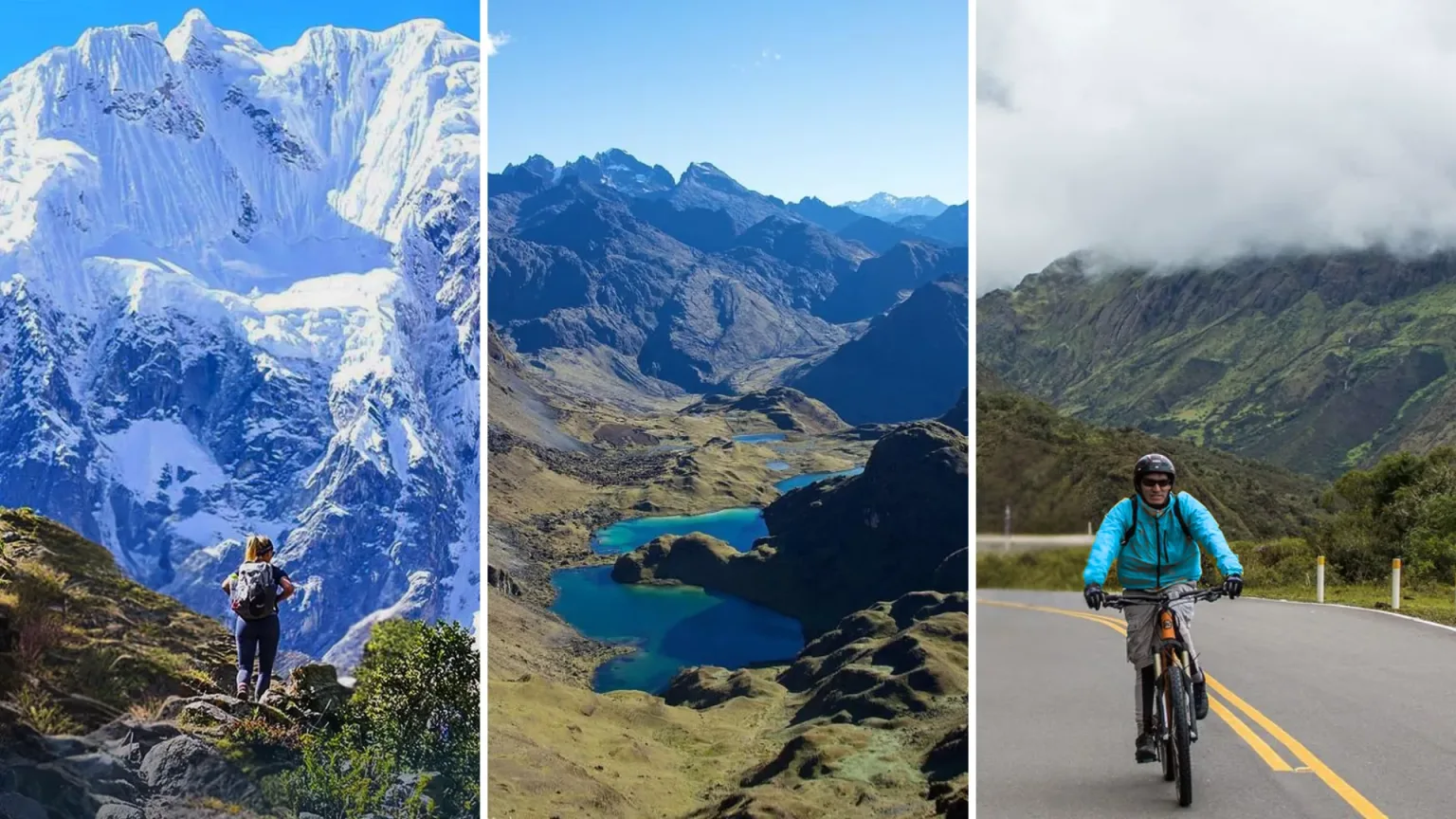
These routes are good options when Classic Inca Trail permits sell out or when you want a different trekking experience.
| Alternative Trek | Duration | Main appeal |
|---|---|---|
| Salkantay Trek | 5 days | High mountain scenery, no classic Inca Trail permit required |
| Lares Trek | 4 days | Cultural focus, Andean villages, fewer crowds |
| Choquequirao Trek | 4–8 days | Remote ruins, challenging route, less touristy |
| Inca Jungle Trek | 4 days | Mixed adventure route with hiking, biking, and jungle scenery |
| Train only | Same day or overnight | Best option if you do not want to trek |
Recommended choice
| Traveler type | Best option |
|---|---|
| You want the classic experience | Classic 4-Day Inca Trail |
| You have less time | 2-Day Inca Trail Km 104 |
| Permits are sold out | Salkantay Trek or Lares Trek |
| You want culture over altitude | Lares Trek |
| You want adventure and variety | Inca Jungle Trek |
| You do not want to hike | Train to Aguas Calientes |
Getting to the Trailhead: The Train from Cusco to the Inca Trail
One question that surprises a lot of first-timers: you don’t actually walk all the way from Cusco city. The train from Cusco to the Inca Trail is how most hikers reach the trailhead or at least get close enough. Here’s how the logistics work.
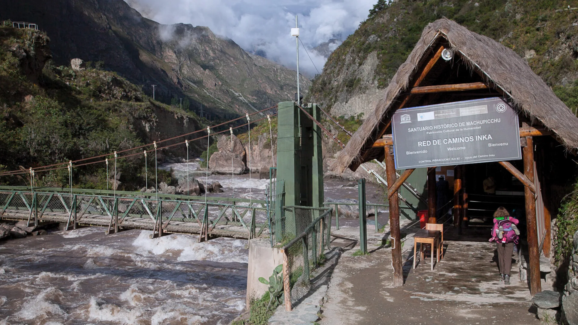
The classic trail starts at Km 82 (Piscacucho). Most operators arrange a pre-dawn bus from Cusco that takes about 2.5–3 hours along the Sacred Valley road through Pisac and Ollantaytambo. However, some trekkers prefer to take the train from Poroy (Cusco’s train station) or Ollantaytambo as far as Aguas Calientes or the intermediate stops, depending on the tour package.
Train options from Cusco to the trail area
| Detail | Information |
|---|---|
| Operator | PeruRail / Inca Rail |
| Route | Cusco or Ollantaytambo to Aguas Calientes |
| Duration | Around 3.5 hours to Aguas Calientes |
| Price range | $70–$200 USD |
| Book ahead? | Yes, especially during high season |
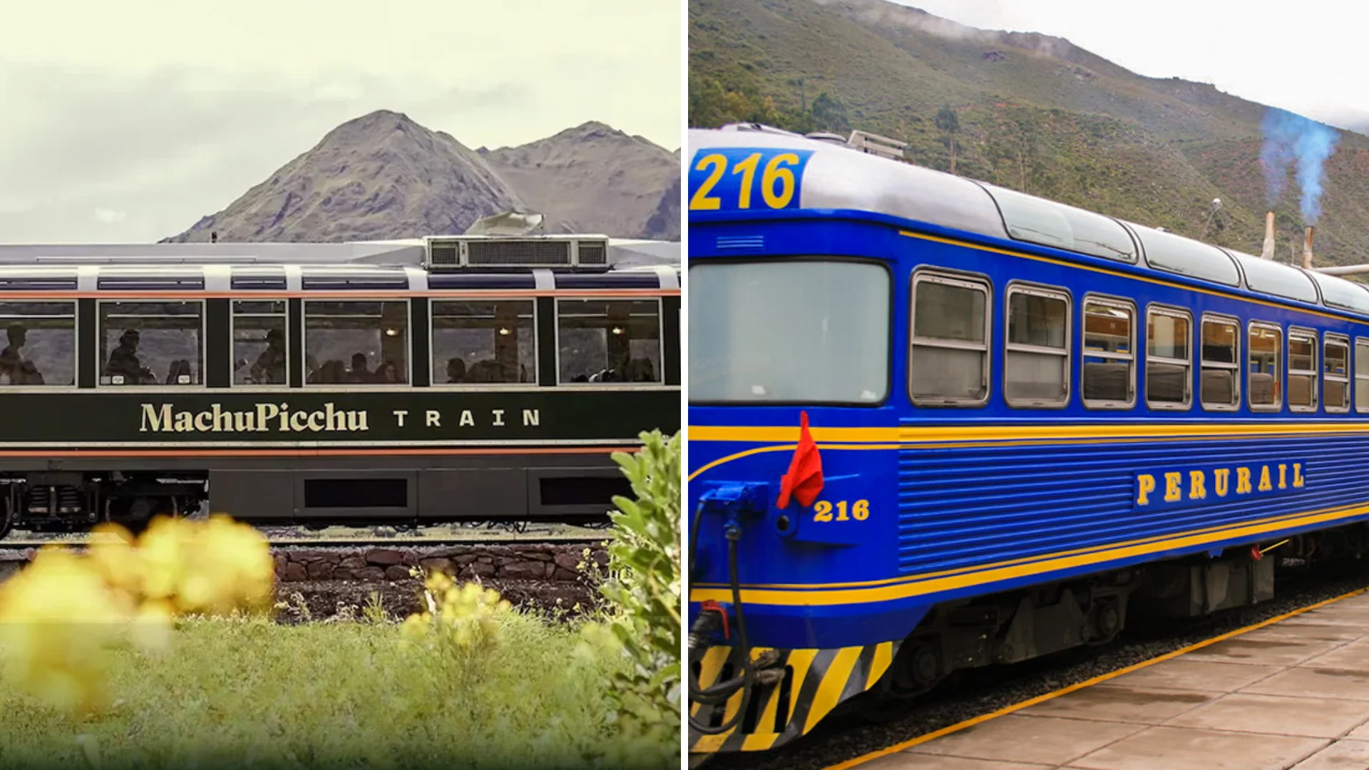
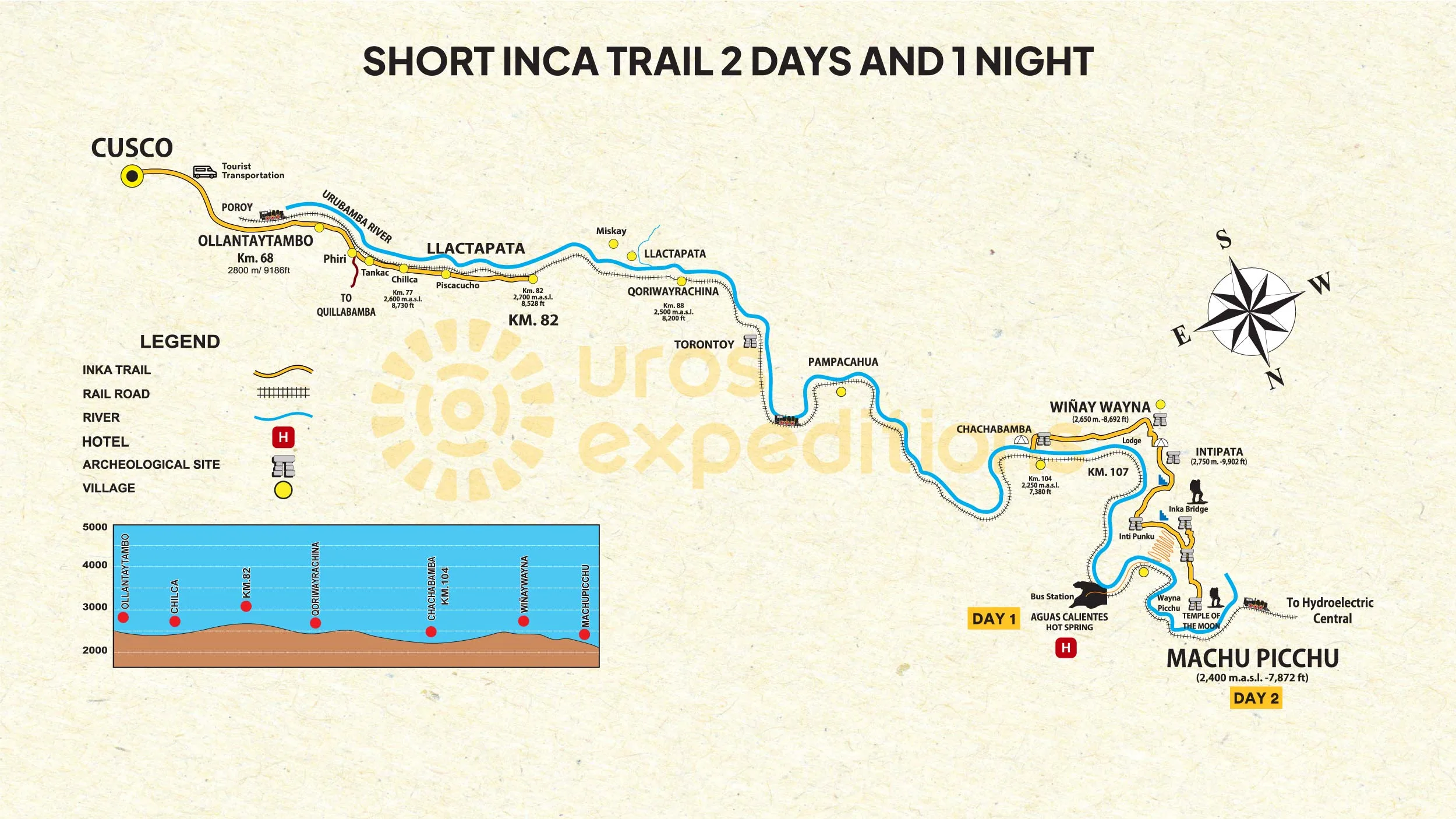
For the 2-day Inca Trail hike to Machu Picchu from Cusco, the train is how you get to Km 104 the alternate trailhead at Chachabamba. The train stops here on request (you must confirm with your operator). From this station, the hike begins immediately.
For the classic 4-day Inca Trail tour from Cusco, most operators use private transport to Km 82 rather than the train, because the road allows earlier departure and flexibility.
Practical note: If you’re arranging the train independently (for example, for a post-hike return from Aguas Calientes to Cusco), book well in advance during peak months. Return tickets from Aguas Calientes are almost always included in full-service Inca Trail tours.
Permits, Booking & What Everything Costs
The Peruvian government limits access to the classic Inca Trail to 500 people per day trekkers, guides, cooks, and porters combined. In practice, that means roughly 200 trekker spots per day. Those spots go fast.
How far ahead should you book?
For June and July departures the heart of the dry season permits are often fully sold out by November of the previous year. May and August book out by December. The shoulder months (April, September, October) are somewhat more forgiving, but even those fill 3–4 months out at reputable agencies.
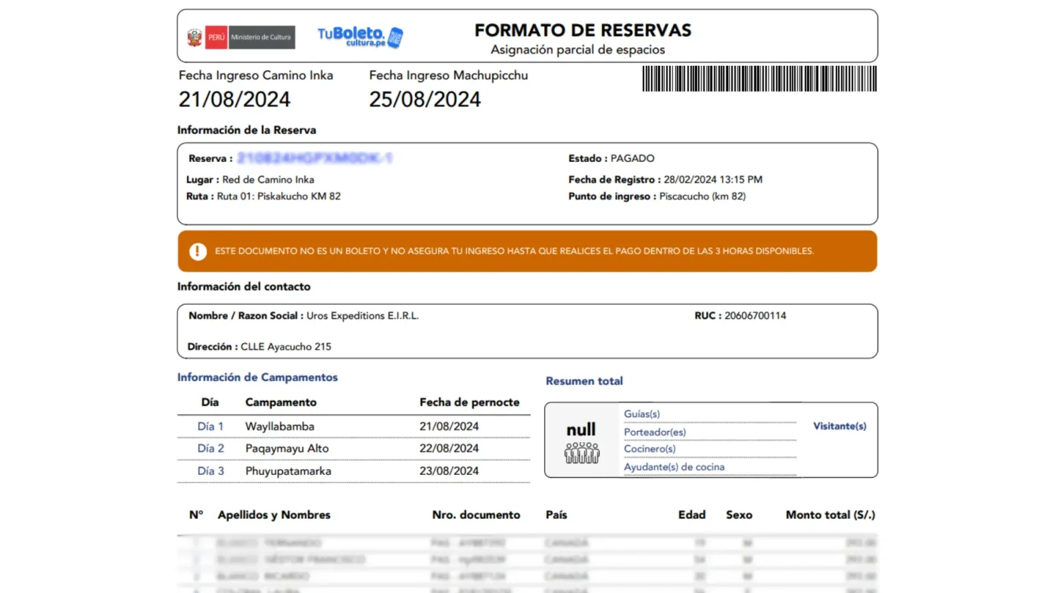
The single most common mistake: Travelers arrive in Cusco hoping to book a last-minute Inca Trail tour and discover every operator is sold out for the next six weeks. You cannot purchase trail permits independently. Only licensed agencies hold them, and they’re registered to your passport number non-transferable.
How much does the Inca Trail cost from Cusco?
| Cost item | Estimated price |
|---|---|
| Budget operators | $600–$750 USD |
| Mid-range operators | $790–$950 USD |
| Premium operators | $1,100–$1,600+ USD |
| Machu Picchu entry ticket | Around $60 USD |
| Huayna Picchu add-on | Around $60 USD |
All-inclusive means: permit, guide, camping equipment, porter service, all meals on trail, and entrance to Machu Picchu. Tips for guides and porters are separate budget around $15–$25 USD per day for the lead guide and $5–$10 per day per porter.
What separates a good operator from a bad one?
Ask every agency these questions before you book: What’s the maximum porter pack weight? How many trekkers per guide? What do they do if a trekker gets altitude sickness? Can they provide references from recent clients?
The Classic 4-Day Inca Trail: A Complete Day-by-Day Guide
This is the full route most people mean when they talk about hiking the Inca Trail from Cusco to Machu Picchu. Each day has its own character, difficulty, scenery, and emotional weight. Understanding what you are walking into makes the entire experience easier to prepare for and much more meaningful once you are there.
Quick Route Overview
| Day | Route | Distance | Difficulty | Main Highlight |
|---|---|---|---|---|
| Day 1 | Km 82 Piscacucho to Ayapata or Huayllabamba | 12 km | Moderate | First ruins, valley scenery, gradual ascent |
| Day 2 | Huayllabamba to Dead Woman’s Pass to Pacaymayo | 12 km | Strenuous | Highest point of the trek at 4,215 m |
| Day 3 | Pacaymayo to Runkurakay Pass to Wiñay Wayna | 16 km | Moderate to strenuous | Cloud forest, Inca ruins, long stone descent |
| Day 4 | Wiñay Wayna to Inti Punku to Machu Picchu | Around 4 km | Easy | Arrival at the Sun Gate and Machu Picchu |
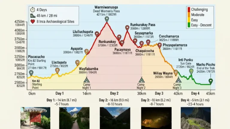
Day 1: Km 82 Piscacucho to Ayapata or Huayllabamba
- Distance: 12 km
- Elevation gain: 400 m
- Difficulty: Moderate
- Typical campsite: Ayapata or Huayllabamba
Your group will almost certainly leave Cusco between 4:30 and 5:30 AM for the 2.5-hour drive to the trailhead. The road follows the Sacred Valley through Pisac and Ollantaytambo. If daylight reaches the valley before you arrive in Ollanta, the Inca fortress on the hillside gives you a preview of what the next three days hold.
At Km 82, after passport checks and the usual group photo at the archway, the trail officially begins.
The first day is the gentlest of the four. It is mostly a valley-floor walk following the left bank of the Urubamba River, passing through agricultural land and small Quechua communities. You will pass through Miskay, cross a few suspension bridges, and gain elevation gradually as the valley narrows.
The first major ruin you encounter is Llactapata, a substantial Inca site set on a ridge above the trail. Lunch is usually served at a designated camp area around noon.
In the afternoon, the trail becomes slightly steeper as it climbs toward the campsite at Ayapata (3,000 m) or Huayllabamba (3,100 m).
Day 1 trail note
Eat your dinner fully. Hydrate consistently. Day 1 may feel manageable, but your body needs energy and water for the much harder climb on Day 2.
Day 2: Huayllabamba to Dead Woman’s Pass to Pacaymayo
- Distance: 12 km
- Elevation gain: Around 1,200 m
- Difficulty: Strenuous
- Highest point: Warmiwañusca (Dead Woman’s Pass), 4,215 m
- Typical campsite: Pacaymayo, 3,600 m
Day 2 is the day the Inca Trail earns its reputation.
You climb from roughly 3,100 meters to the summit of Warmiwañusca, better known as Dead Woman’s Pass, at 4,215 meters above sea level. That means more than 1,100 meters of elevation gain in about 5 kilometers of trail, much of it on original Inca stone steps.
The climb begins right after breakfast. The first hour feels manageable. The second gets harder. The third, as you approach the pass, tests almost everyone.
At this altitude, there is significantly less oxygen available than at sea level, and even fit, experienced hikers usually slow down. The key is not speed. The key is rhythm.
The pass itself offers one of the most spectacular 360-degree views on the entire trail, with snowcapped peaks in several directions and the Sacred Valley far below.
After the summit, the descent to Pacaymayo camp (3,600 m) is steep and tough on the knees. This is where trekking poles become genuinely useful.
Altitude tip for Day 2
Slow is the strategy. The Quechua idea of poco a poco (little by little) is not a cliché here. It is the correct approach. Hikers who push too hard often feel worse than those who climb steadily. Your guide sets the pace for a reason.
Day 3: Pacaymayo to Runkurakay Pass to Wiñay Wayna
- Distance: 16 km
- Main challenge: Two mountain passes
- Difficulty: Moderate to strenuous
- Typical campsite: Wiñay Wayna
Day 3 is the longest, most varied, and for many hikers, the most beautiful day on the Inca Trail.
You start early from Pacaymayo and immediately begin climbing toward the second pass, Runkurakay Pass (3,998 m). Along the way, you pass the oval-shaped Inca tambo ruin of Runkurakay, one of the most distinctive archaeological sites on the route.
From the second pass, the trail descends into increasingly lush vegetation. This is where the route begins to shift into the cloud forest zone.
After visiting Sayacmarca, known as “the inaccessible town,” the trail continues through dramatic cloud forest scenery before reaching the third and final pass at Phuyupatamarca (3,650 m).
On a clear day, this section gives you your first distant view of Machu Picchu Mountain.
The descent toward Wiñay Wayna is long and steep, following a stone staircase of roughly 2,500 steps through the cloud forest. It is demanding, but the reward at the bottom is one of the finest ruins on the entire trail.
Wiñay Wayna is a spectacular Inca site with agricultural terraces, ceremonial areas, and water channels. For many trekkers, it is the archaeological highlight before Machu Picchu itself.
Day 4: Wiñay Wayna to Inti Punku to Machu Picchu
- Distance: Around 4 km
- Difficulty: Easy
- Main highlight: Arrival at the Sun Gate and Machu Picchu
- Final destination: Aguas Calientes
Wake-up call is usually around 3:30 AM.
At 5:30 AM, when the checkpoint gate opens, you begin the final push through the cloud forest. The walk takes around 45 minutes. It is still dark, headlamps cut through the mist, and the mood on the trail changes completely.
Then Inti Punku, the Sun Gate, appears at 2,720 meters.
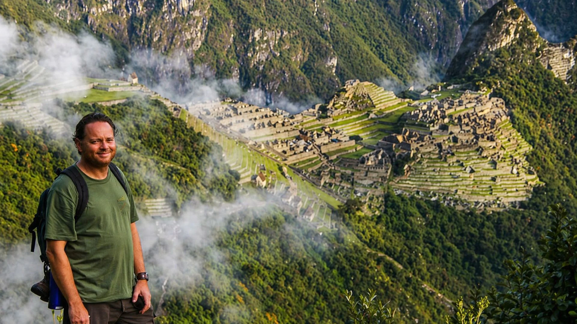
As you step through the stone gateway, Machu Picchu unfolds before you sometimes wrapped in morning fog and other times illuminated by the first rays of sunlight; however, in either case, the view feels different because you did not arrive by train or bus, but walked all the way there, making the experience far more meaningful and unforgettable.
From the Sun Gate, the trail descends toward the citadel. Machu Picchu appears on its mountain saddle, framed by Huayna Picchu, exactly as it does in the famous photographs, except now you are standing there in person.
After the guided visit, a shuttle or walk brings you down to Aguas Calientes for a meal, a shower, and the train journey back toward Cusco.
The 2-Day Inca Trail from Cusco: The Short Route Explained
The 2-day Inca Trail from Cusco is a real and legitimate trail option not a compromise, though it’s often framed that way. It’s a different experience: shorter, lower in altitude, accessible when classic permits are sold out, and still genuinely spectacular.
The 2-day route begins at Km 104, a train stop in the Urubamba valley known as Chachabamba. From there, you hike approximately 12 kilometers on Day 1, overnighting at the Wiñay Wayna campsite. Day 2 follows the same final stretch as the classic route up to Inti Punku, down into Machu Picchu.
| Detail | Information |
|---|---|
| Start point | Km 104 |
| Distance | Around 12 km |
| Max elevation | 2,700 m |
| Overnights | 1 night, usually near Wiñay Wayna |
| Difficulty | Moderate |
| Permit | Required, but usually easier to get than the Classic Inca Trail permit |
What you gain on the 2-day route: lower altitude stress, more flexibility with dates, a substantially lower price, and still the Sun Gate arrival at dawn. What you miss: Dead Woman’s Pass, the high-altitude landscape, and the ruins of Runkurakay and Sayacmarca.
Who the 2-day route is best for: Travelers with limited time, anyone who discovers the classic trail is fully booked, hikers who want the Sun Gate experience without the altitude extremes, and families with older children (minimum age for Inca Trail tours is typically 5–8 depending on the operator).
Every Archaeological Site on the Inca Trail, Described
This is what separates the Inca Trail from every other trek to Machu Picchu: the journey passes through a living archaeological corridor. These sites weren’t built as tourist attractions they were administrative centers, religious sanctuaries, and astronomical observatories. Here’s every major site in order of appearance.
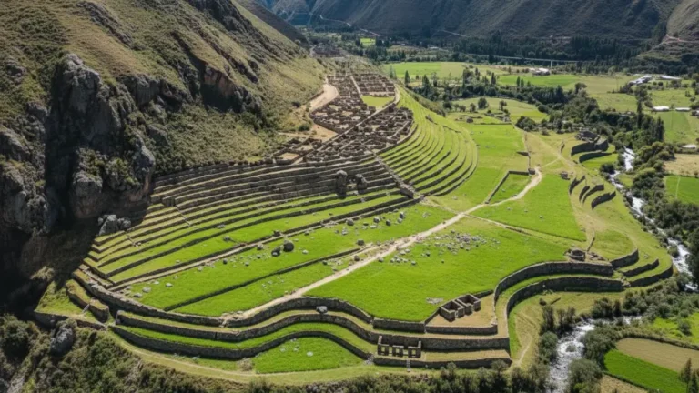
1. Llactapata
- Elevation: 2,840 m
- Location: Km 82 area
Llactapata is the first major ruin encountered on the Inca Trail. Its name means “flat town” in Quechua. The site served as an administrative checkpoint and storage facility at the entrance of the trail.
It was discovered and partially excavated by Hiram Bingham in 1912, around the same period as his work at Machu Picchu. In 2003, Gary Ziegler and Johan Reinhard re-examined the site and found strong evidence of astronomical alignment. During the June winter solstice, the sunrise viewed from Llactapata aligns with the Temple of the Sun at Machu Picchu across the ridge.
2. Runkurakay
- Elevation: 3,760 m
- Timing: Day 3
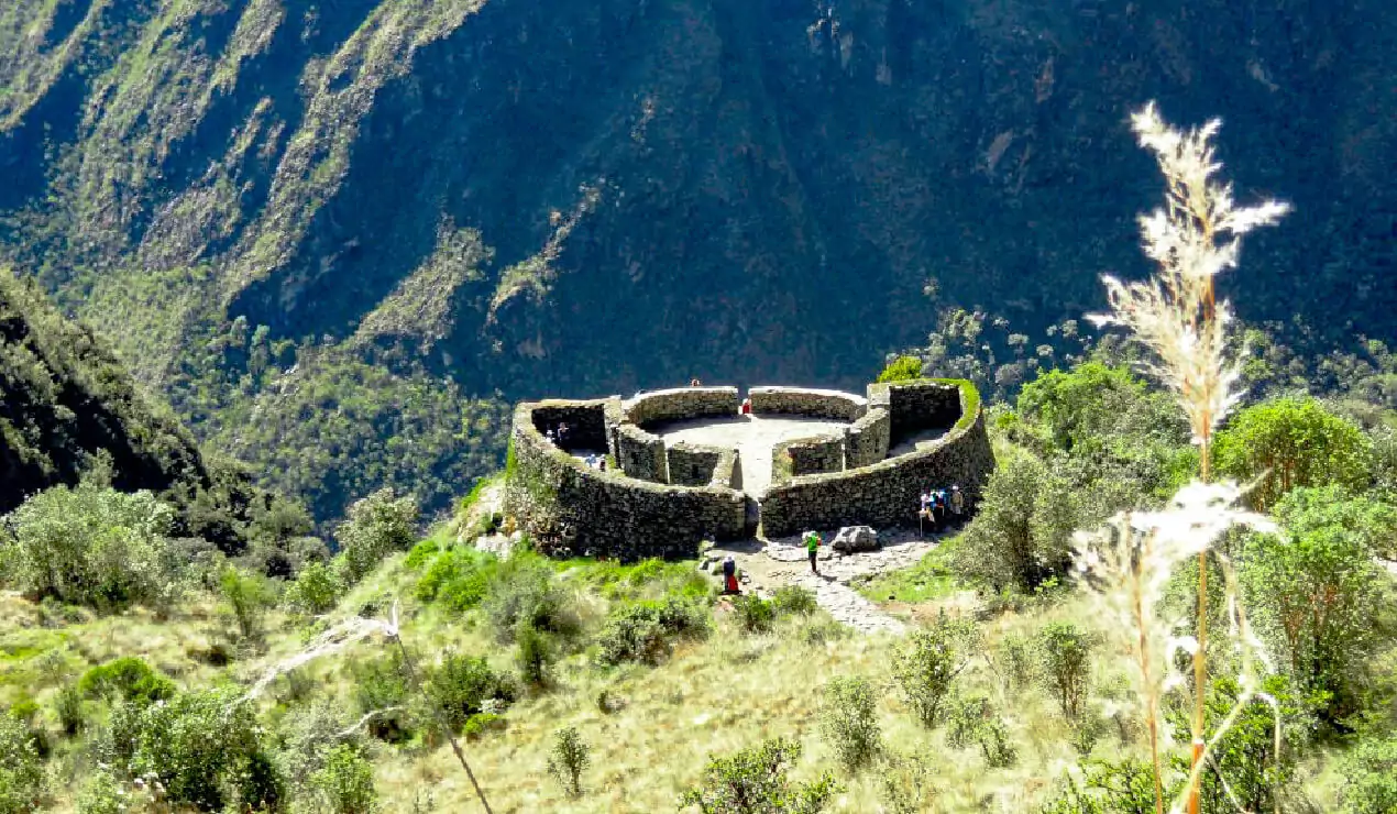
Runkurakay sits on a ridge below the second pass. Its name means “egg-shaped building”, referring to its unusual oval form, which is rare in Inca architecture.
The site functioned as a tambo, or waystation, where Inca messengers, known as chasquis, and officials traveling the royal road could rest and resupply. The nearby pass offers some of the best 360-degree views on the entire trail.
3. Sayacmarca
- Elevation: 3,625 m
- Timing: Day 3
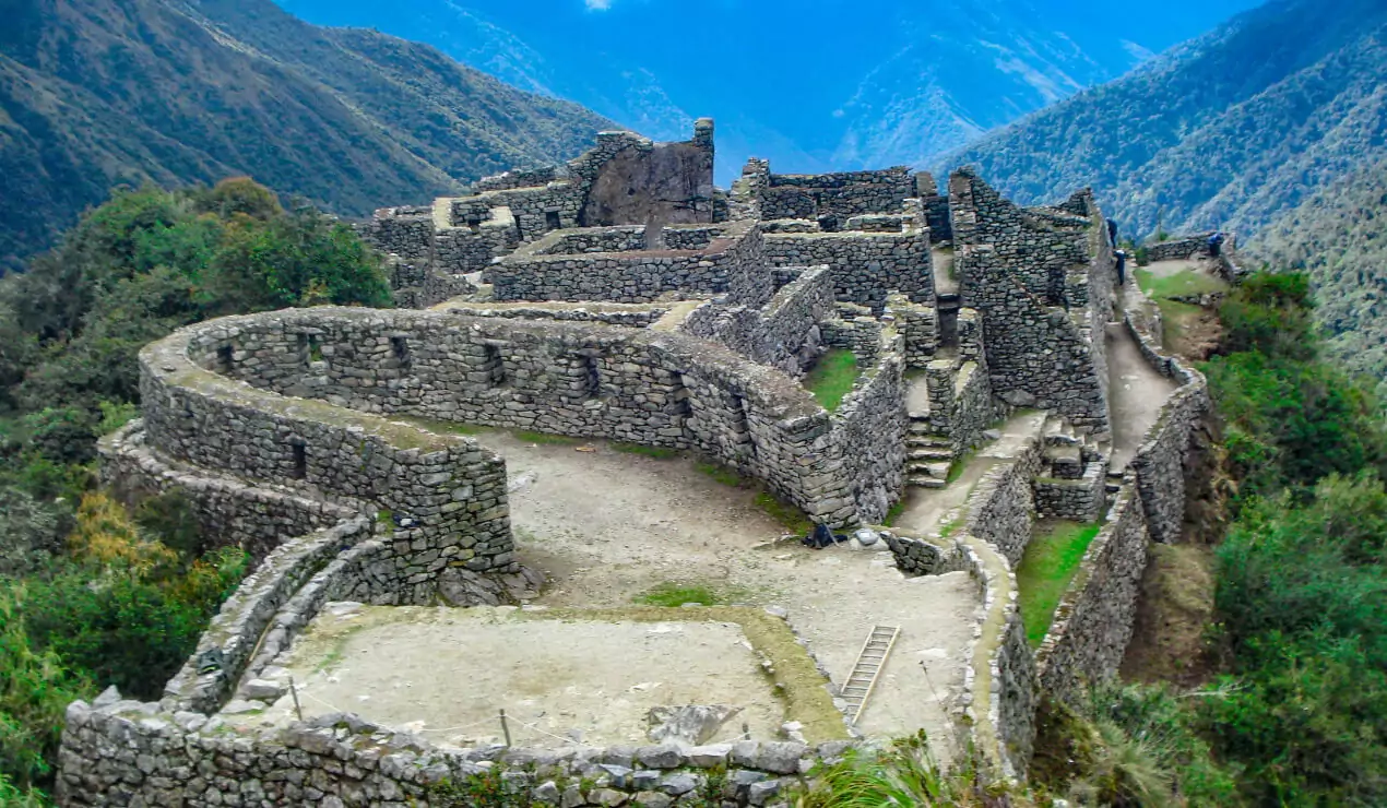
Sayacmarca means “the inaccessible town,” and the name is accurate. The site occupies a narrow rocky promontory with steep drops on three sides.
The complex includes ceremonial plazas, a solar observation tower, residential quarters, and a series of water fountains fed by channels cut into the cliff face. Its water engineering is especially impressive, and some of the channels are still partially functional.
4. Conchamarca
- Elevation: 3,500 m
- Timing: Day 3
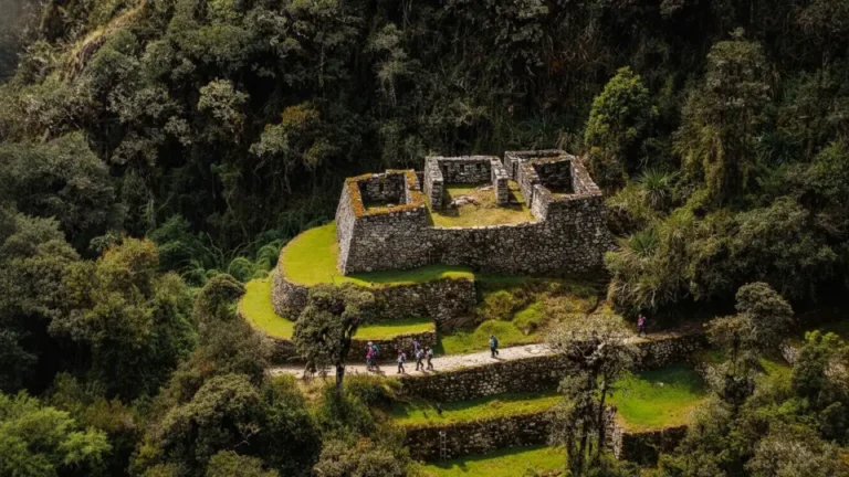
Conchamarca is a smaller site located between Sayacmarca and Phuyupatamarca. Its name means “shell plaza.”
The site features several terraced platforms with classic Inca trapezoidal niches. These recesses served both decorative and functional purposes, often holding offerings or sacred objects. The stonework reflects the precision found throughout the trail, with stones cut and fitted using harder stone tools and bronze chisels.
5. Phuyupatamarca
- Elevation: 3,600 m
- Timing: Day 3 — Third Pass
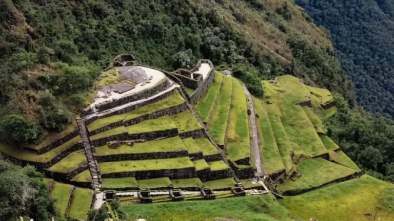
Phuyupatamarca means “town above the clouds.” On foggy mornings, clouds can literally roll through the ruins, giving the site a dramatic atmosphere.
The site is built around a complex of six ceremonial baths fed by natural spring water through channels that still function today. The baths descend in a staircase pattern, each one slightly lower than the last.
For the Inca, water worship was part of a sophisticated cosmological system. Water, or yaku, was considered the blood of Pachamama, and ritual bathing sites were places where the human, natural, and divine worlds met.
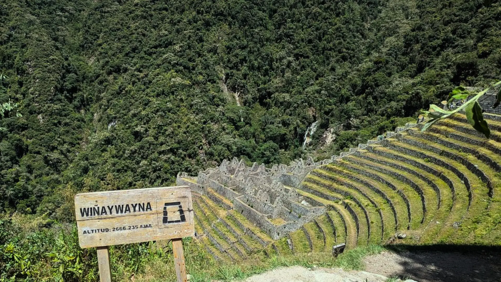
6. Wiñay Wayna
- Elevation: 2,650 m
- Timing: End of Day 3
Wiñay Wayna means “Forever Young” in Quechua. The site is named after the pink orchid that blooms year-round on the surrounding cliffs.
It is arguably the most architecturally impressive site on the Inca Trail. Wiñay Wayna combines two distinct zones: an upper sector with residential and ceremonial buildings, and a lower sector with precision-cut agricultural terraces.
A cascading series of ten ceremonial baths connects the two areas. Many archaeologists consider Wiñay Wayna one of the finest examples of Inca architecture outside Machu Picchu itself.
7. Intipata
- Elevation: 2,630 m
- Location: Near Wiñay Wayna
Intipata means “sun terrace.” It is located on the terraced slopes below Wiñay Wayna and was almost certainly cultivated by the residents of the site above.
The terraces are built on an extreme gradient and would have required constant maintenance. Crops likely included maize, quinoa, and potatoes, along with medicinal plants used for ceremonial purposes.

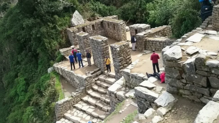
8. Inti Punku the Sun Gate
- Elevation: 2,720 m
- Timing: Day 4
Inti Punku means “Gate of the Sun.” It is the ceremonial entrance to Machu Picchu via the Inca Trail.
The structure is a double-jambed trapezoidal gateway with a central window. During the June solstice, the rising sun passes through the gate and aligns with Machu Picchu, illuminating the Intihuatana stone. For modern trekkers, Inti Punku marks the moment when the trail ends and the citadel begins.
9. Machu Picchu
- Elevation: 2,430 m
- Location: End point
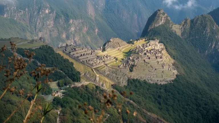
Machu Picchu was built around 1450 CE under Pachacuti Inca Yupanqui. It served simultaneously as a royal estate, religious sanctuary, and astronomical observatory.
The citadel contains roughly 150 structures on a mountain saddle. Key sectors include the Royal Palace, the Temple of the Sun, the Room of the Three Windows, the Intihuatana stone, and the Agricultural Terraces.
The Spanish never found or conquered Machu Picchu. It remained effectively hidden by the jungle until Hiram Bingham arrived in 1911. UNESCO designated it a World Heritage Site in 1983.
10. Huayna Picchu Mountain (Optional)
- Elevation: 2,693 m
- Location: Within Machu Picchu
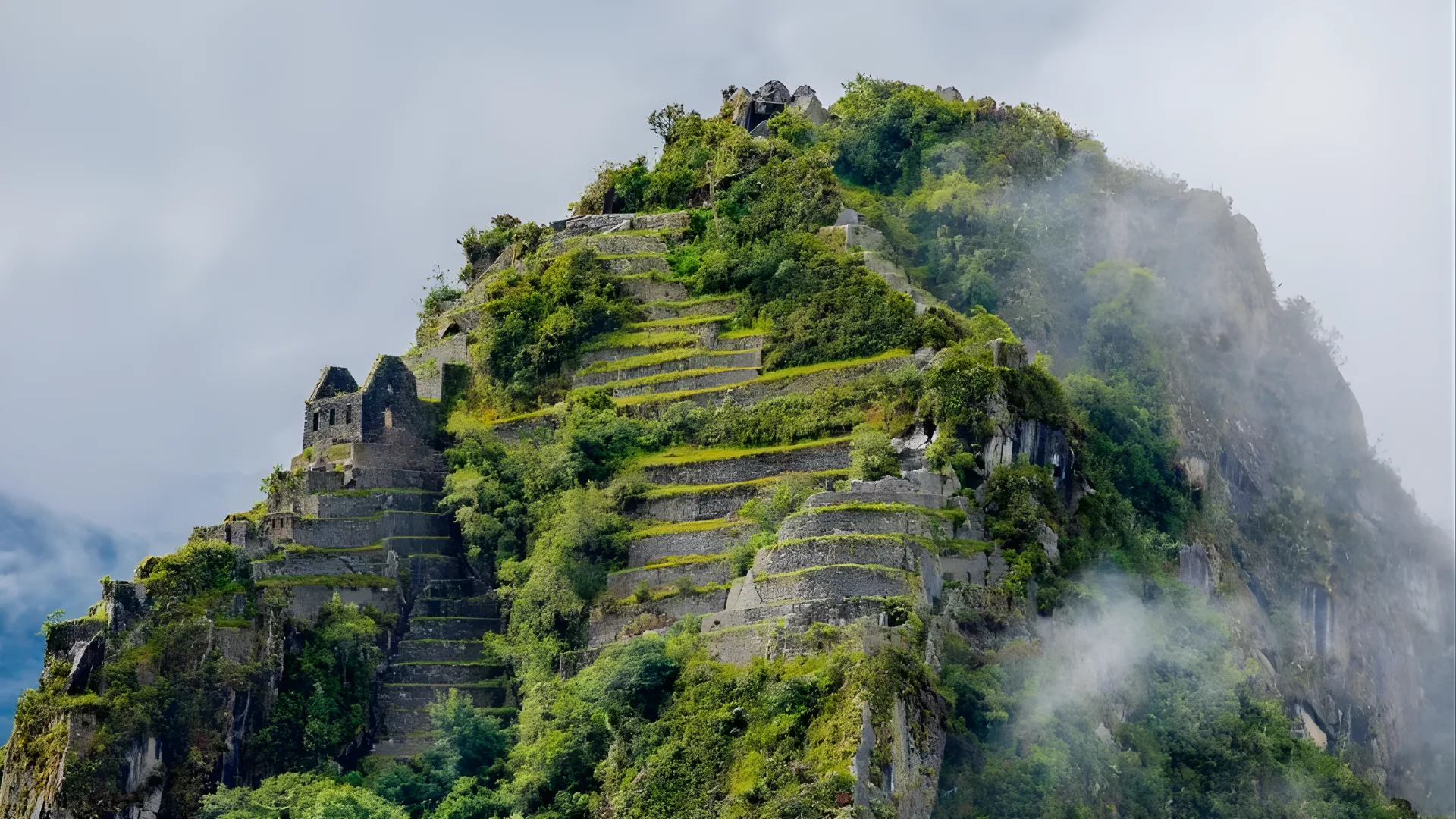
Huayna Picchu is the steep mountain rising behind Machu Picchu in nearly every classic photograph.
The mountain contains ruins near its summit, including a small ritual site and observatory. Permits are strictly limited to 400 visitors per day in two entry slots: 7–8 AM and 10–11 AM. These permits must be booked months in advance.
From the summit, visitors look down over Machu Picchu with the Urubamba River about 600 meters below, creating one of the most dramatic views in Peru.
Complete Packing & Gear List for the Inca Trail
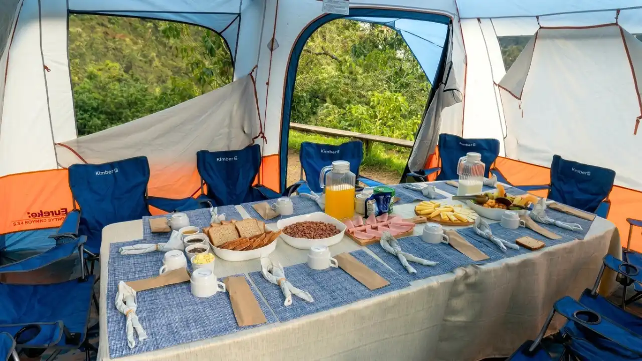
Your agency provides: tent, sleeping mat, dining tent, all meals on trail, first-aid kit, and supplemental oxygen. You typically need to provide: a sleeping bag rated to at least -5°C (23°F), which is often rentable from the agency, and everything in your daypack.
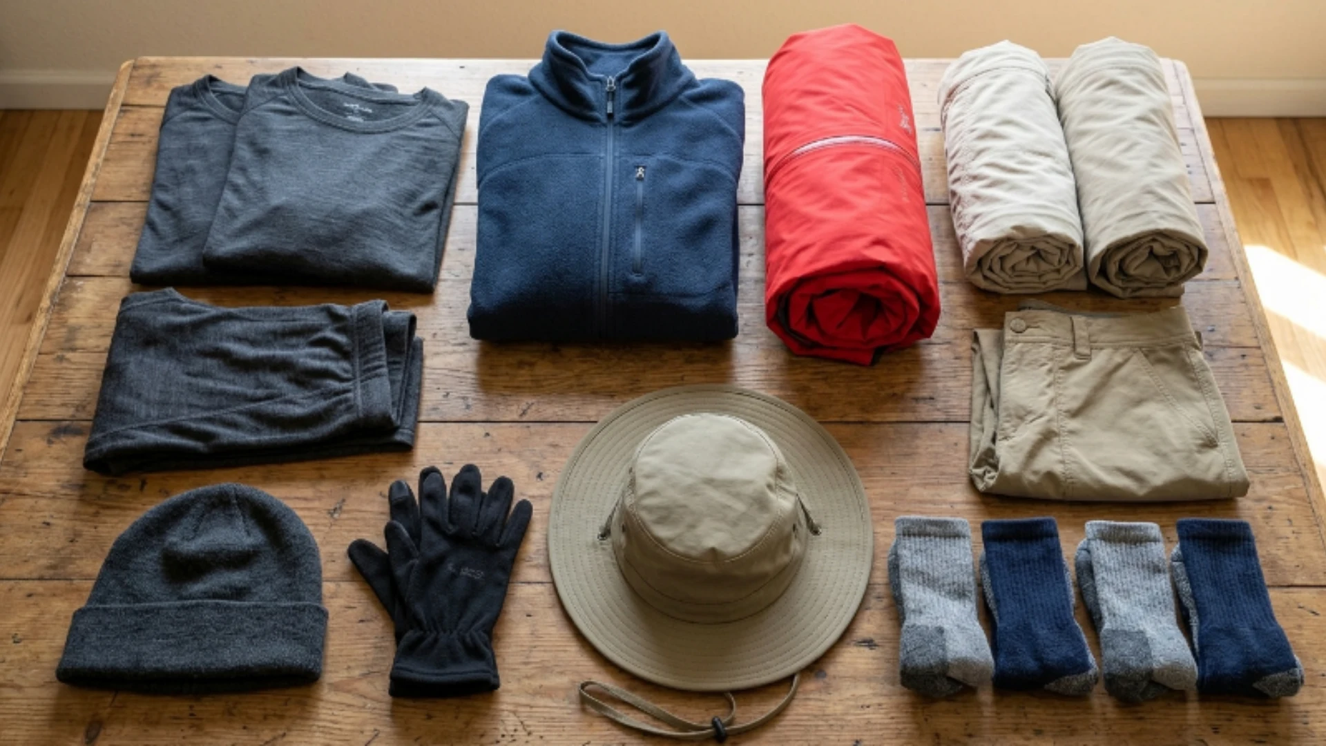
Clothing layering is the strategy
- Merino wool base layer top (x2)
- Merino wool base layer bottom
- Fleece jacket or mid-layer
- Waterproof hardshell jacket (essential)
- Waterproof pants
- Lightweight hiking pants (x2)
- Shorts (optional for Day 1)
- Warm hat / beanie
- Lightweight gloves
- Sun hat with brim
- Wool or synthetic hiking socks (x4 pairs)
Footwear
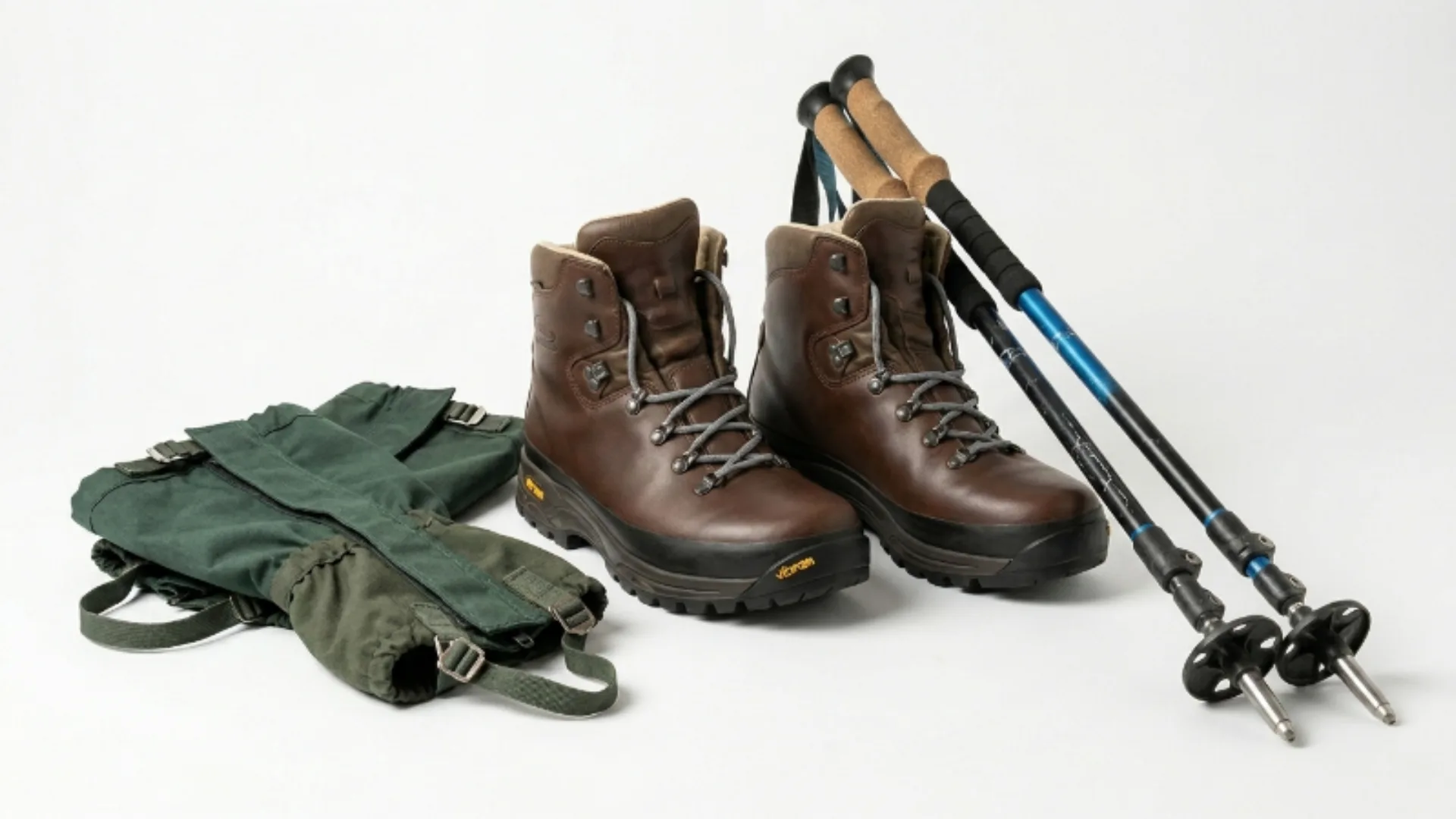
- Waterproof hiking boots (must be broken in, not new)
- Trekking poles
- Gaiters (optional; useful in wet season)
Navigation & Safety
- Headlamp + spare batteries
- Backup phone power bank
- Waterproof dry bags or pack liner
- Personal first-aid kit
- Blister treatment (Compeed / moleskin)
- Ibuprofen / paracetamol
- Altitude medication (prescription)
- Rehydration sachets
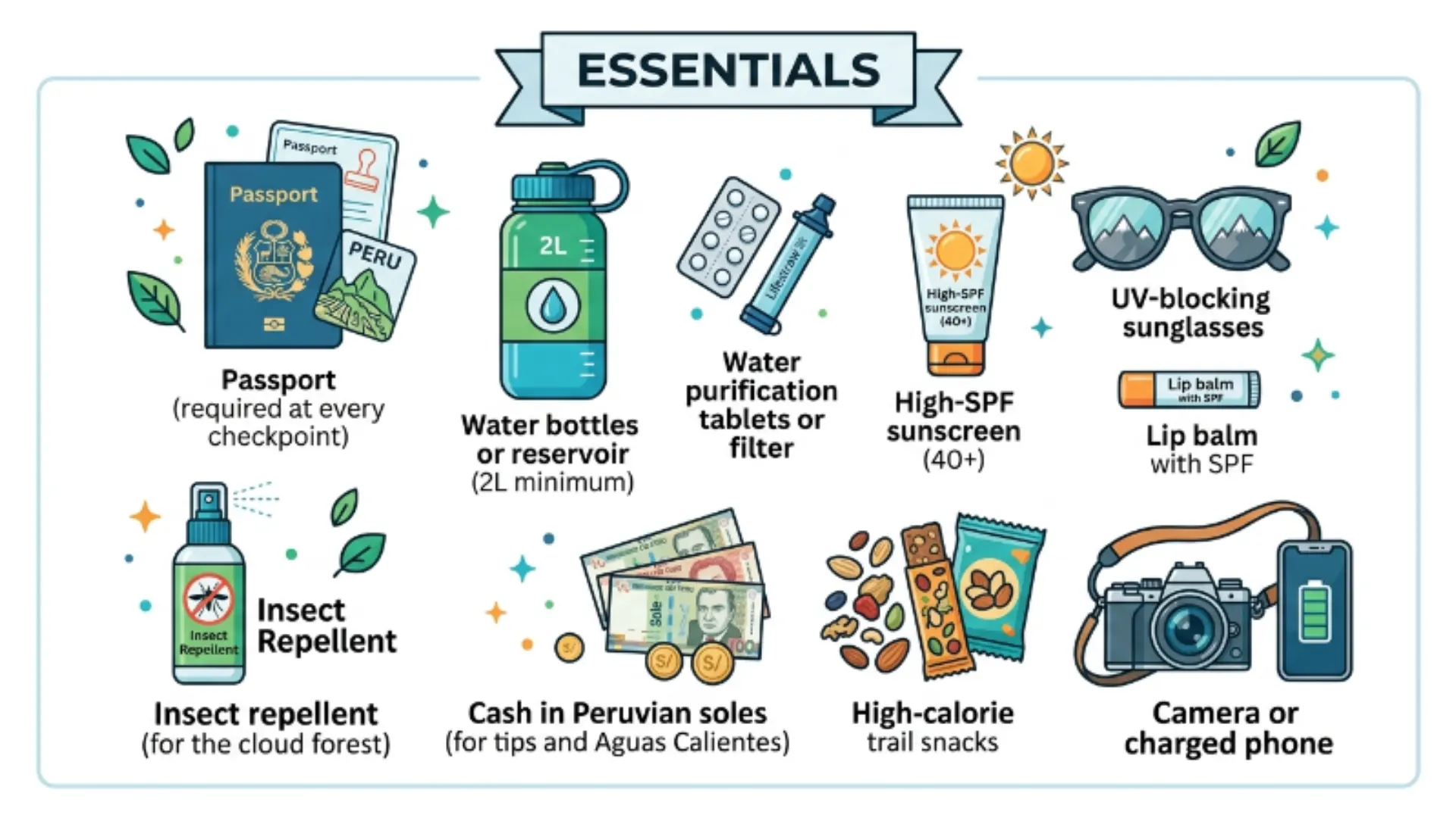
Essentials
- Passport (required at every checkpoint)
- Water bottles or reservoir (2L minimum)
- Water purification tablets or filter
- High-SPF sunscreen (40+)
- UV-blocking sunglasses
- Lip balm with SPF
- Insect repellent (for the cloud forest)
- Cash in Peruvian soles (for tips and Aguas Calientes)
- High-calorie trail snacks
- Camera or charged phone
Daypack weight target: 8 kg or less. Porters carry the heavy duffel (max 7 kg of your gear). Everything in your daypack stays on your back for 8–12 hours on Day 2. Every extra kilogram matters at 4,200 meters.
Altitude, Acclimatization & Health on the Inca Trail
Altitude sickness (Acute Mountain Sickness – AMS) affects approximately 25–40% of visitors to Cusco and the surrounding highlands, regardless of age, fitness, or prior hiking experience. It can sideline experienced athletes and leave relatively sedentary travelers unaffected. There is no reliable way to predict individual susceptibility.
Before you arrive: acclimatization timeline
The standard medical recommendation is to spend a minimum of 2 full days in Cusco (3,400 m) before starting any strenuous trekking. Ideally 3–4 days if you’re coming from near sea level. During these acclimatization days: drink 3–4 liters of water daily, avoid alcohol completely, eat lightly, walk around town but don’t push into the mountains, and sleep as much as possible.
A pre-trek acclimatization hike is highly recommended something that reaches 3,800–4,000 meters and back, such as the hike to Rainbow Mountain (Vinicunca), the Pisac ruins loop, or the viewpoints above Sacsayhuamán.
Diamox (acetazolamide): should you take it?
Diamox is a prescription medication that helps the body acclimatize faster. The standard preventive dose is 125–250 mg twice daily, starting 24–48 hours before significant altitude exposure. Side effects are common: tingling in the fingers and toes, increased urination. The drug is contraindicated for people with sulfa allergies. See your doctor or a travel medicine clinic before your trip.
Recognize severe AMS: Mild symptoms (headache, fatigue, mild nausea) are normal at altitude. Severe symptoms confusion, loss of coordination, severe shortness of breath at rest, coughing pink or frothy mucus indicate HAPE or HACE, both medical emergencies. Descent is the only treatment. Your guide is trained to recognize these symptoms and carries supplemental oxygen.
When to Go: Month-by-Month Trail Conditions
The Inca Trail is open every month except February, when it closes for annual maintenance and restoration work. Beyond that closure, every month has its own trade-offs.
| Season | Months | Conditions | Crowds / Booking |
|---|---|---|---|
| Dry season peak | June, July, August | Best weather, clear skies, cold nights near freezing at high camps. | Most crowded; permits sell out 6+ months ahead. |
| Shoulder dry | May, September | Excellent conditions, slightly fewer crowds. May is lush after the wet season. | Book 4–5 months ahead. |
| Shoulder wet | April, October, November | Afternoon rain likely. Cloud forest is dramatic. Misty views are genuinely beautiful if you accept the rain. | Less crowded. |
| Wet season | December, January, March | Regular heavy rain. Some trail sections become muddy and slippery. Orchids and bromeliads are extraordinary. | Much easier to book. |
| Trail closed | February | No access due to annual maintenance closure. Alternative treks remain open. Aguas Calientes and Machu Picchu are accessible by train. | No trail permits available. |
Choosing Inca Trail Tours from Cusco: What Actually Matters
There are over 100 licensed agencies in Cusco that offer Inca Trail tours. The price range spans from approximately $550 to $1,600 USD for the same basic route. What drives that difference?
Non-negotiables regardless of budget
Every operator must by law: use licensed, certified English-speaking guides; comply with the Porter Protection Law (20 kg maximum per porter); provide proper camping equipment; include the Machu Picchu entrance fee; and ensure all permits are registered to your passport before departure.
Where budget operators cut corners
Budget agencies often overbook groups (12–16 trekkers versus 6–8 at premium agencies), use older or lower-quality camping gear, reduce porter wages below the ethical minimum, provide less experienced guides, and offer simpler meals. None of these make the trail impassable but they change the experience significantly.
Green flags when researching agencies
- Responsive, detailed pre-trip communication.
- Clear answers about porter weights and wages.
- Recent client reviews that specifically mention the guide by name.
- A clear emergency protocol and at least one first-aid certified staff member per group.
- A sleeping bag temperature rating clearly stated.
Frequently asked questions about The Inca Trail from Cusco to Machu Picchu
No. Peruvian law requires all Inca Trail trekkers to be accompanied by a licensed guide as part of an authorized tour agency. Independent trekking on the classic route is not permitted. This is enforced at the checkpoint at Km 82, where your guide must present all permits and your group’s passport details before entry is granted.
Almost all Inca Trail tours from Cusco include the return train from Aguas Calientes to Ollantaytambo, and then a bus back to Cusco all on Day 4 after Machu Picchu. You typically arrive back in Cusco between 8 and 10 PM.
Bring broken-in hiking boots, layered clothing, a waterproof jacket, trekking pants, a warm hat and gloves, a lightweight backpack, a warm sleeping bag, 2 liters of water, a filter or purification tablets, sunscreen, sunglasses, trekking poles, a headlamp, a basic first aid kit, energy snacks, toilet paper, hand sanitizer, your passport, permits, and some cash.
Most agencies set a minimum age of 5–8 years old, but practically speaking the trail is extremely challenging for children under 10 given the altitude and physical demands of Day 2. Families with children under 12 often find the 2-day Inca Trail from Cusco or the Salkantay Trek more manageable alternatives.
Moderate fitness is sufficient for most people, but altitude is the great equalizer cardiovascular fitness matters more than muscular strength here. If you can comfortably hike 10–15 km in a day with a moderate pack at your home elevation, you’re in the right ballpark.